Digitized plat maps and atlases
This page contains links to digitized content from our Minnesota plat and atlas collection. Interested in digitized versions of our other maps? Check out what is available at UMedia!
Counties beginning with A
Aitkin County
1916 - Aitkin County Plat Book of the State of MinnesotaCounties beginning with B
Becker County
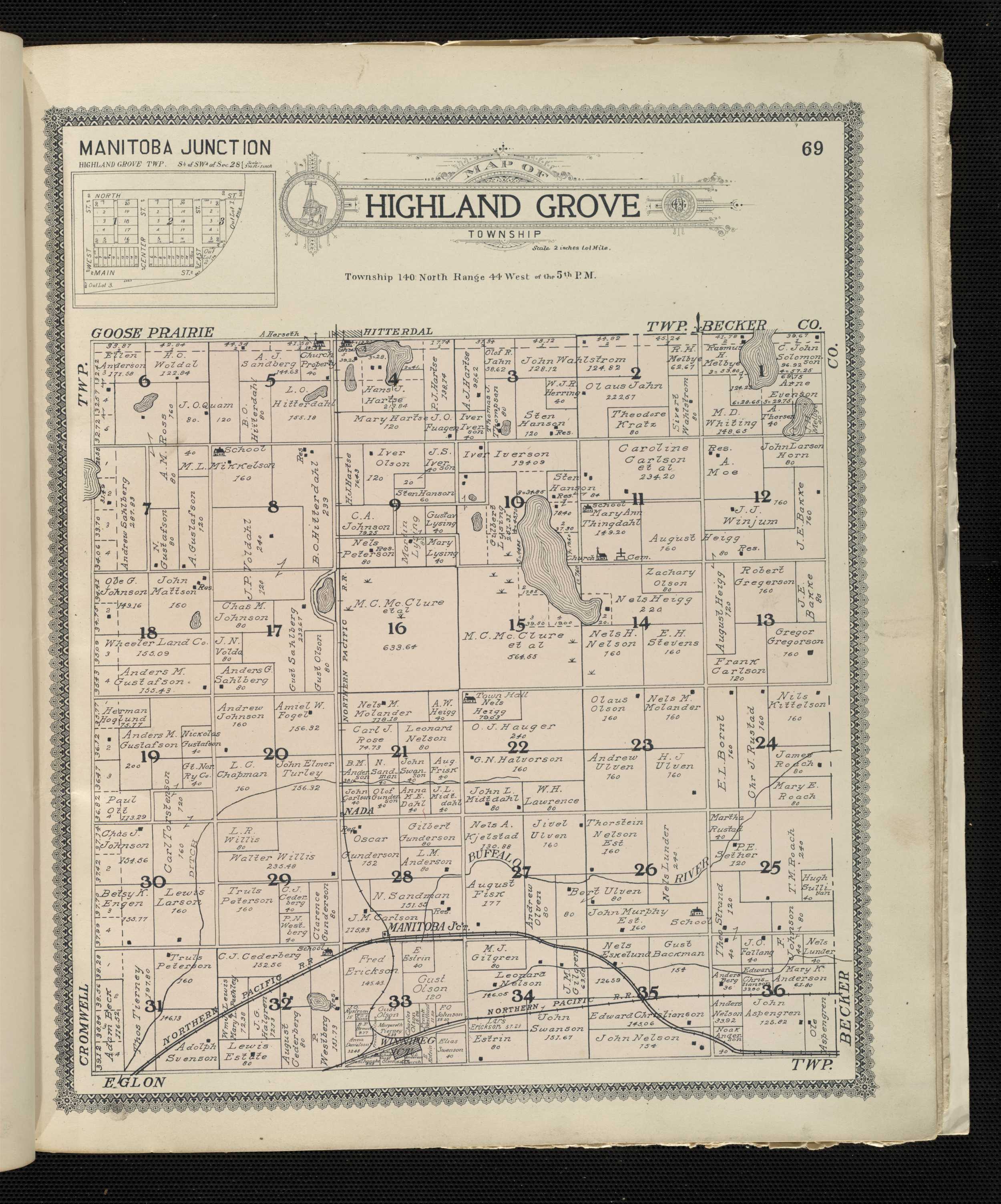
1916 - Becker County Plat Book of the State of MinnesotaBeltrami County
1916 - Beltrami County Plat Book of the State of MinnesotaBenton County
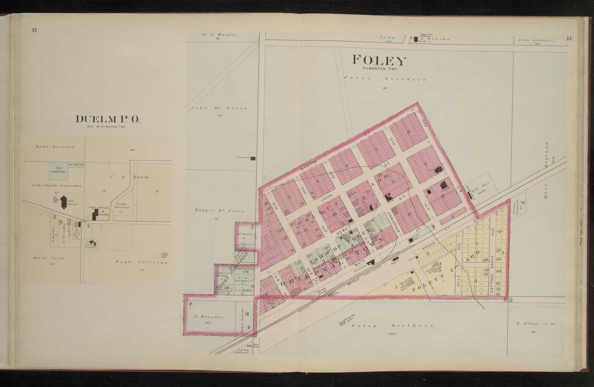
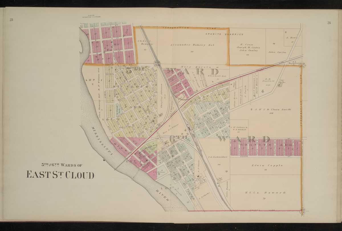
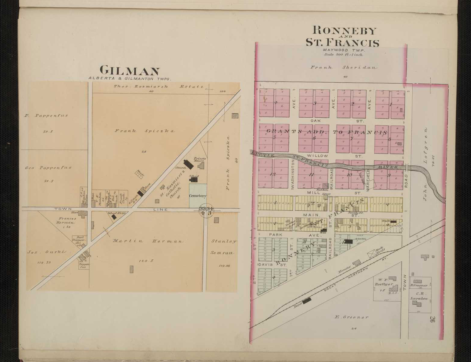
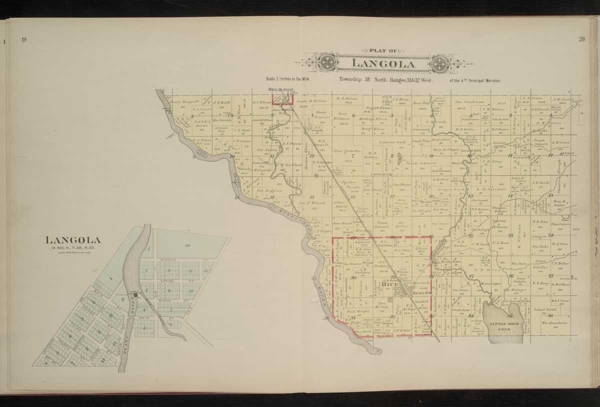
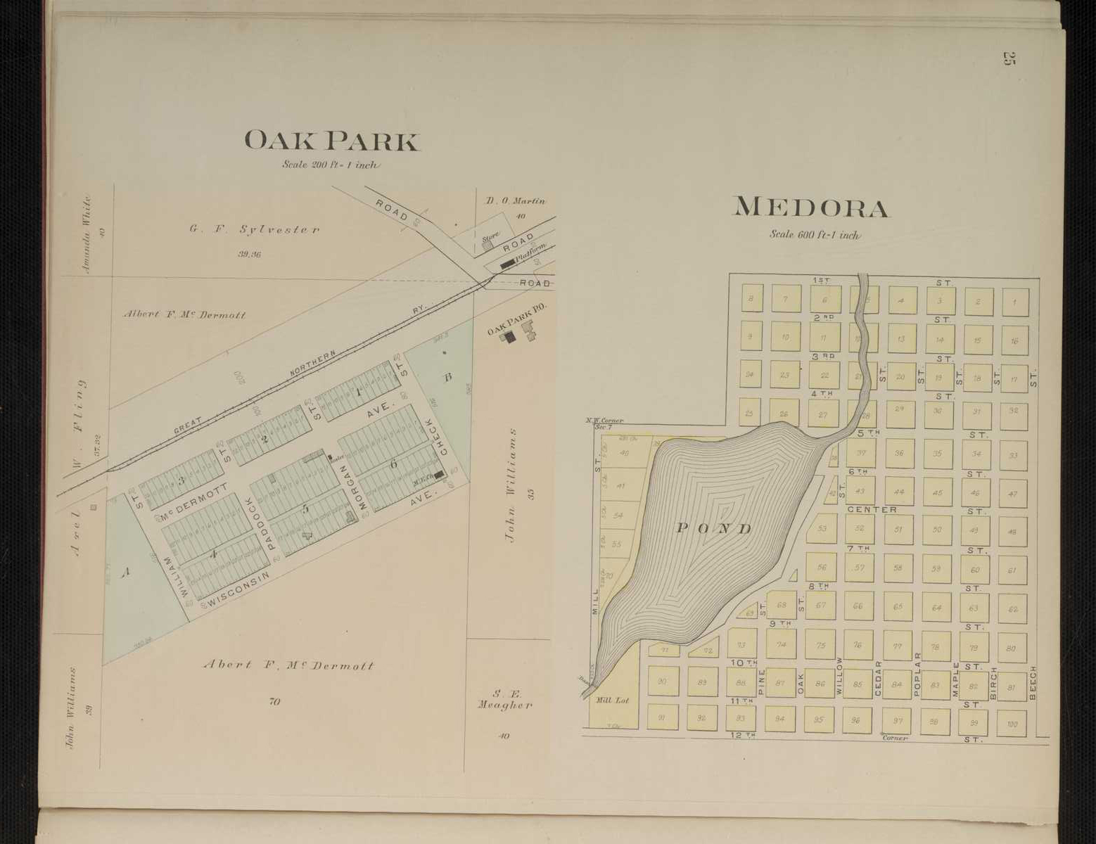
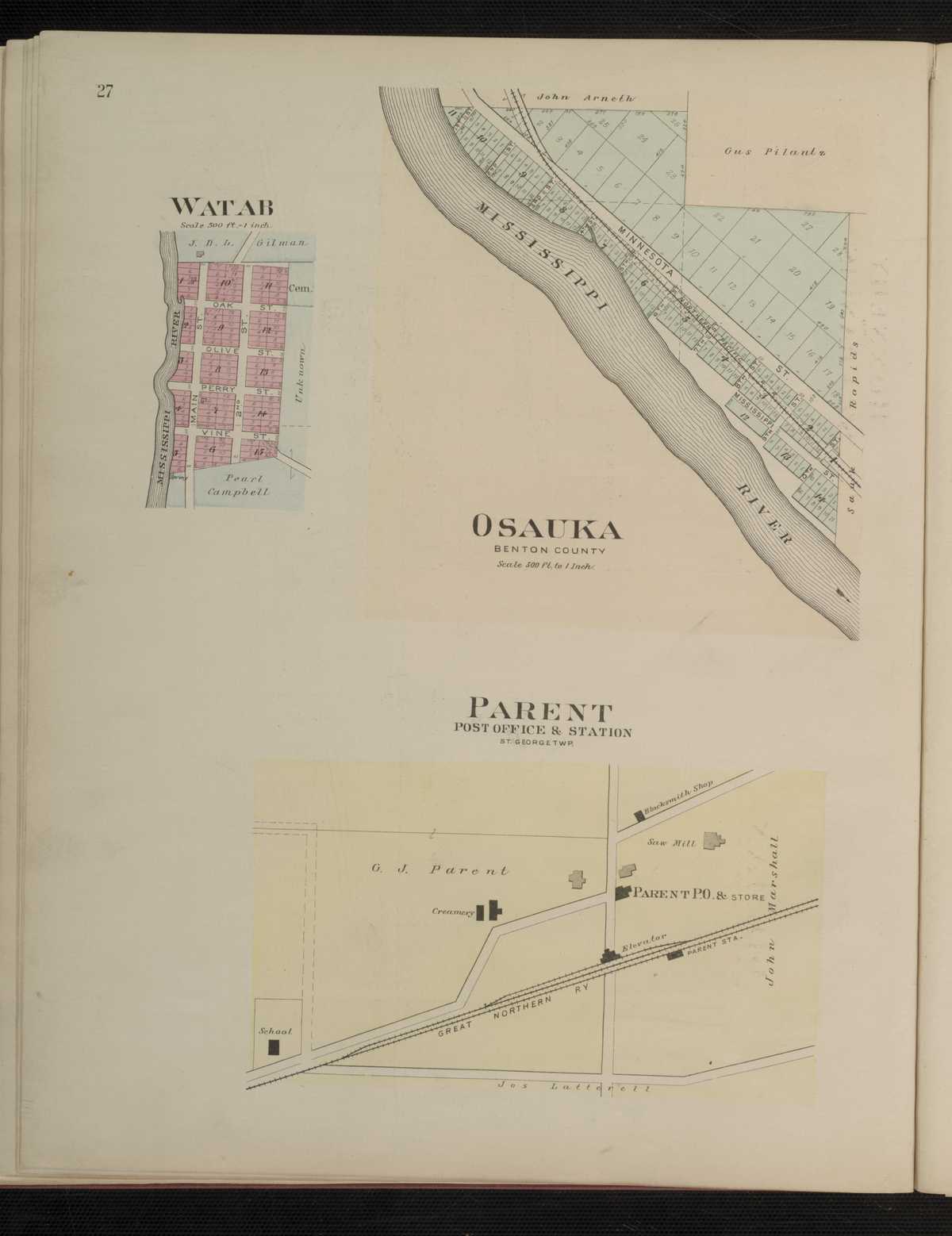
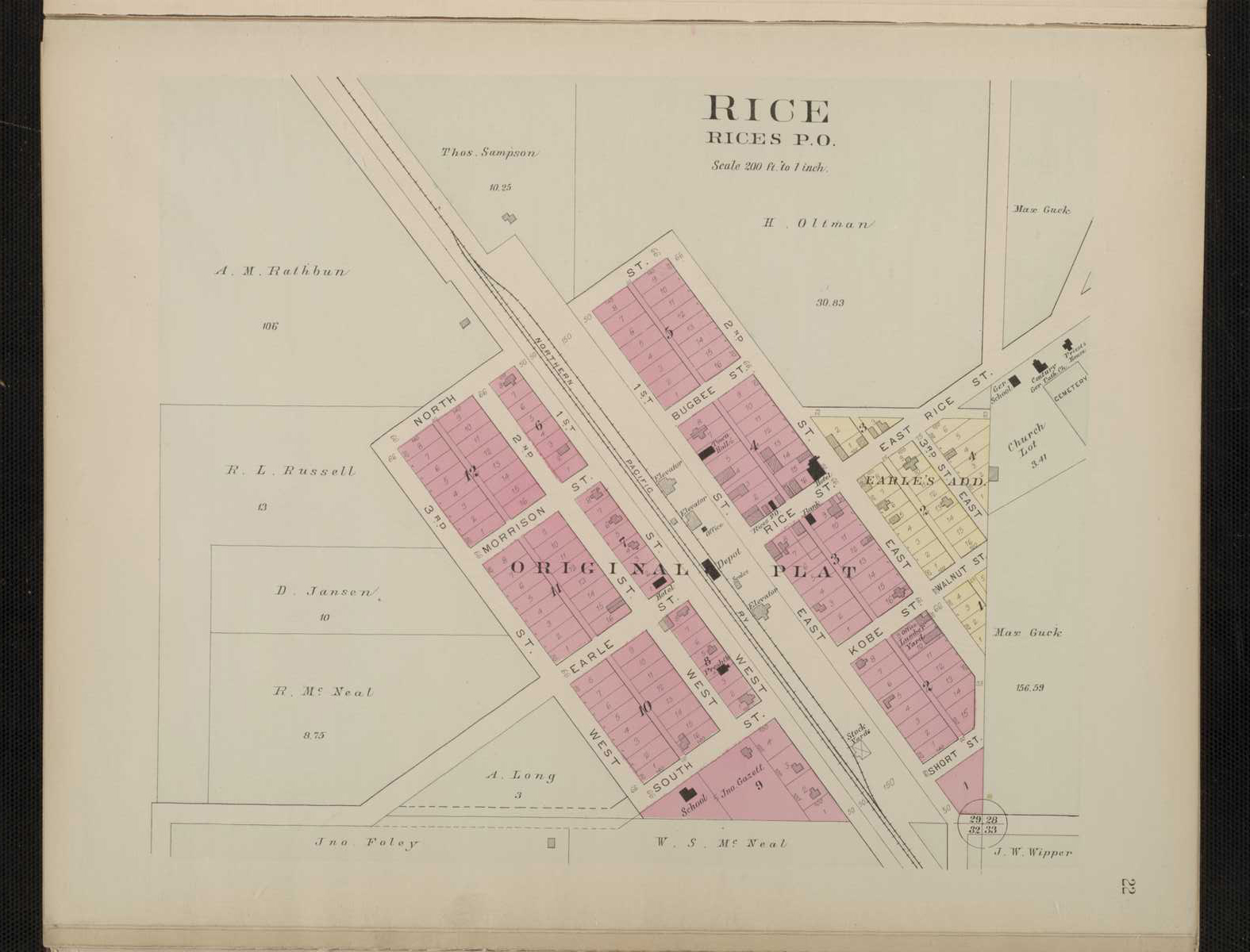
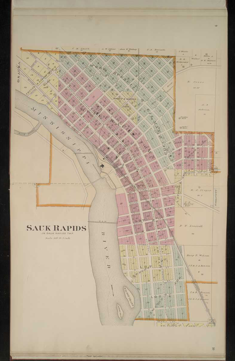
1903 - Benton County Digitized interactive Northwest Publishing Company MapFor individual 1903 plats of cities and towns, select the name of the city/ town of interest: Duelm East St. Cloud, 5th and 6th Wards Foley Gilman Langola Mendora Oak Park Osauka Parent Rice Ronneby St. Francis Sauk Rapids Watab
Benton County
1916 - Benton County Plat Book of the State of MinnesotaBig Stone County
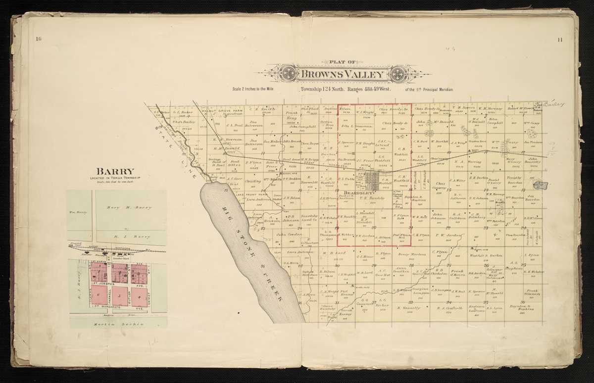
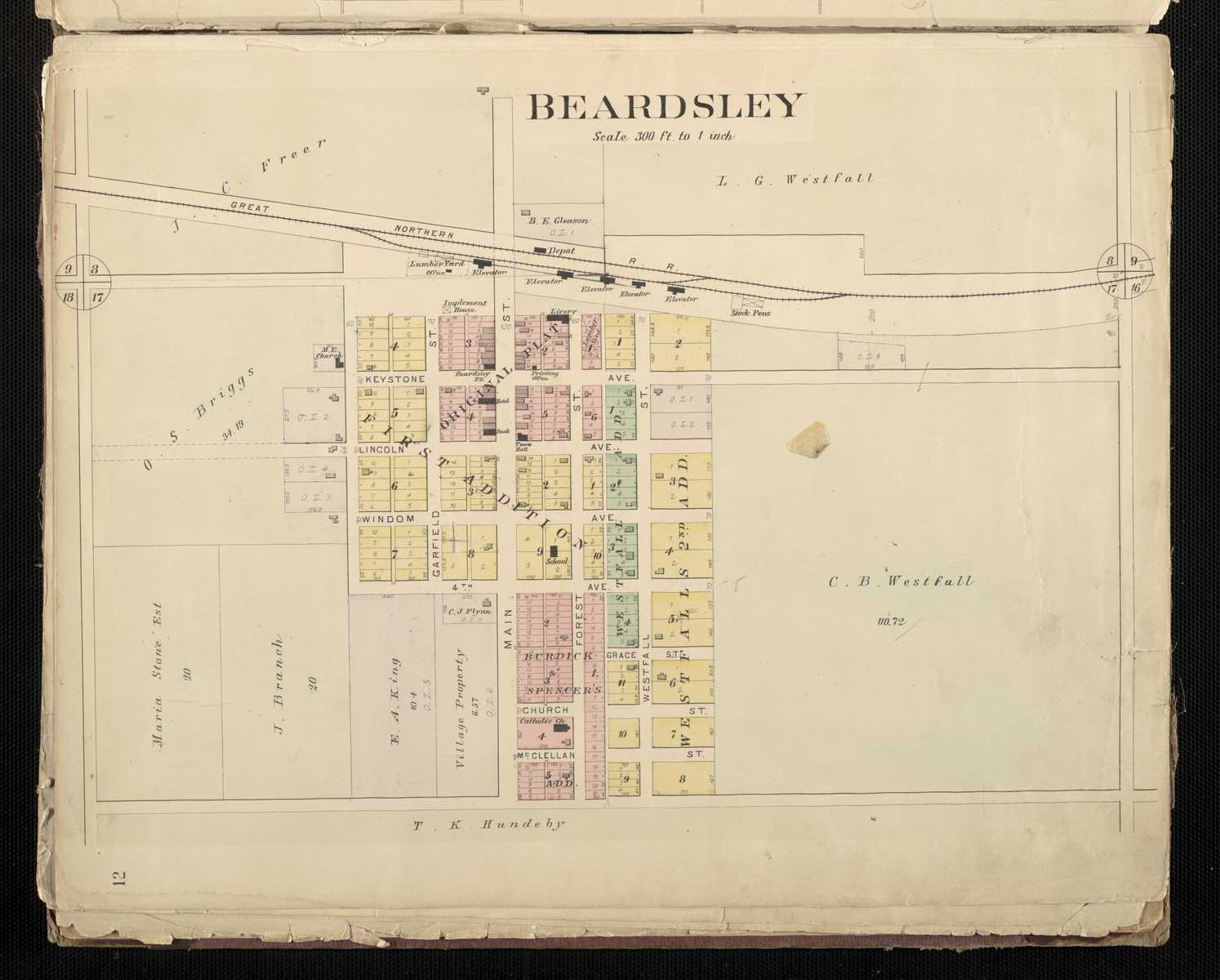
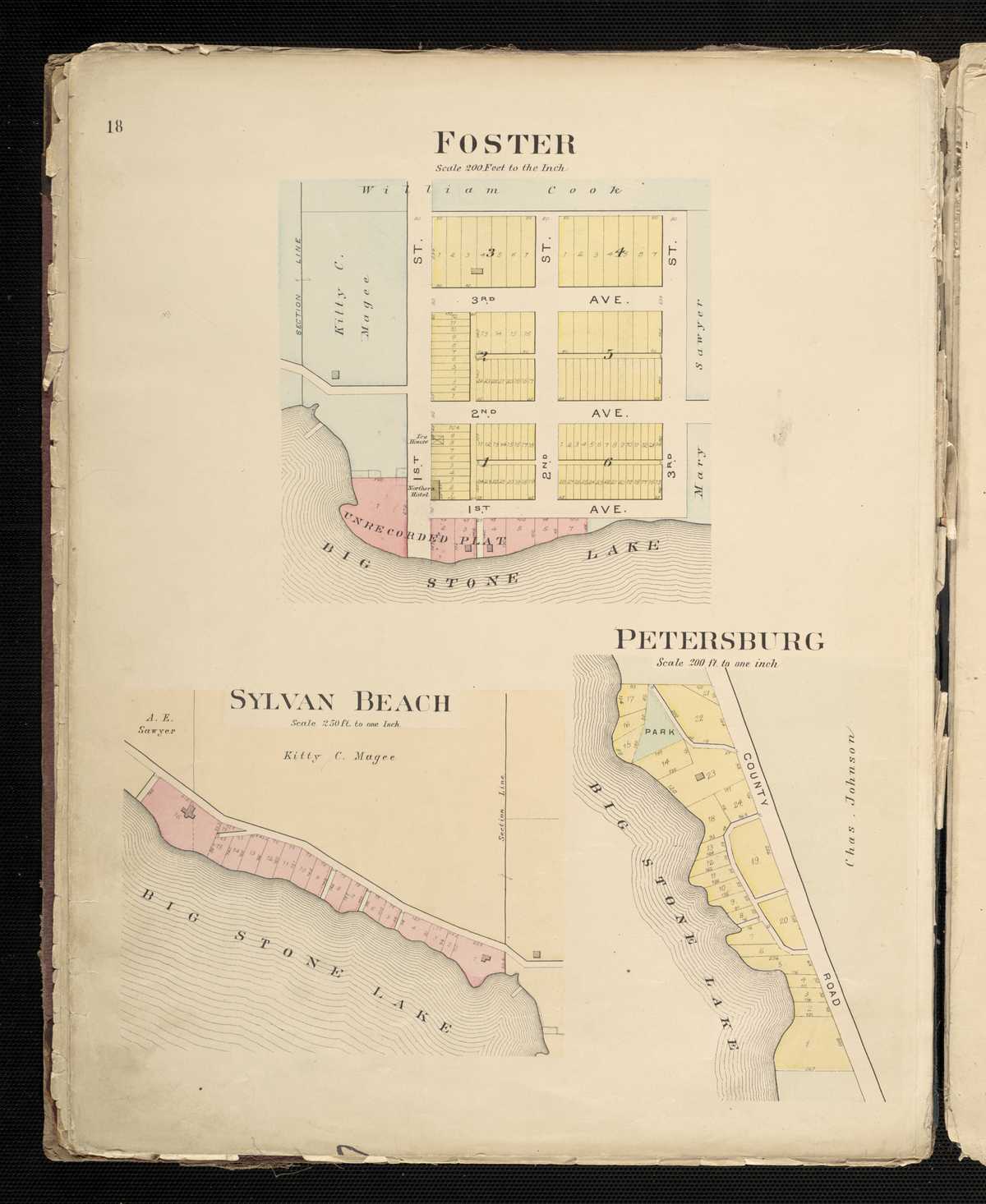
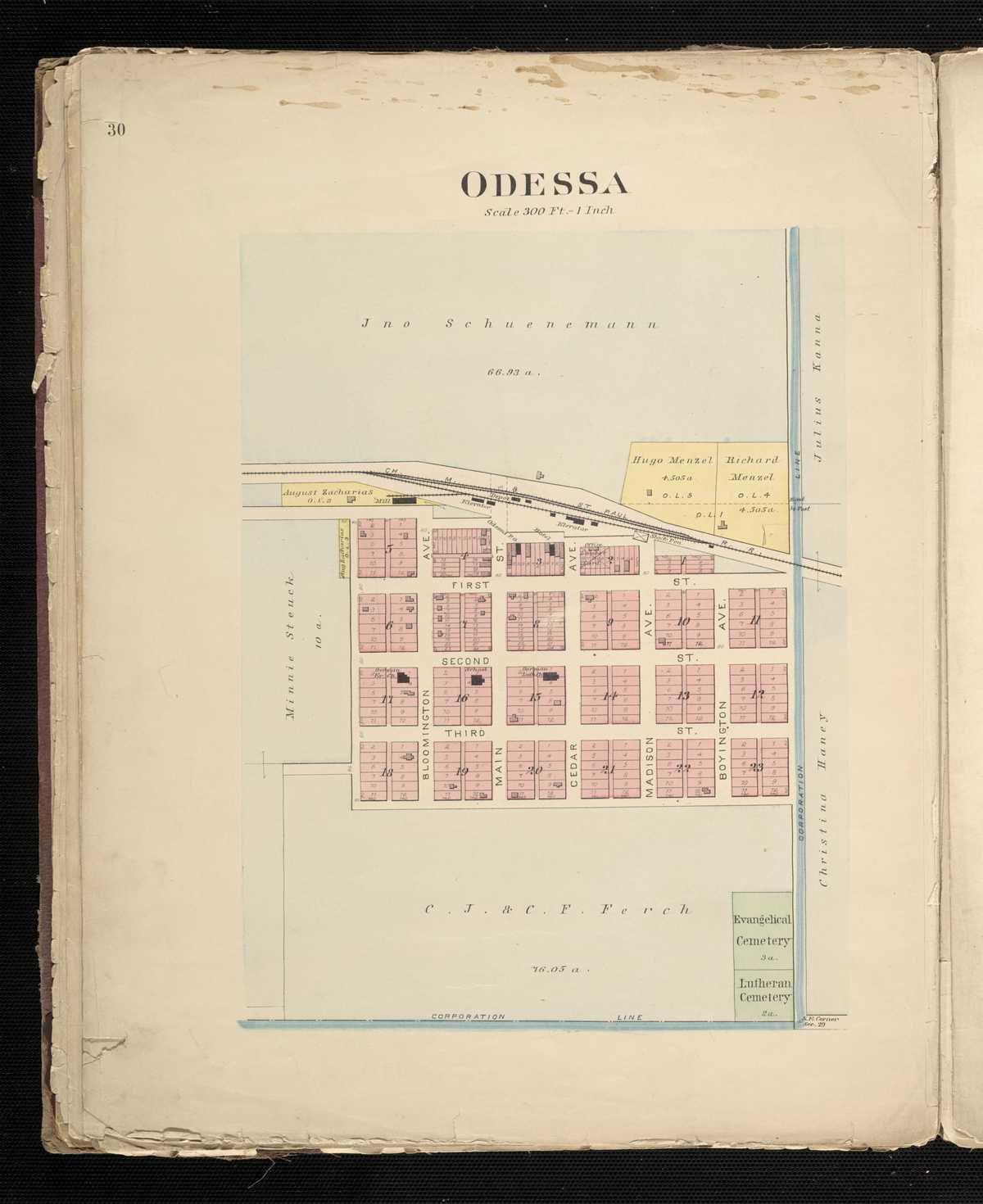
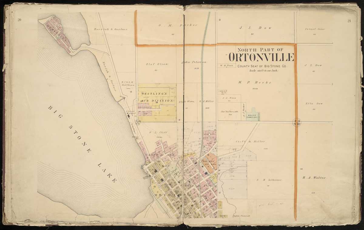
1890 - Big Stone County Digitized interactive Northwest Publishing Company mapFor individual 1890 plats of cities and towns, select the name of the city/town of interest: Barry Beardley Clinton Correll Foster Odessa Ortonville, North Petersburg Sylvan Beach
Big Stone County
1916 - Big Stone County Plat Book of the State of MinnesotaBlue Earth County
1916 - Blue Earth County Plat Book of the State of MinnesotaCounties beginning with C
Carlton County
1916 - Carlton County Plat Book of the State of MinnesotaCarver County
1916 - Carver County Plat Book of the State of MinnesotaChippewa County
1916 - Chippewa County Plat Book of the State of MinnesotaChisago County
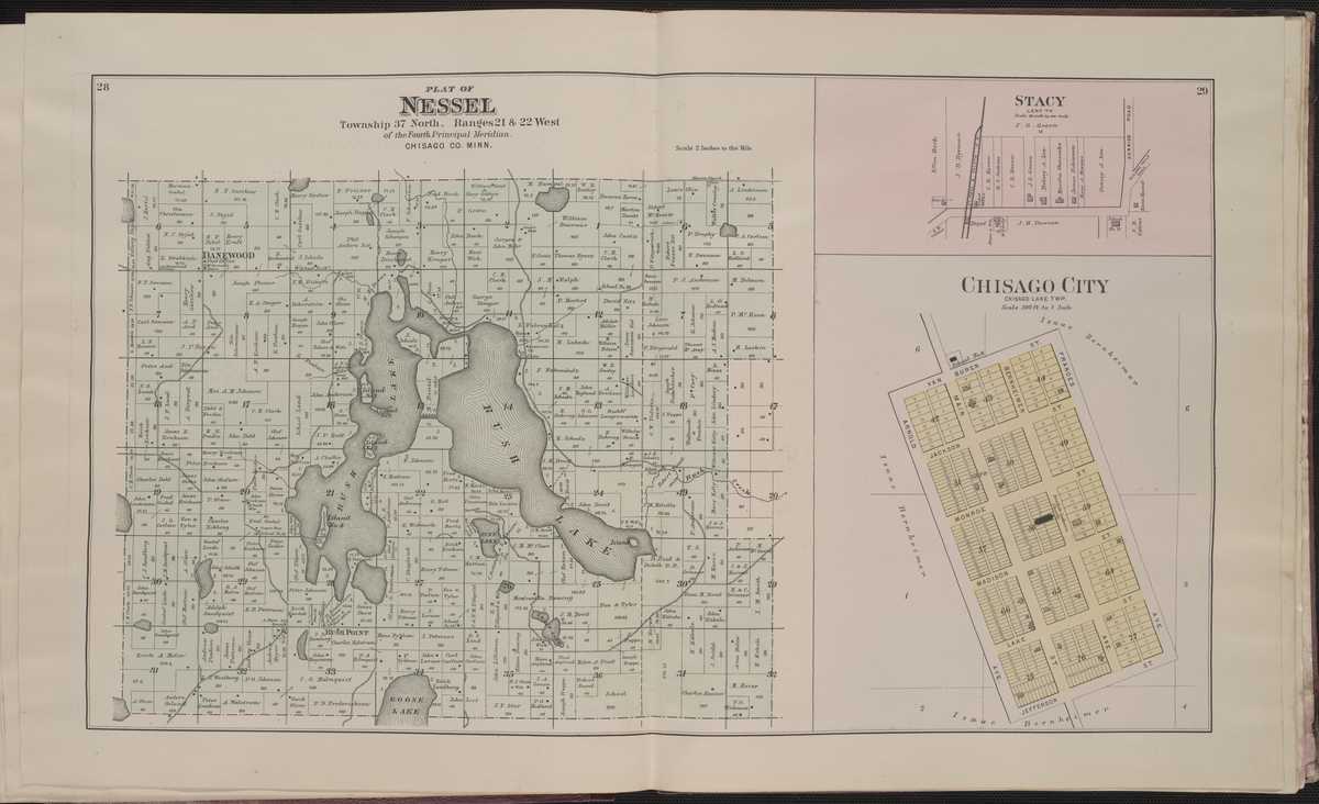
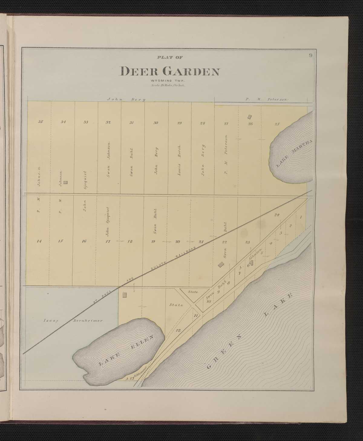
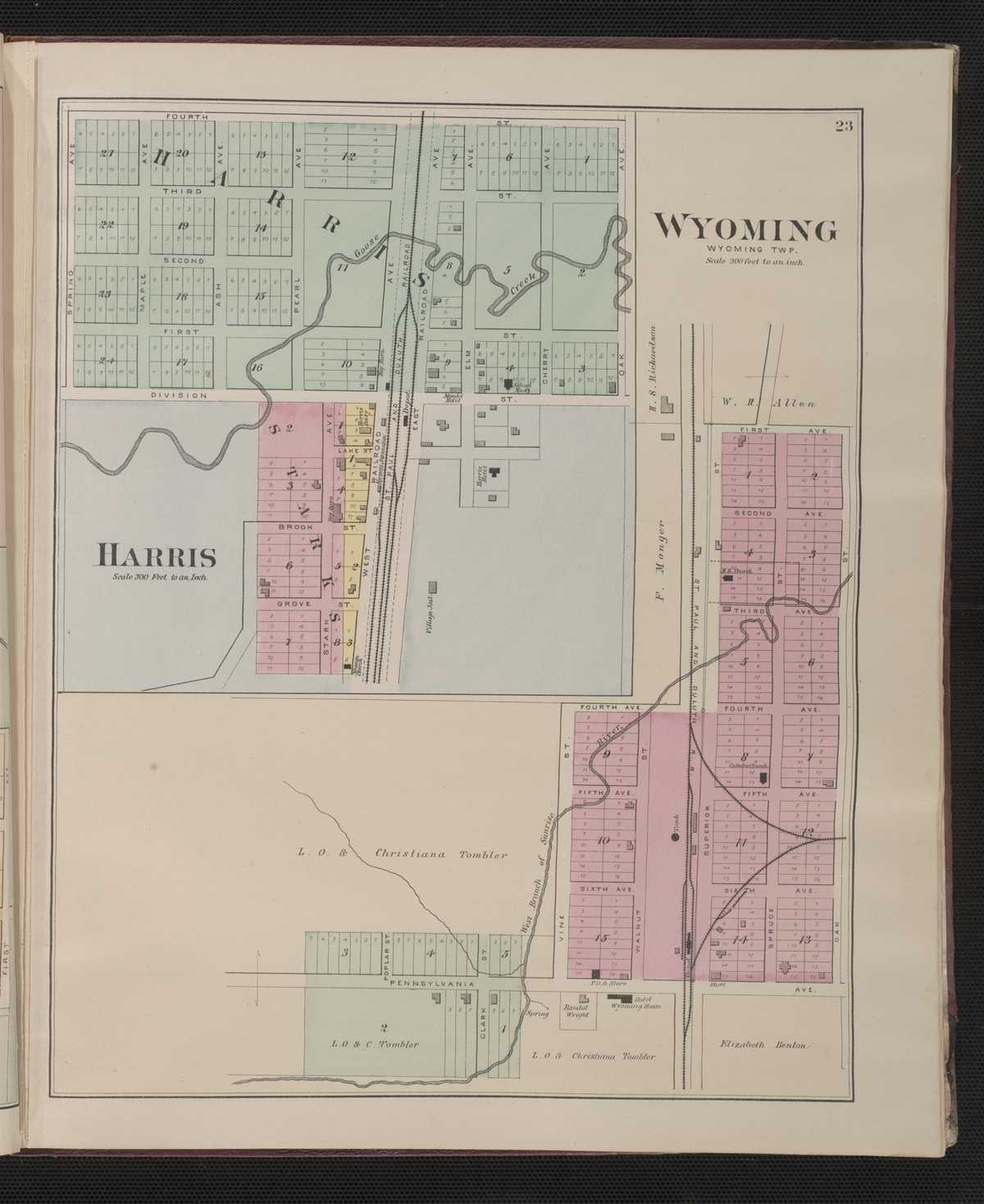
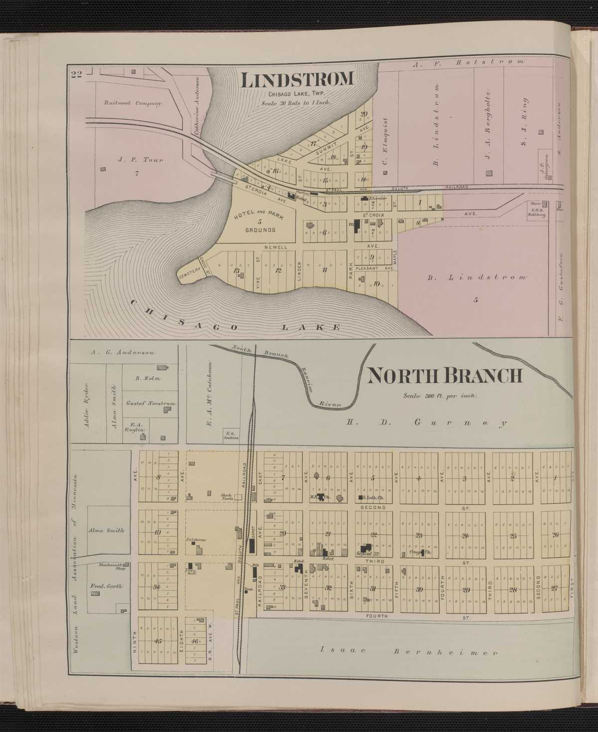
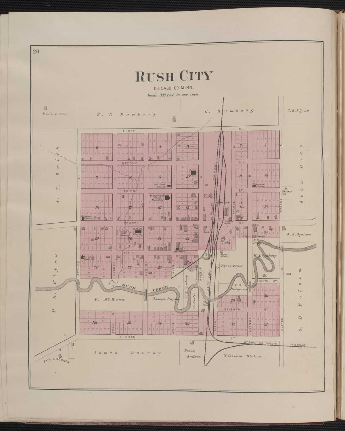
1888 - Chisago County Digitized interactive C.M. Foote & Company mapFor individual plats of cities and towns, select the name of the city/ town of interest: Center City Chisago Chisago City Deergarden Franconia Harris Lindstrom North Branch Rush City Stacy Stark Sunrise City Taylor's Falls Wyoming
Chisago County
1916 - Chisago County Plat Book of the State of MinnesotaClay County
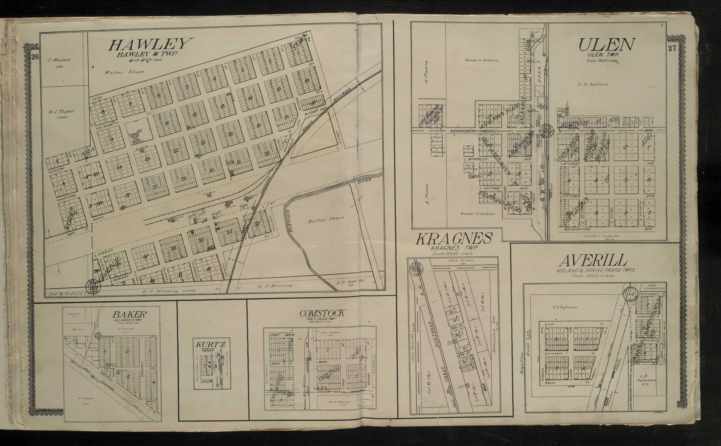
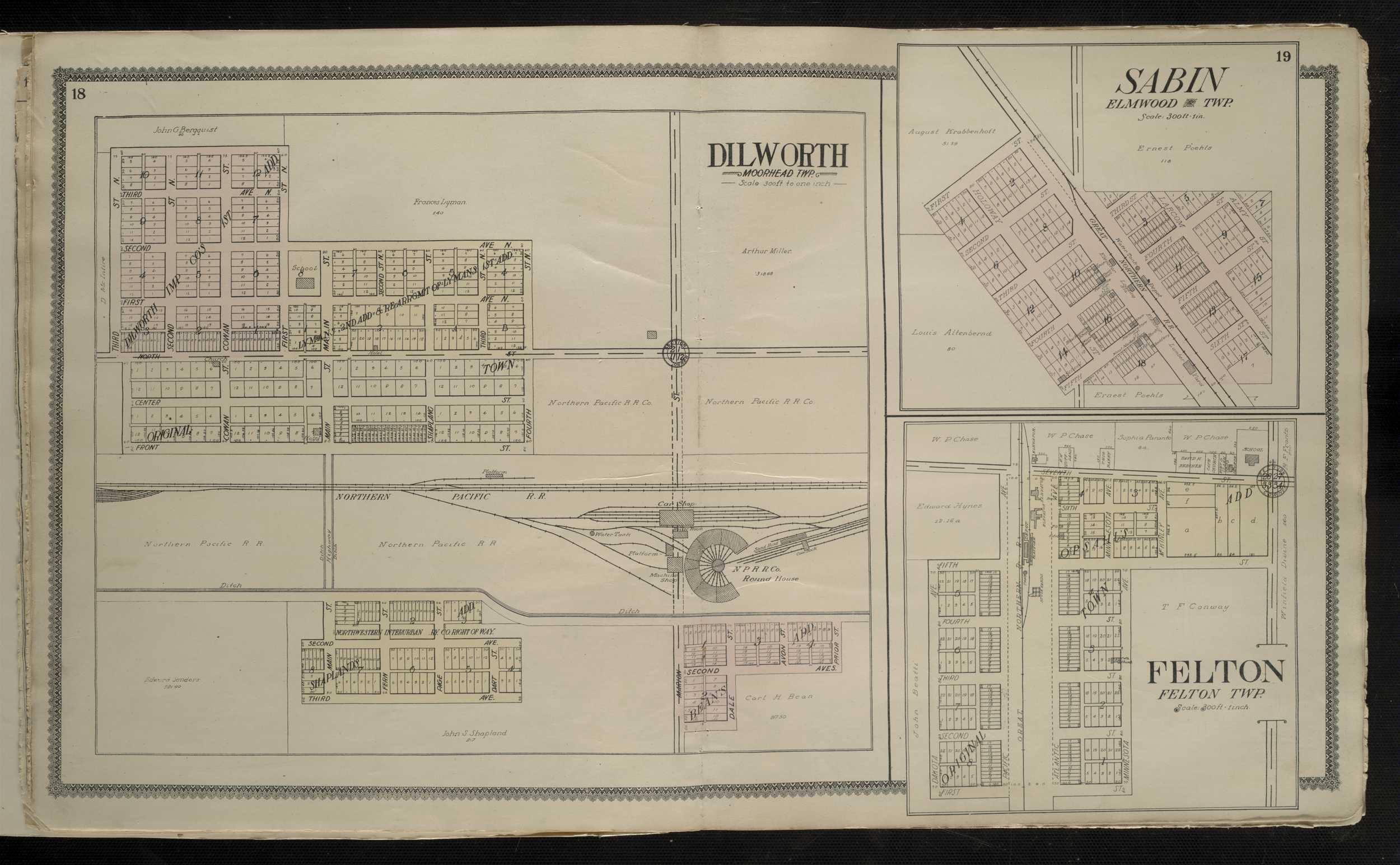
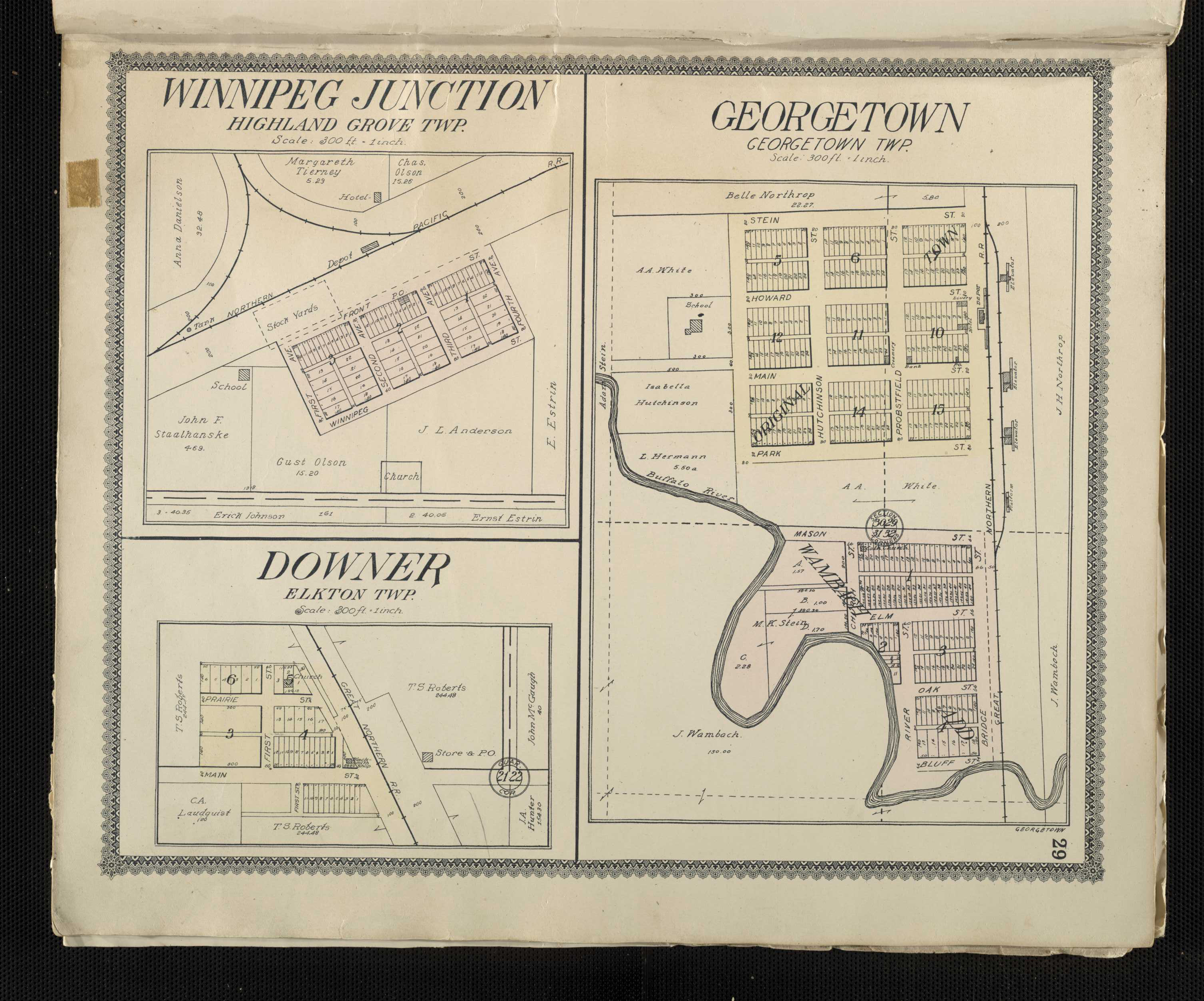
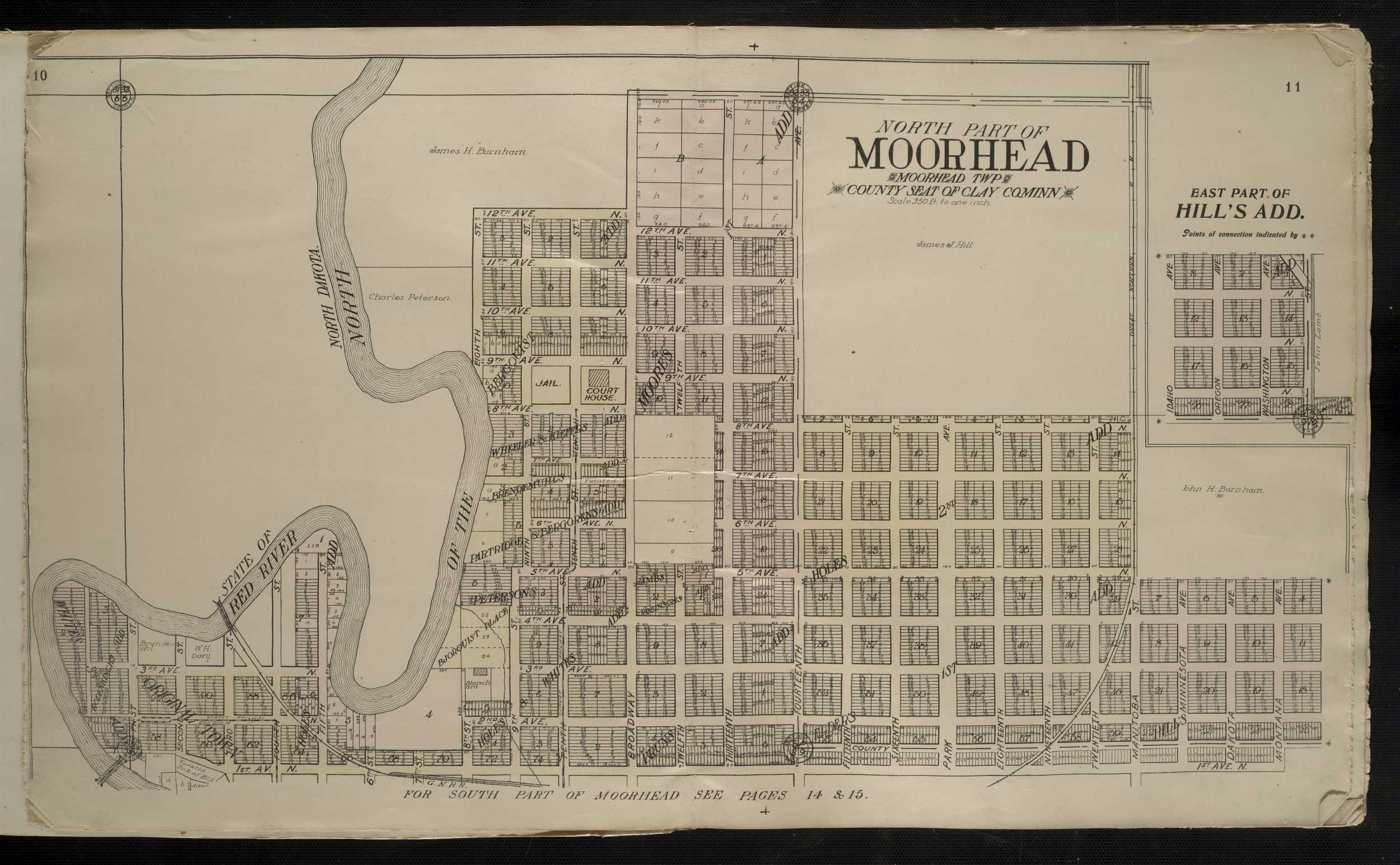
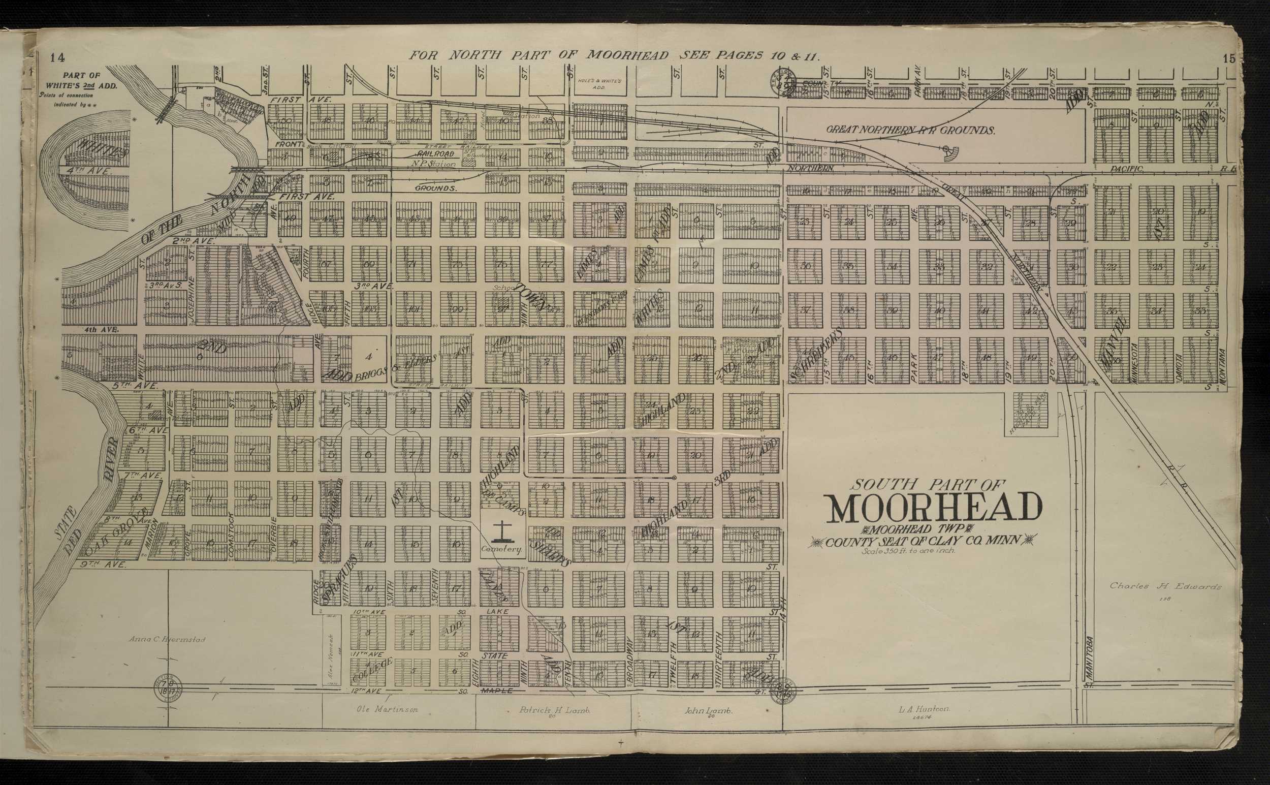
1909 - Clay County Digitized interactive Alden Publishing Company mapFor individual 1909 plats of cities and towns, please click on the name of the city/ town of interest: Averill Baker Barnesville Comstock Dilworth Downer Felton Georgetown Glyndon Hawley Hitterdal Kragnes Kurtz Manitoba Junction Moorhead, North Moorhead, South Rustad P.O. Sabin Ulen Winnipeg Junction
Clearwater County
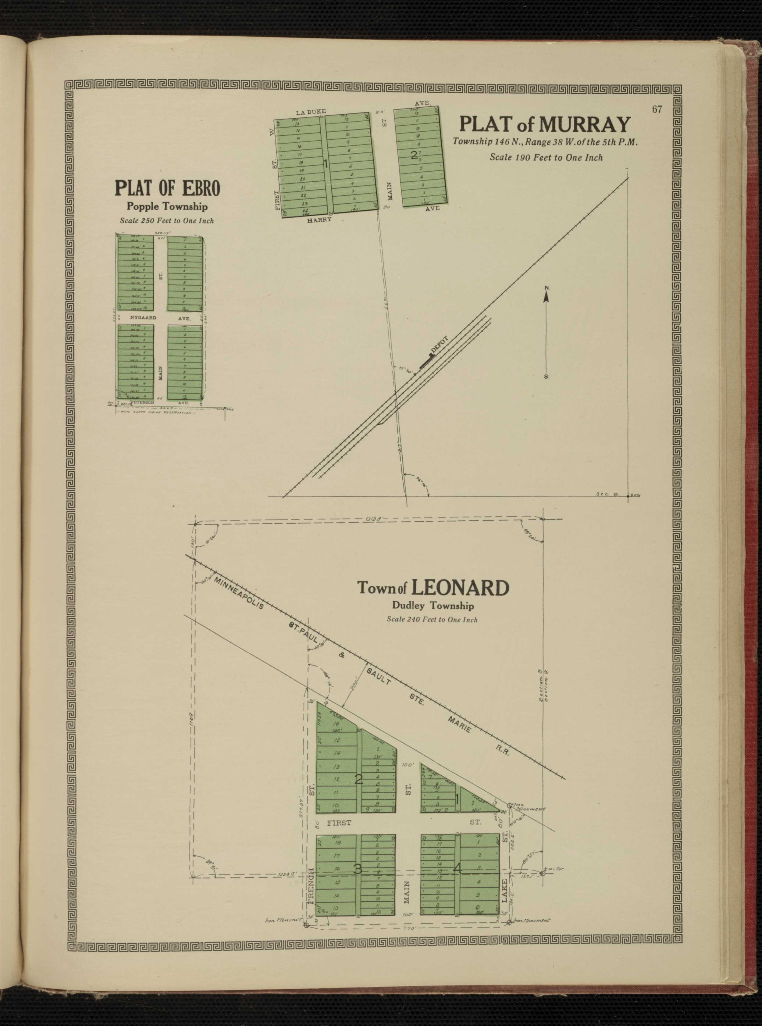
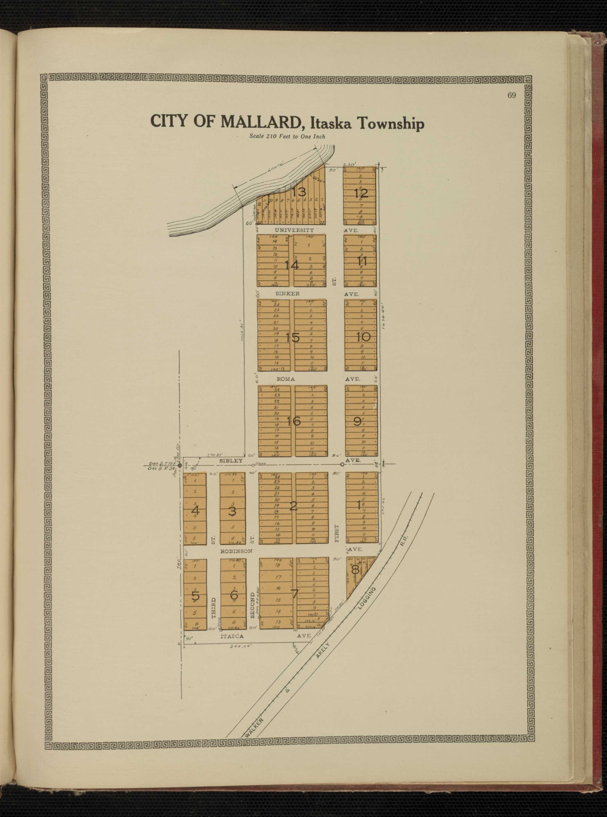
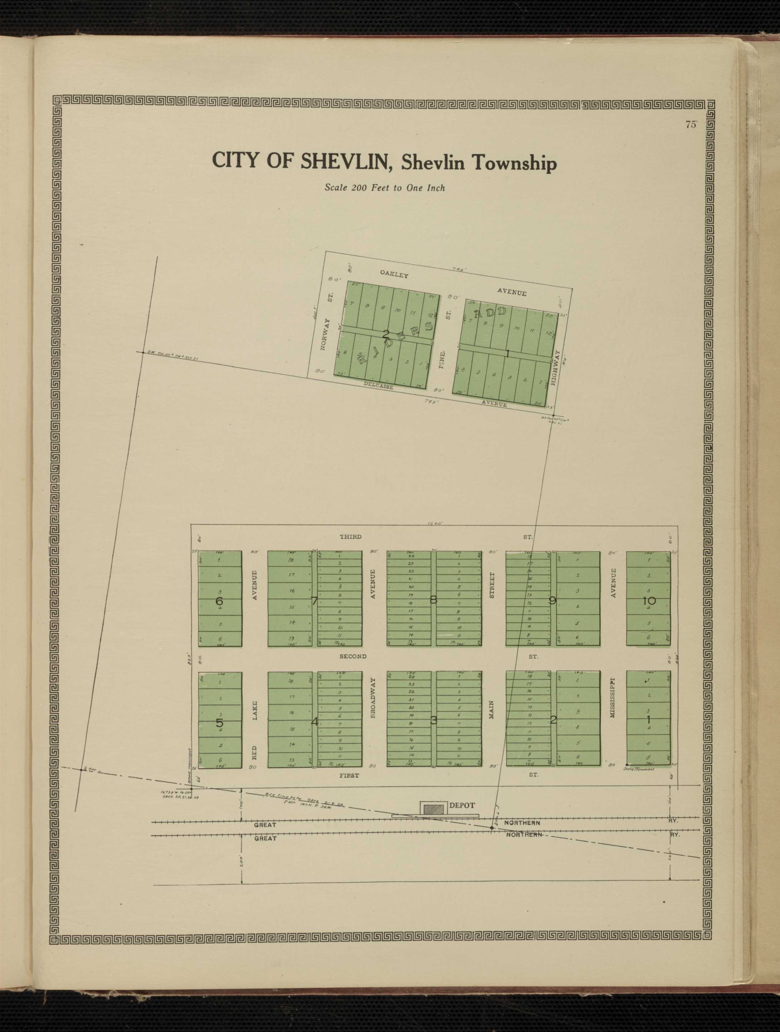
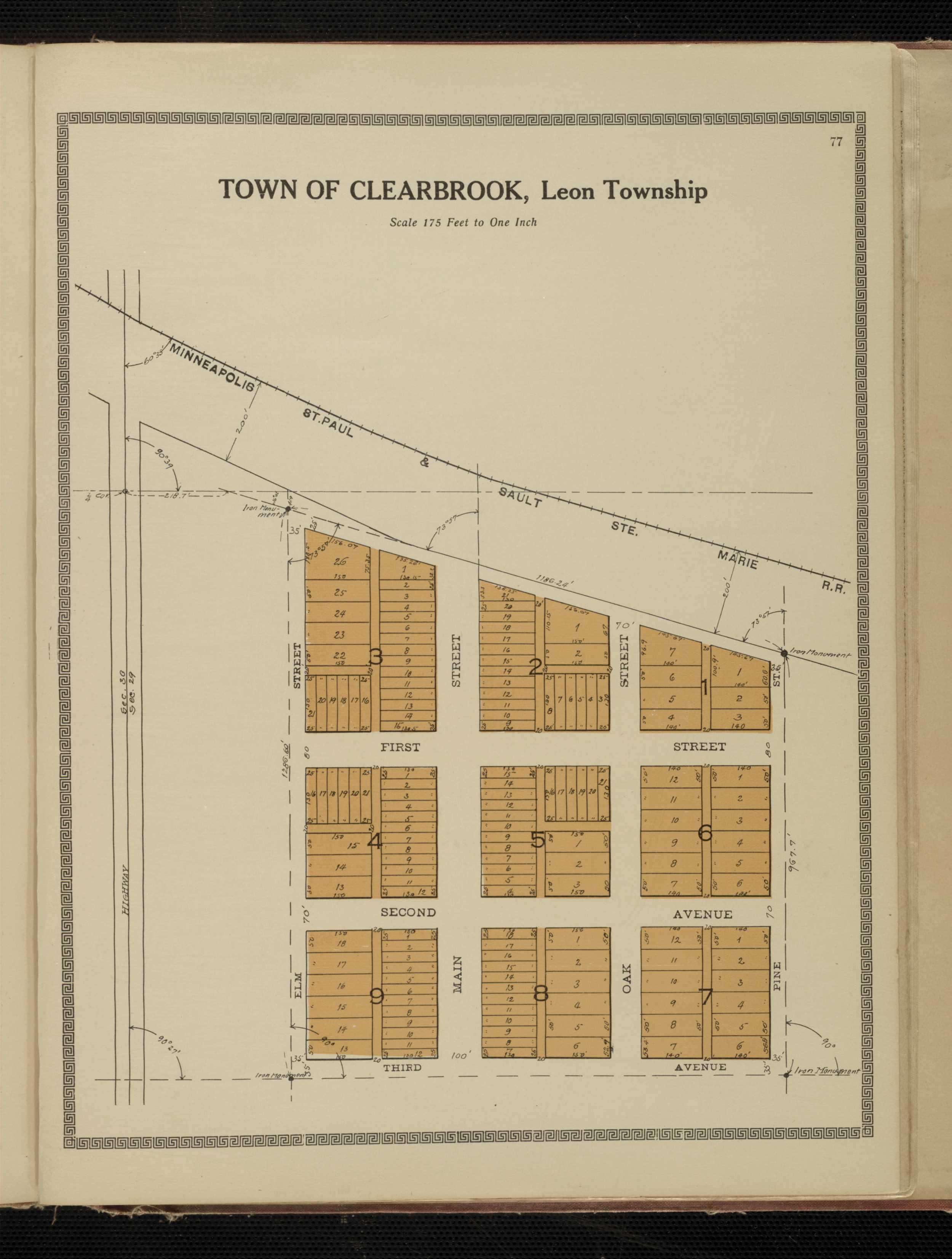
1912 - Clearwater County Digitized interactive Kenyon Co. mapFor individual 1912 plats of cities and towns, select the name of the city/ town of interest: Ebro Murray Leonard Mallard Bagley Gonvick Shevlin Clearbrook
Clearwater County
1916 - Clearwater County Plat Book of the State of MinnesotaCottonwood County
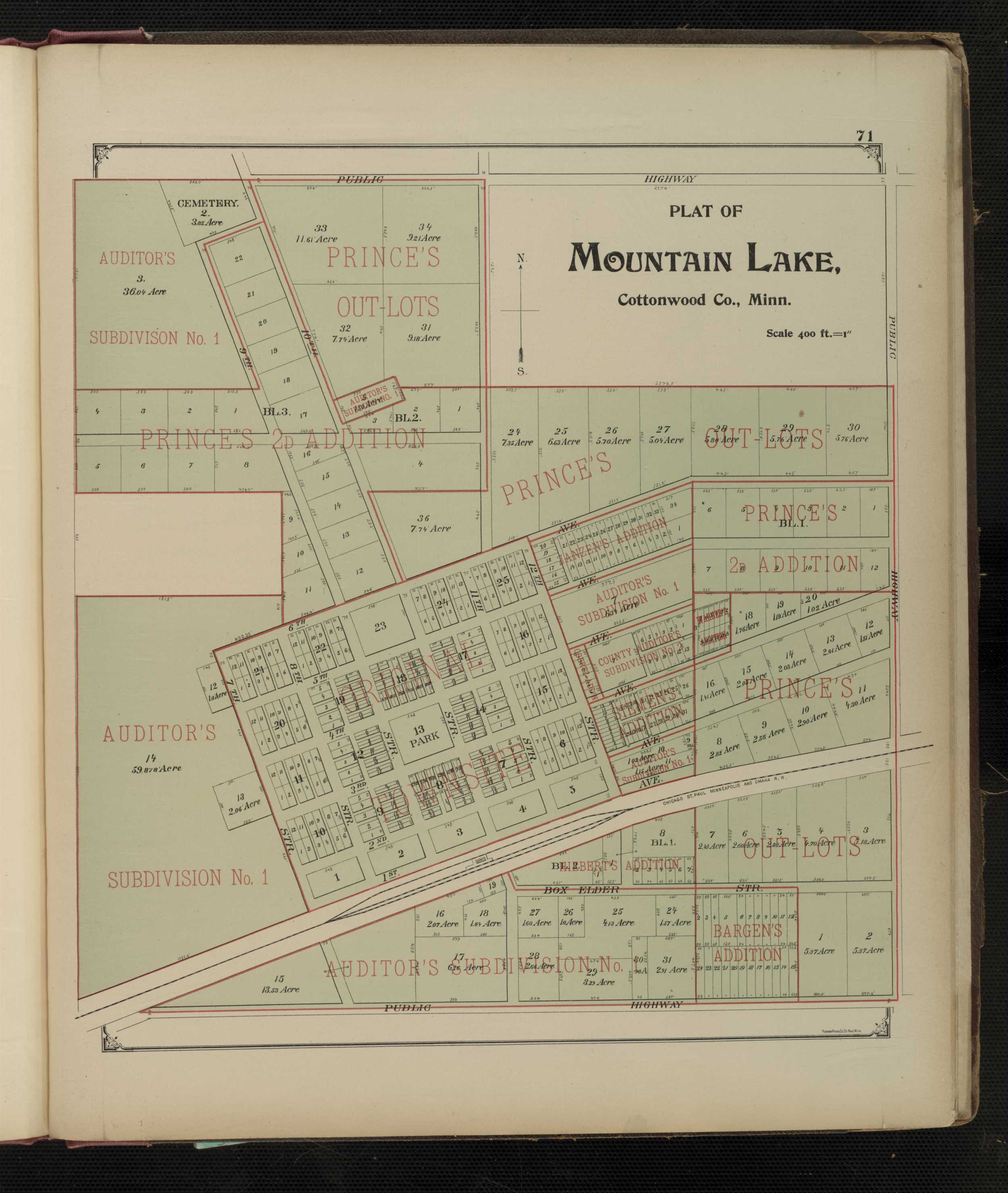
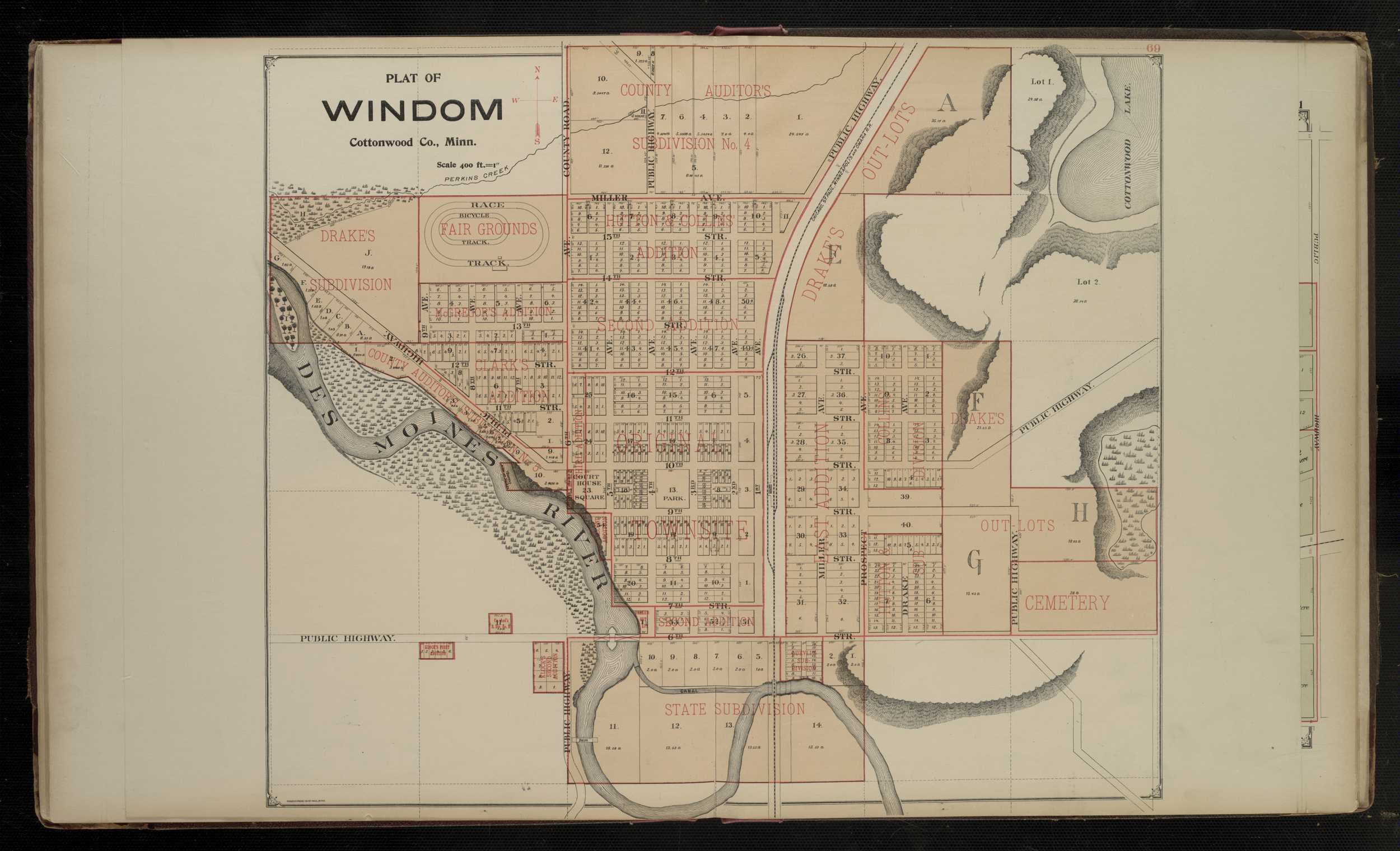
1896 - Crow Wing County Digitized interactive Arthur Gibson, M. & C.E. mapFor individual 1896 plats of cities and towns, select the name of the city/ town of interest: Bingham Lake Mountain Lake Windom
Cottonwood County
1916 - Cottonwood County Plat Book of the State of MinnesotaCrow Wing County
1913 - Crow Wing County Digitized Geo. A. Ogle & Co. Plat BookCrow Wing County
1916 - Crow Wing County Plat Book of the State of MinnesotaCounties beginning with D
Dakota County
1916 - Dakota County Plat Book of the State of MinnesotaDouglas County
1916 - Douglas County Plat Book of the State of MinnesotaCounties Beginning with F
Faribault County
1916 - Faribault County Plat Book of the State of MinnesotaFillmore County
1916 - Fillmore County Plat Book of the State of MinnesotaFreeborn County
1916 - Freeborn County Plat Book of the State of MinnesotaCounties beginning with G
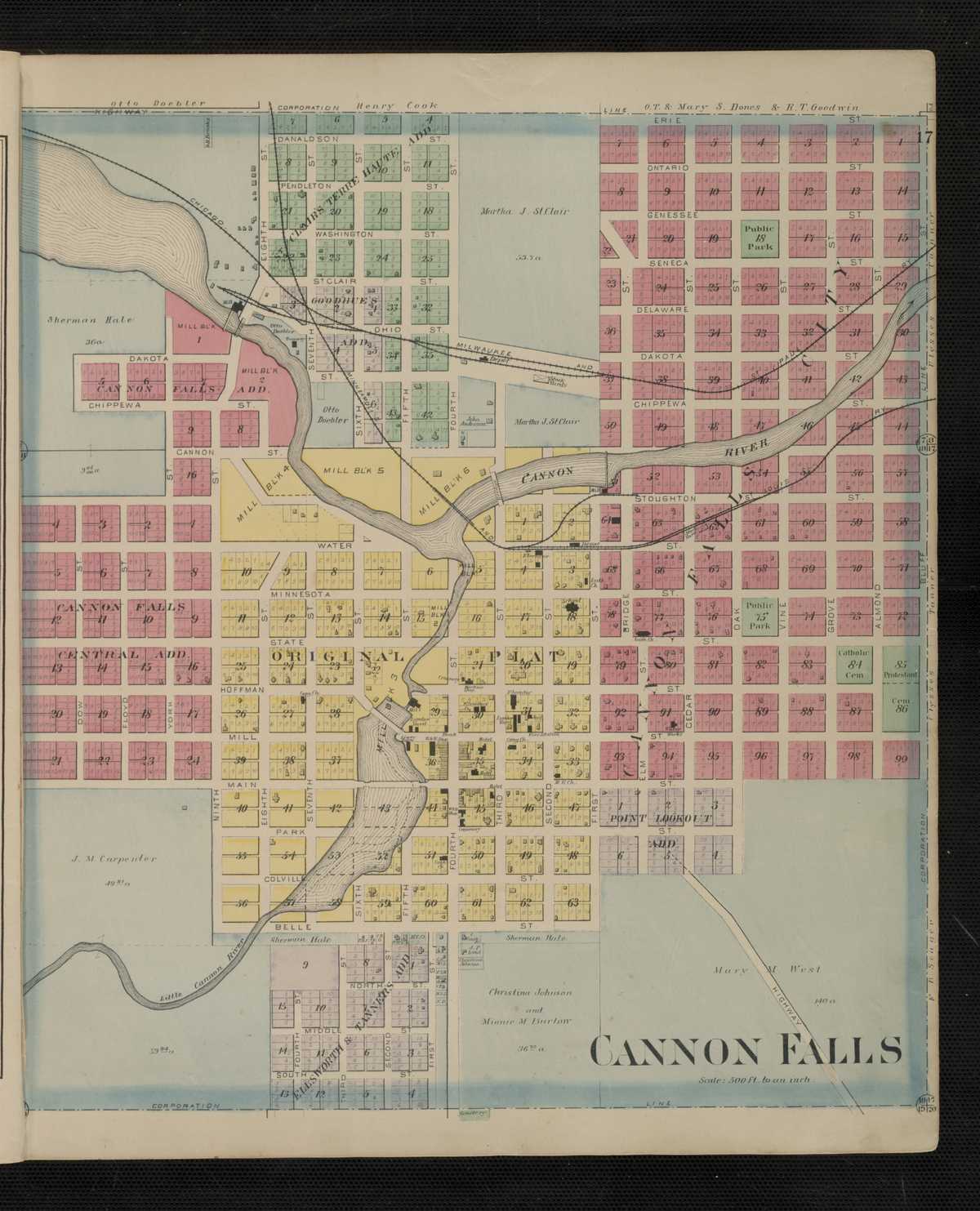
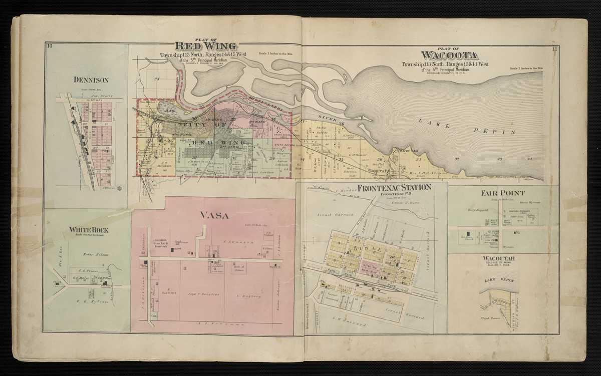
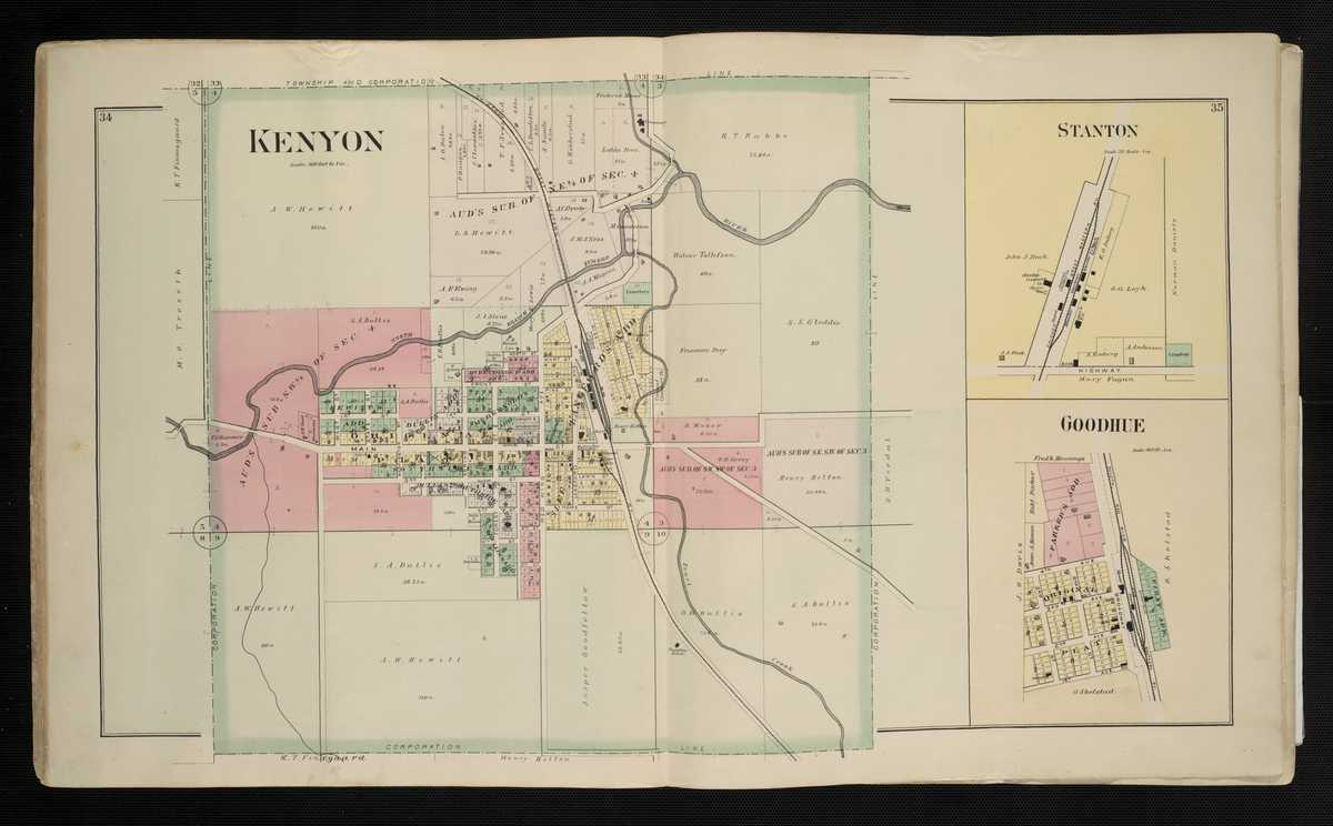
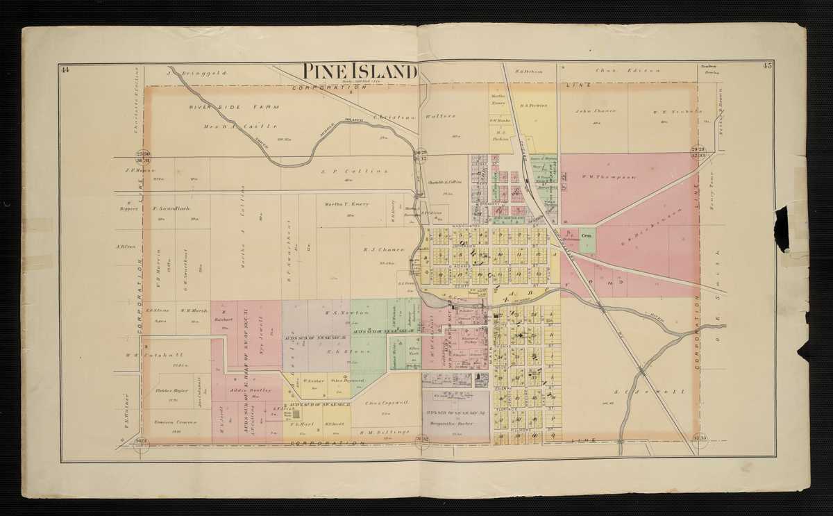
Goodhue County
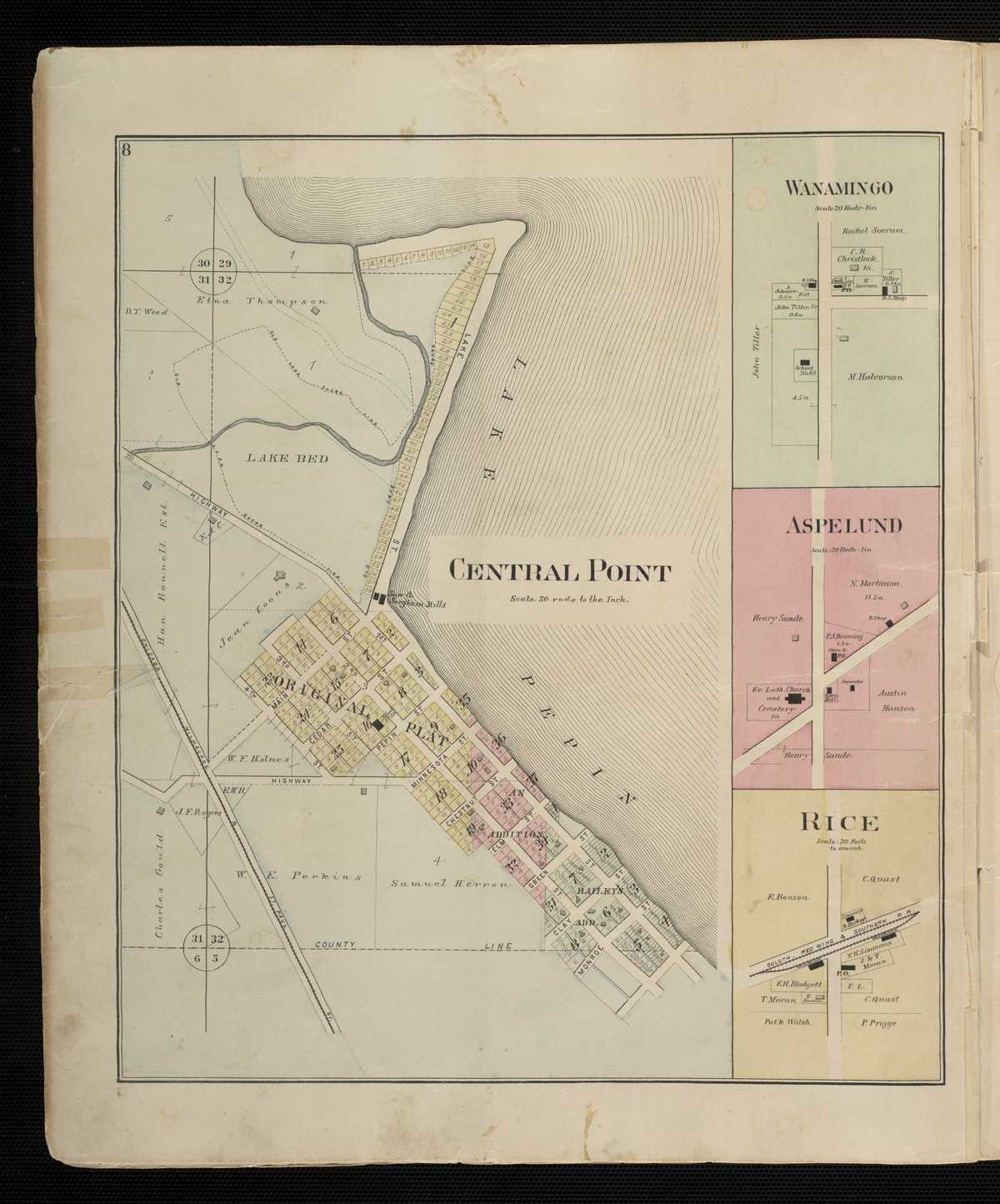
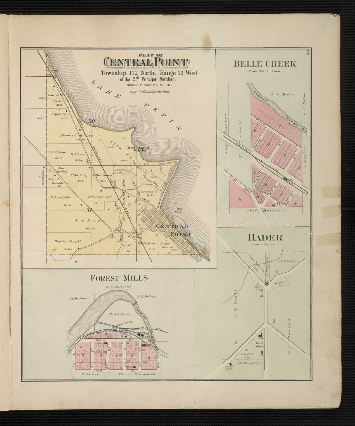
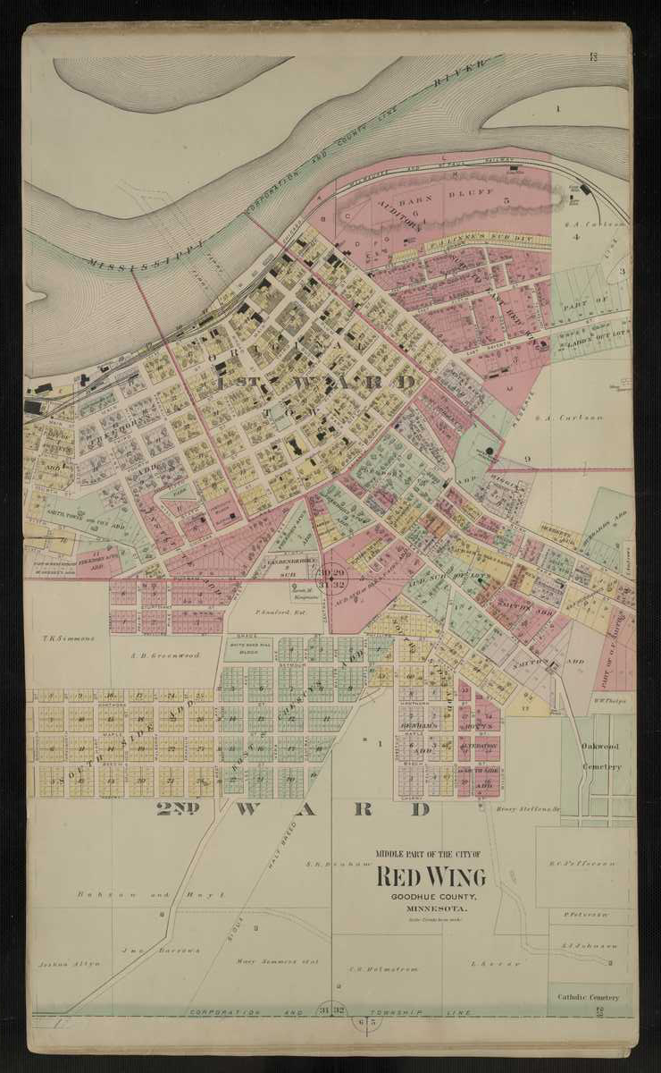
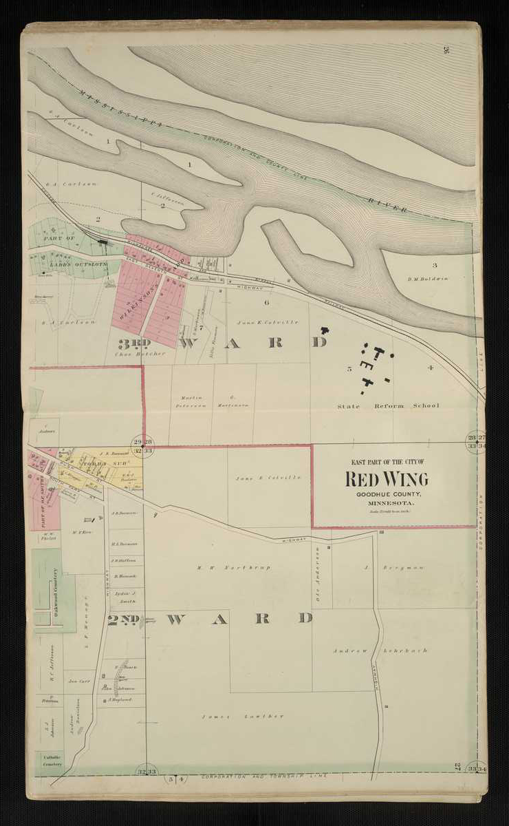
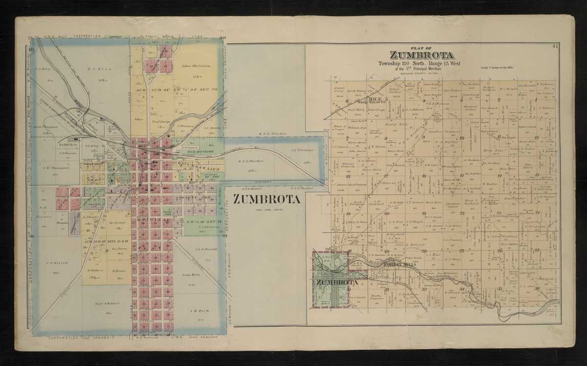
1894 - Goodhue County Digitized interactive . M. Foote & Co. mapFor individual 1894 plats of cities and towns, select the name of the city/ town of interest: Aspelund Auditor's Sub Belle Creek Cannon Falls Central Point Dennison Fair Point Forest Mills Frontenac Frontenac Station Goodhue Hader Kenyon Pine Island Red Wing, West Red Wing, Middle Red Wing, East Rice Stanton Vasa Wacoutah Wanamingo White Rock Zumbrota
Goodhue County
1916 - Goodhue County Plat Book of the State of MinnesotaCounties Beginning with H
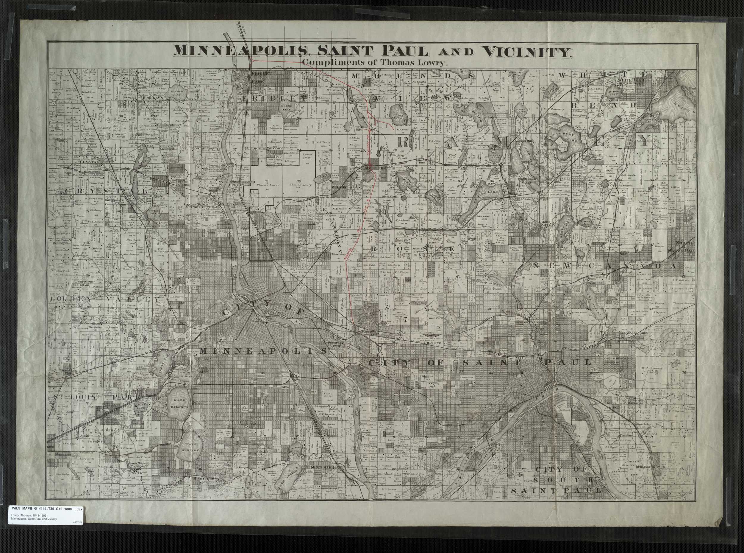
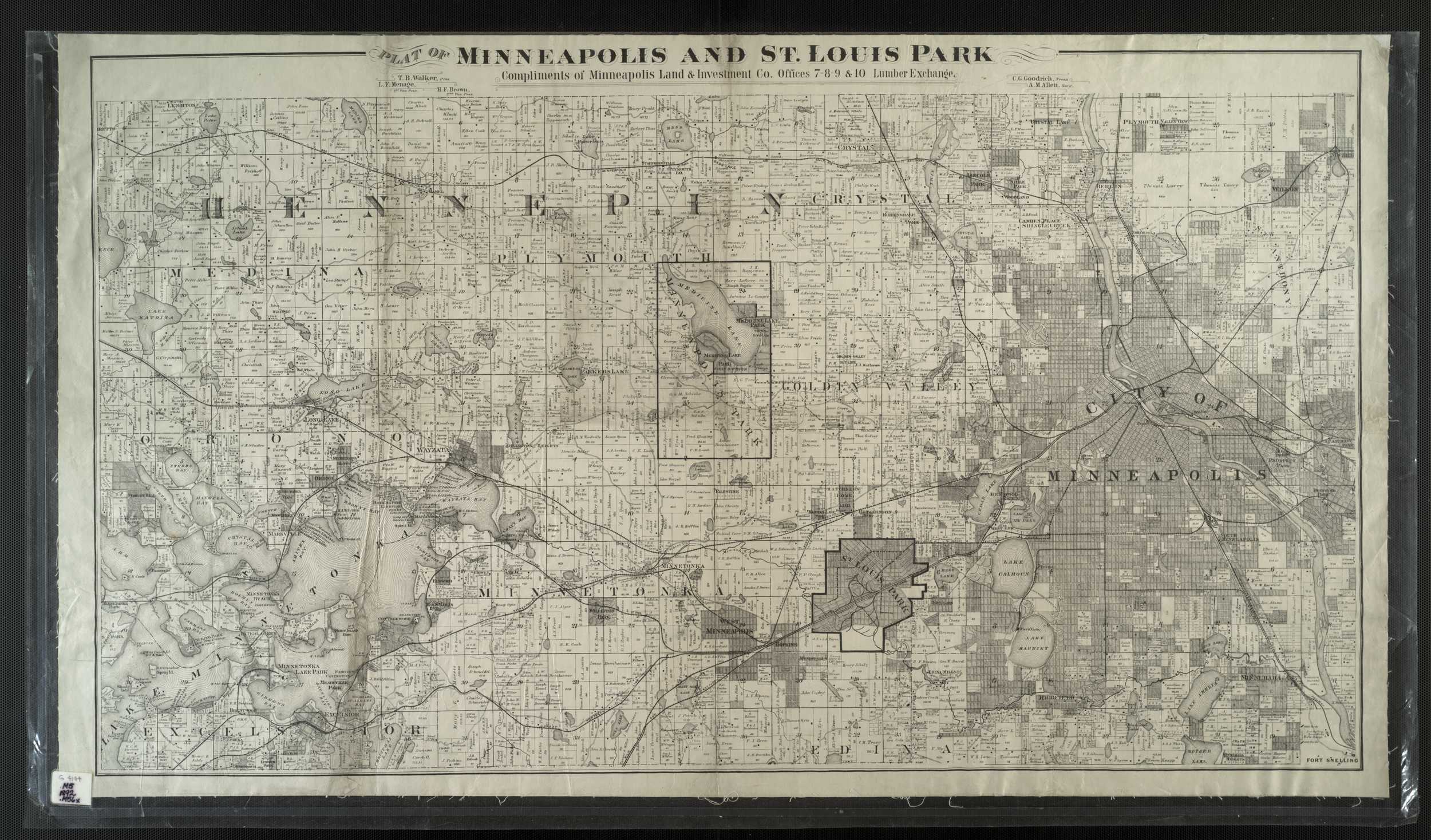
Hennepin County
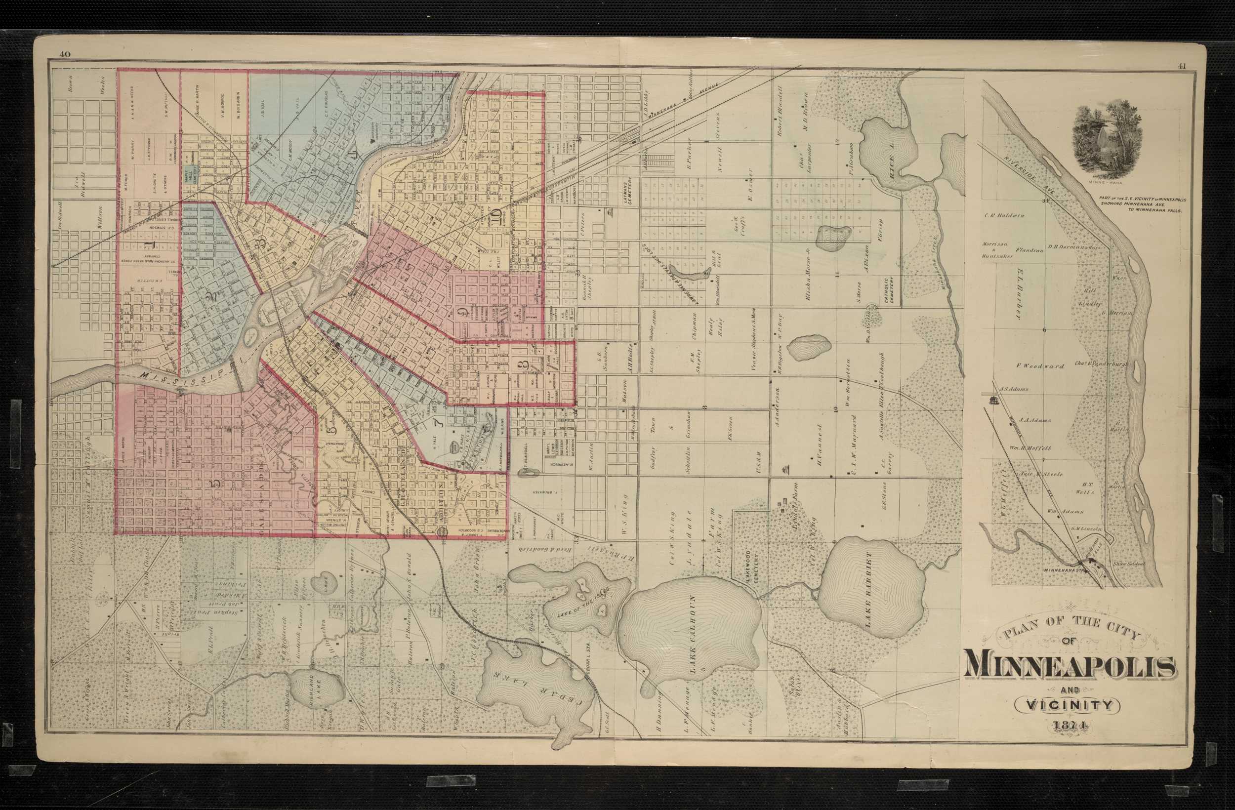
1873 - Hennepin County Digitized interactive Geo B. Wright mapHennepin County
1874 - Hennepin County Digitized interactive A.T. Andreas map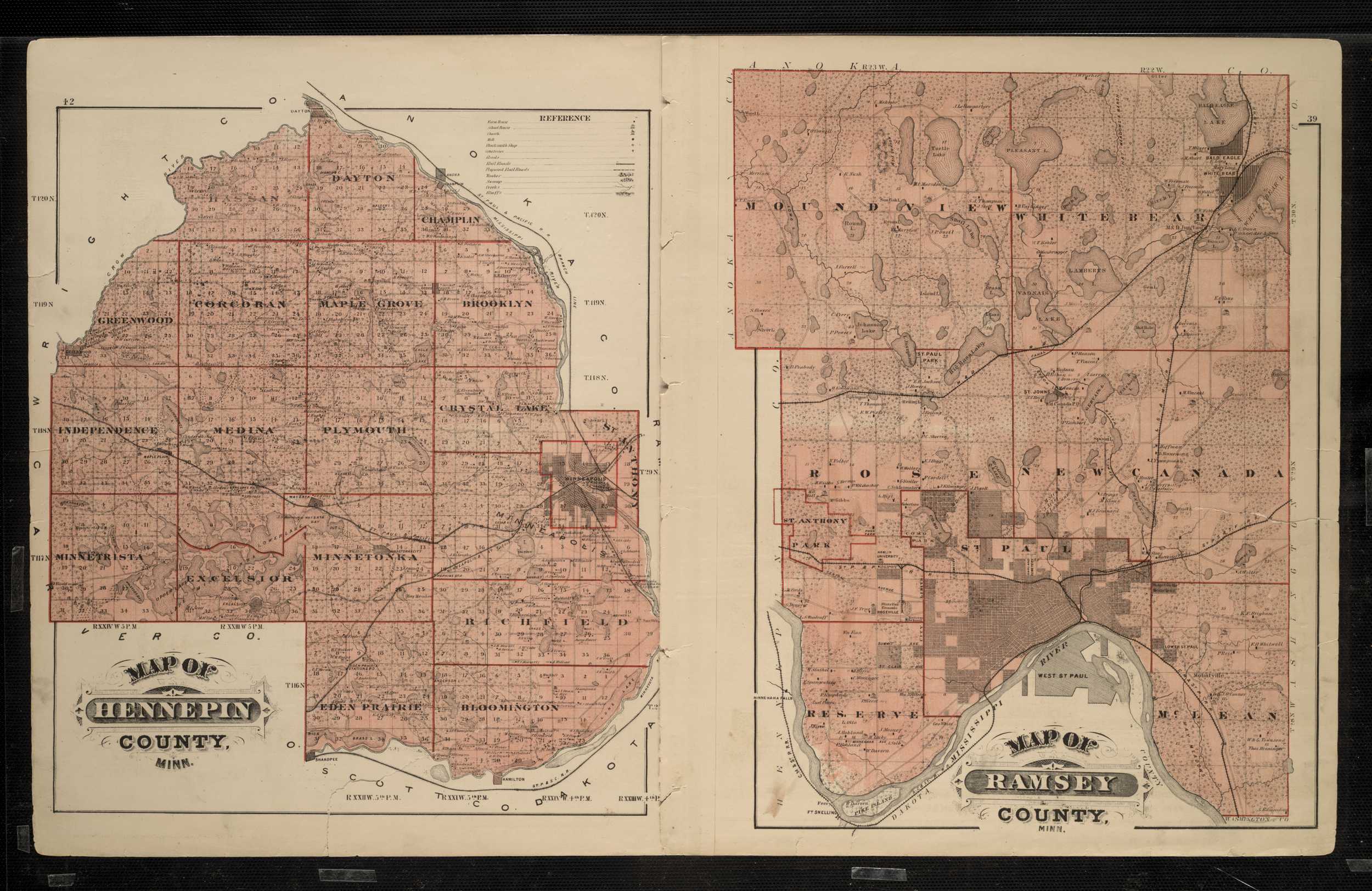
Hennepin County
1898 - Hennepin County Digitized interactive P.M. Dahl map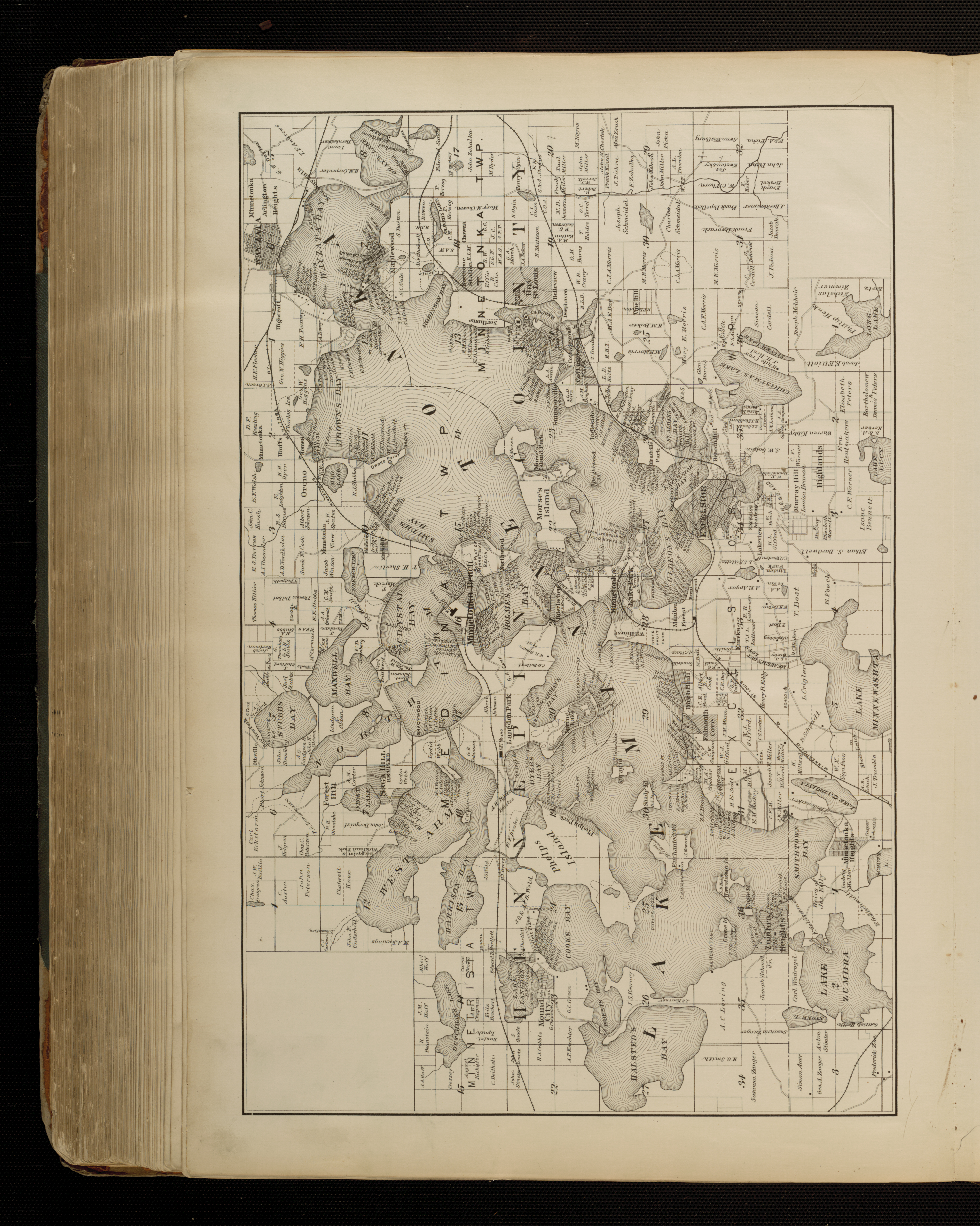
Hennepin County
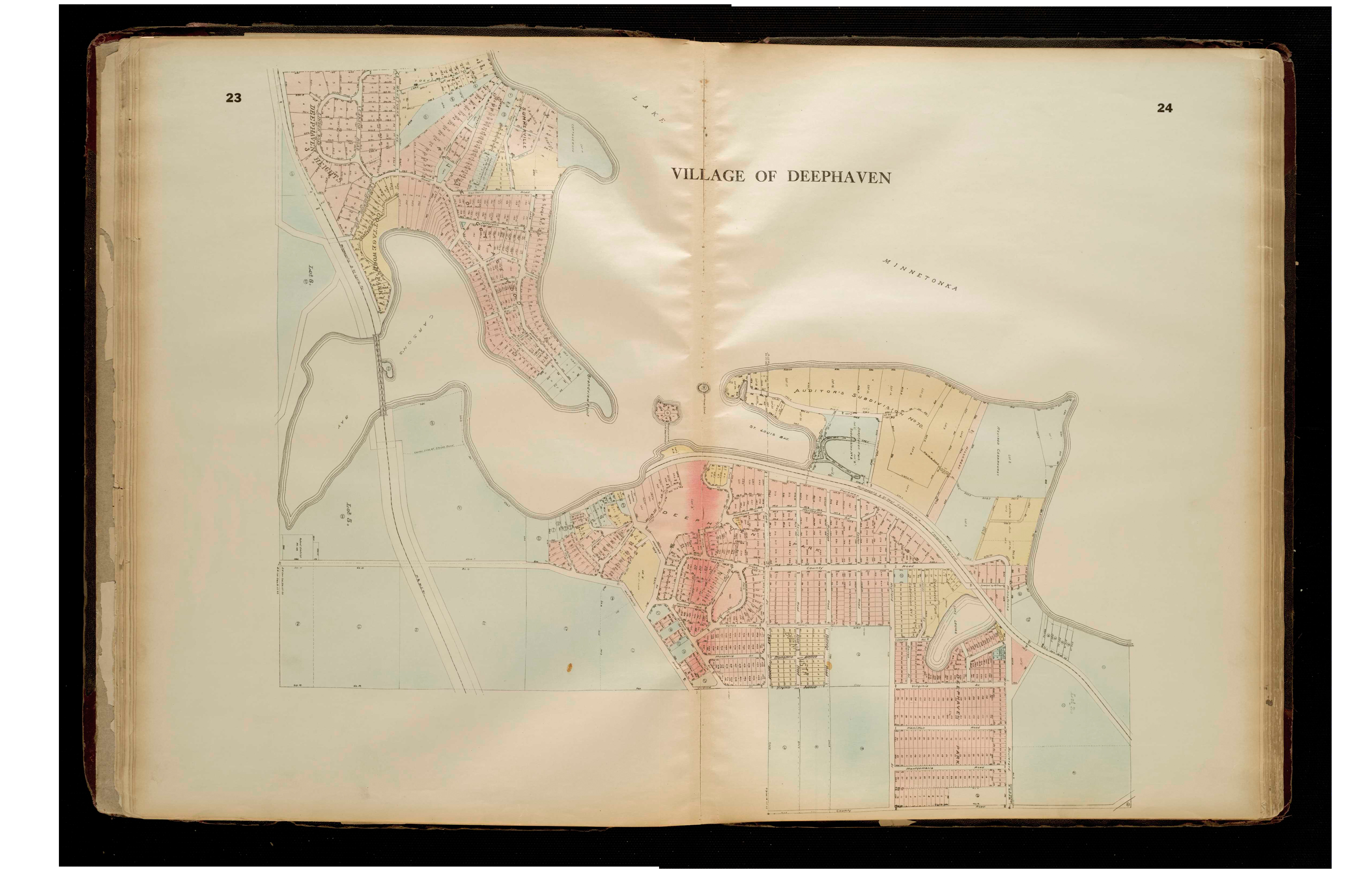
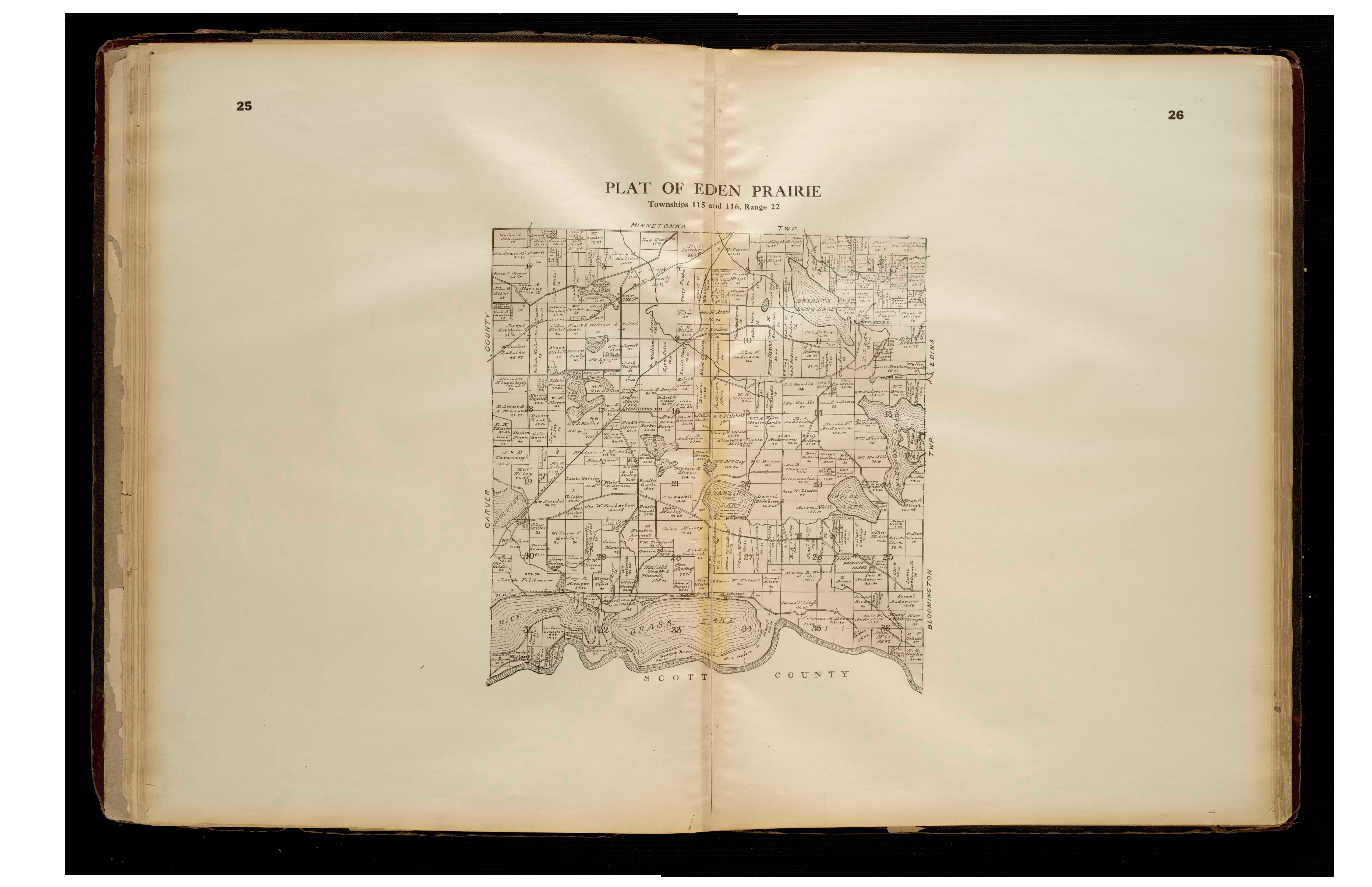
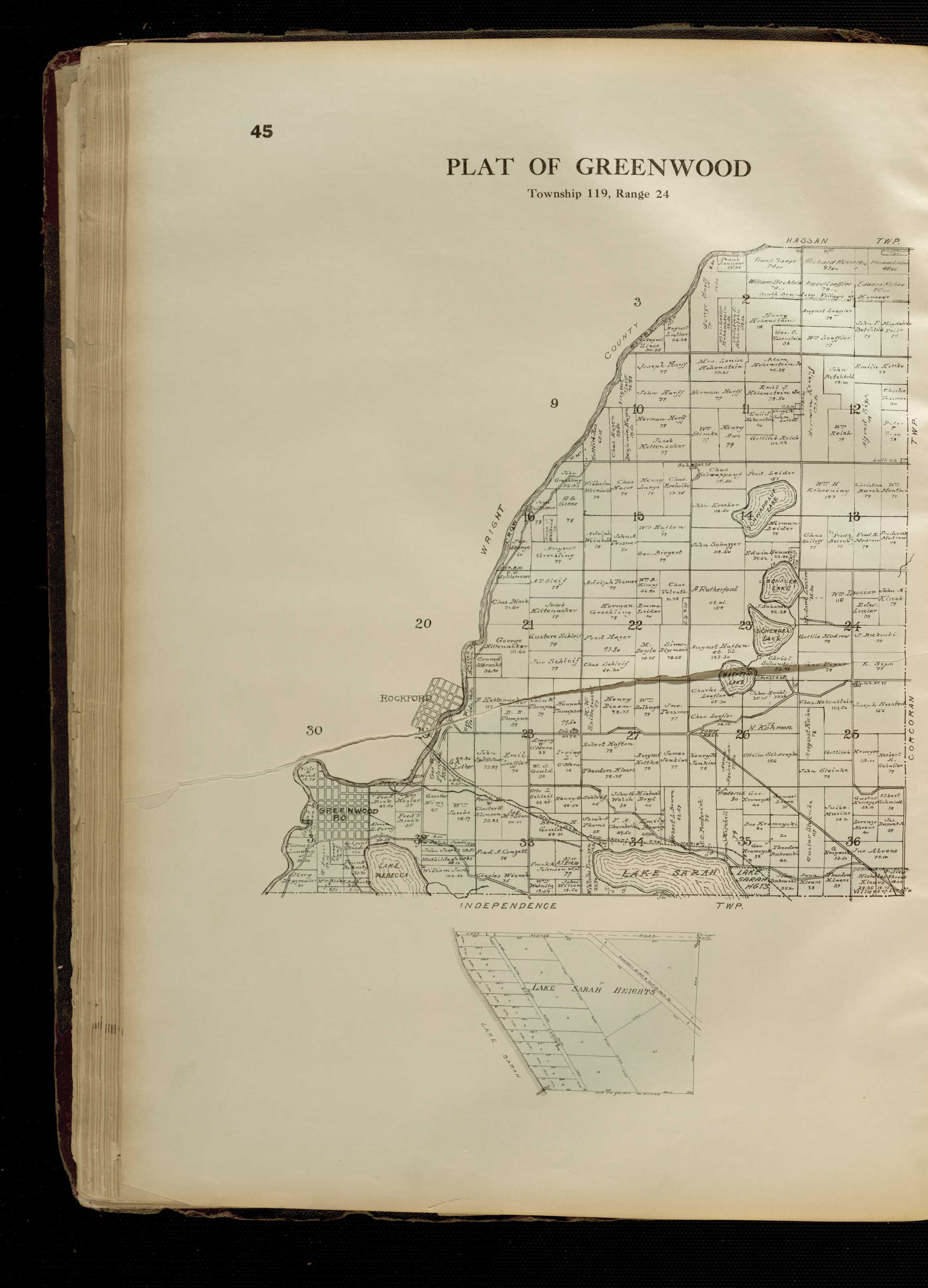
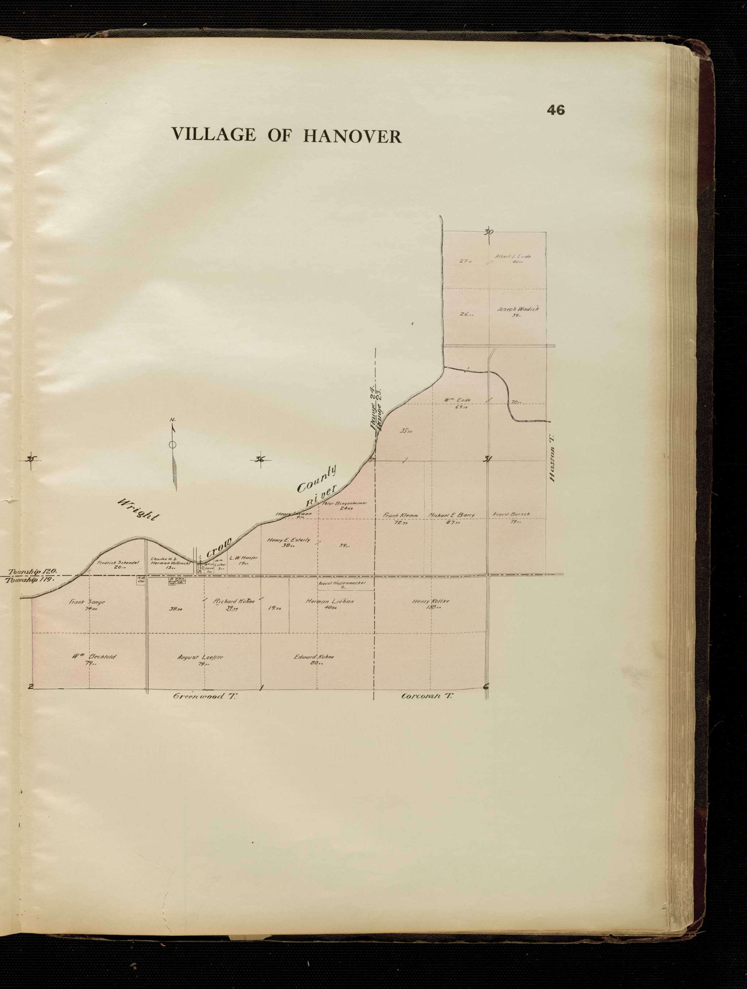
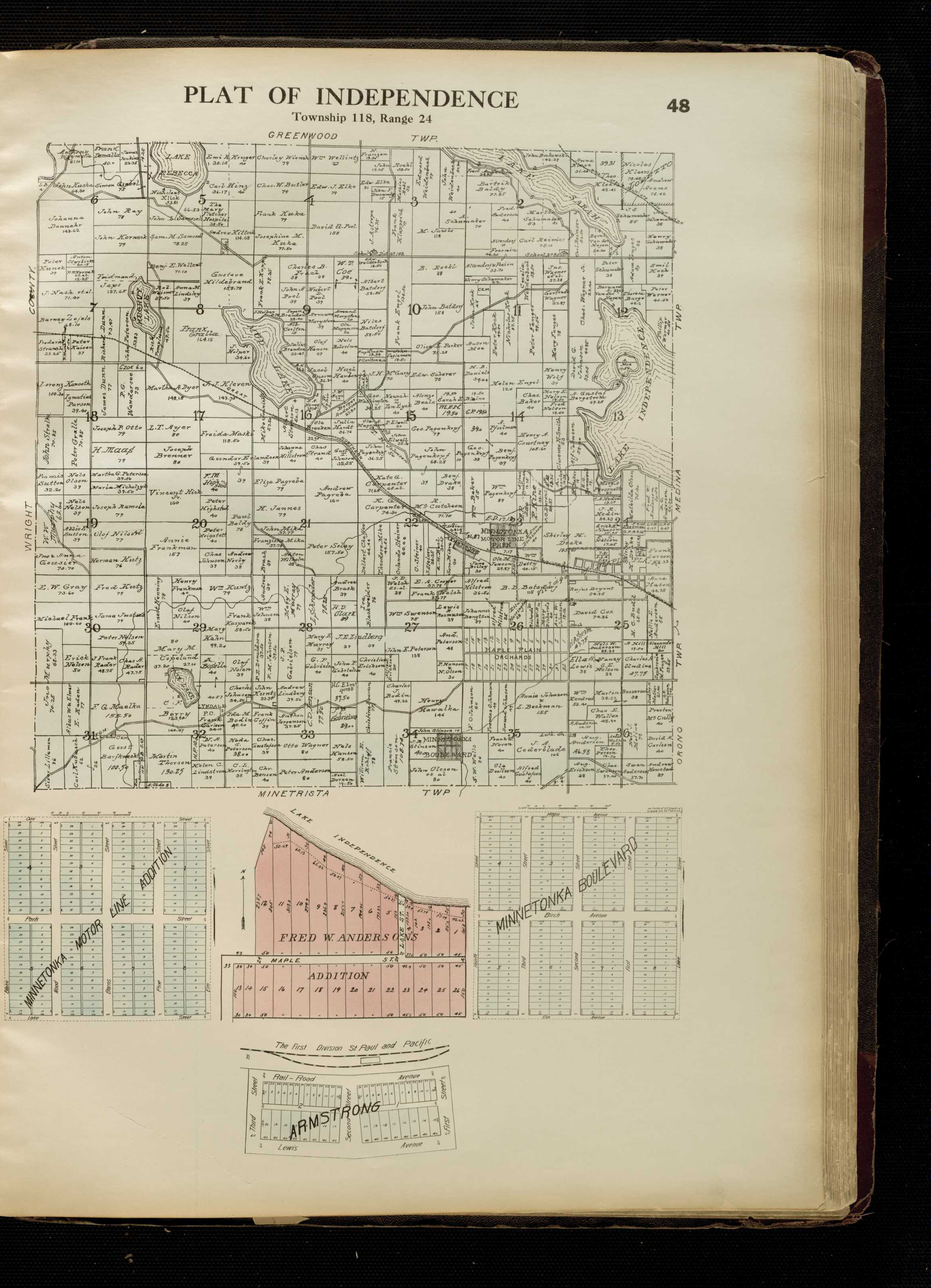
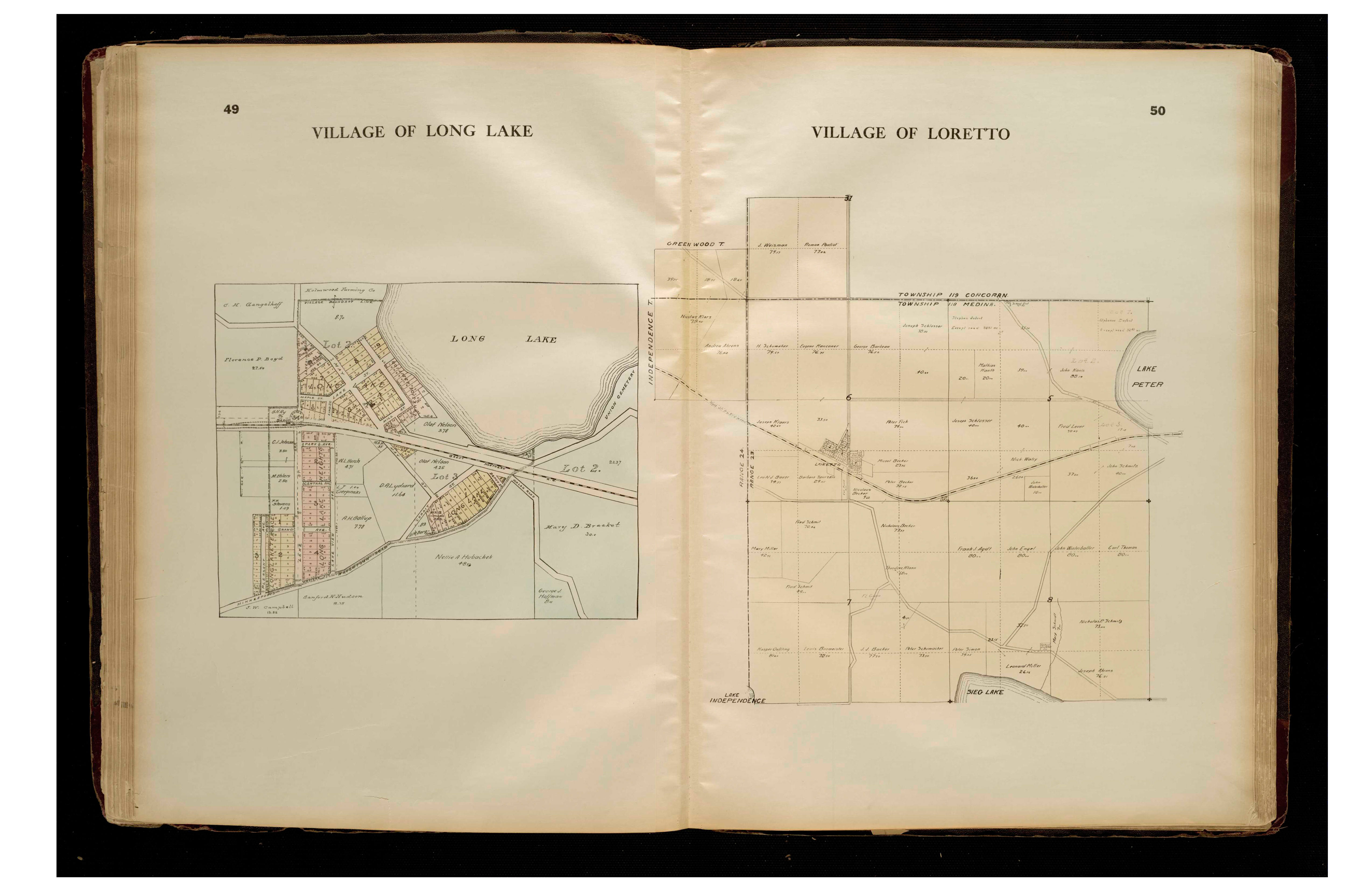
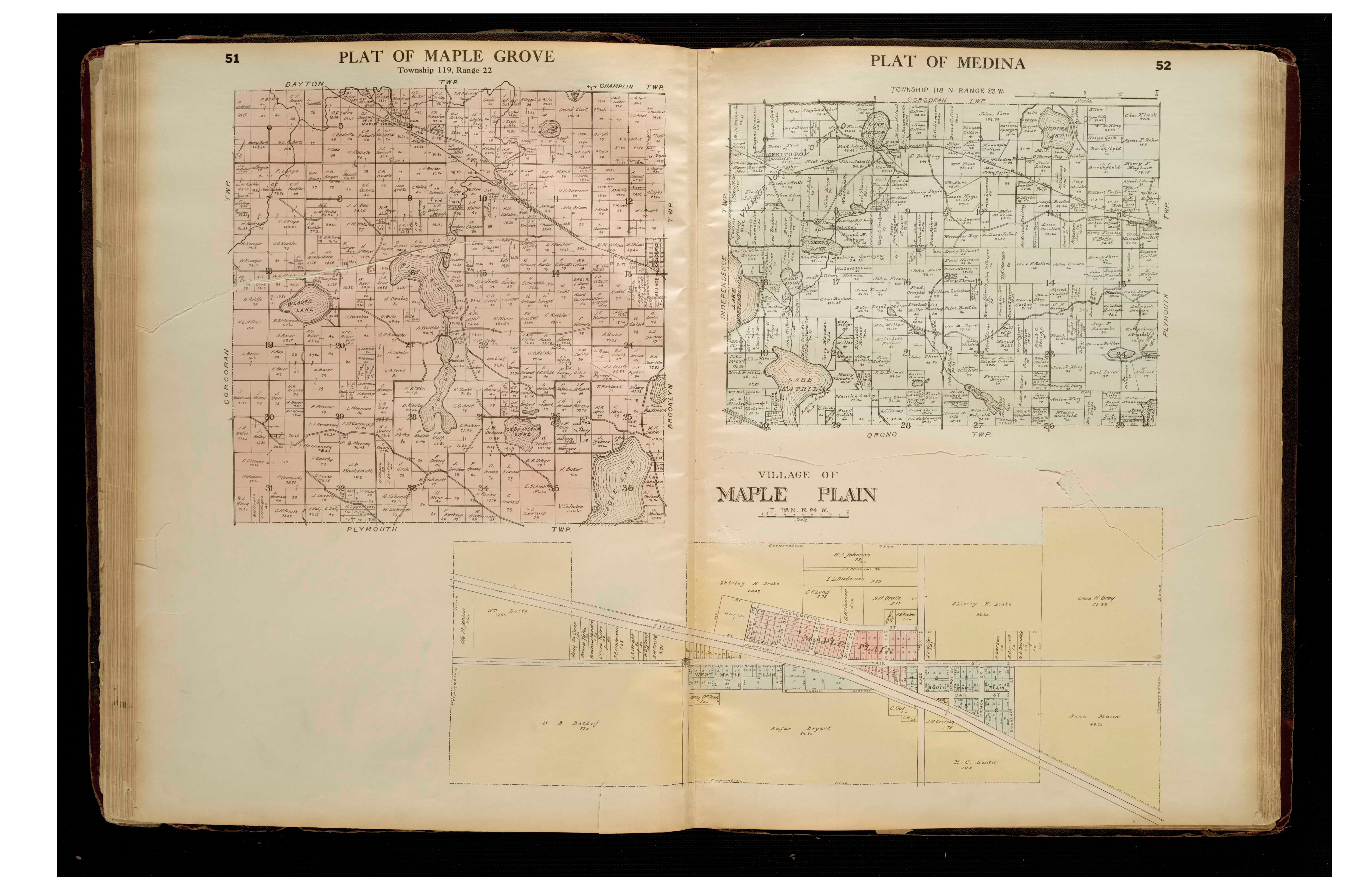
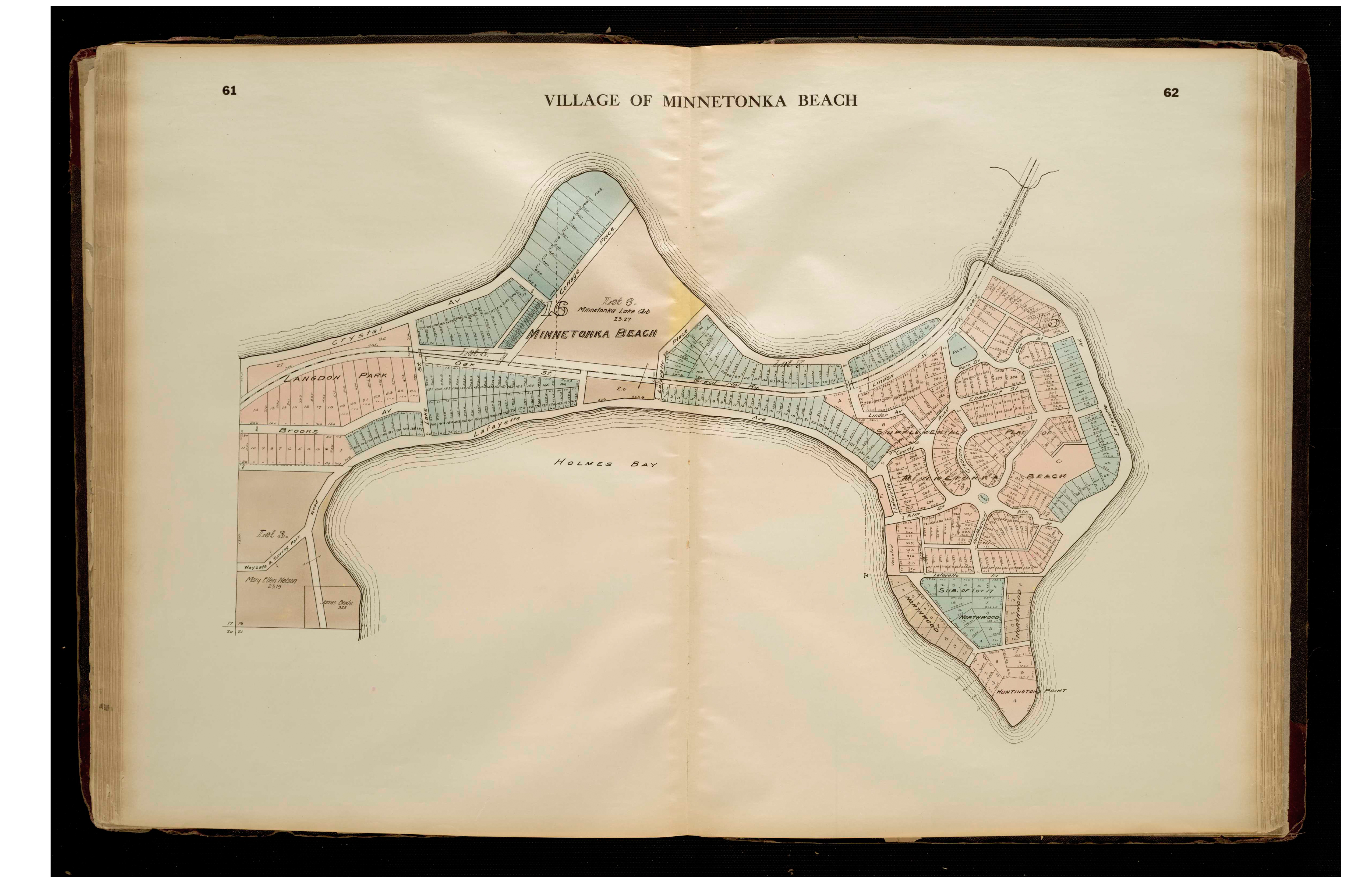
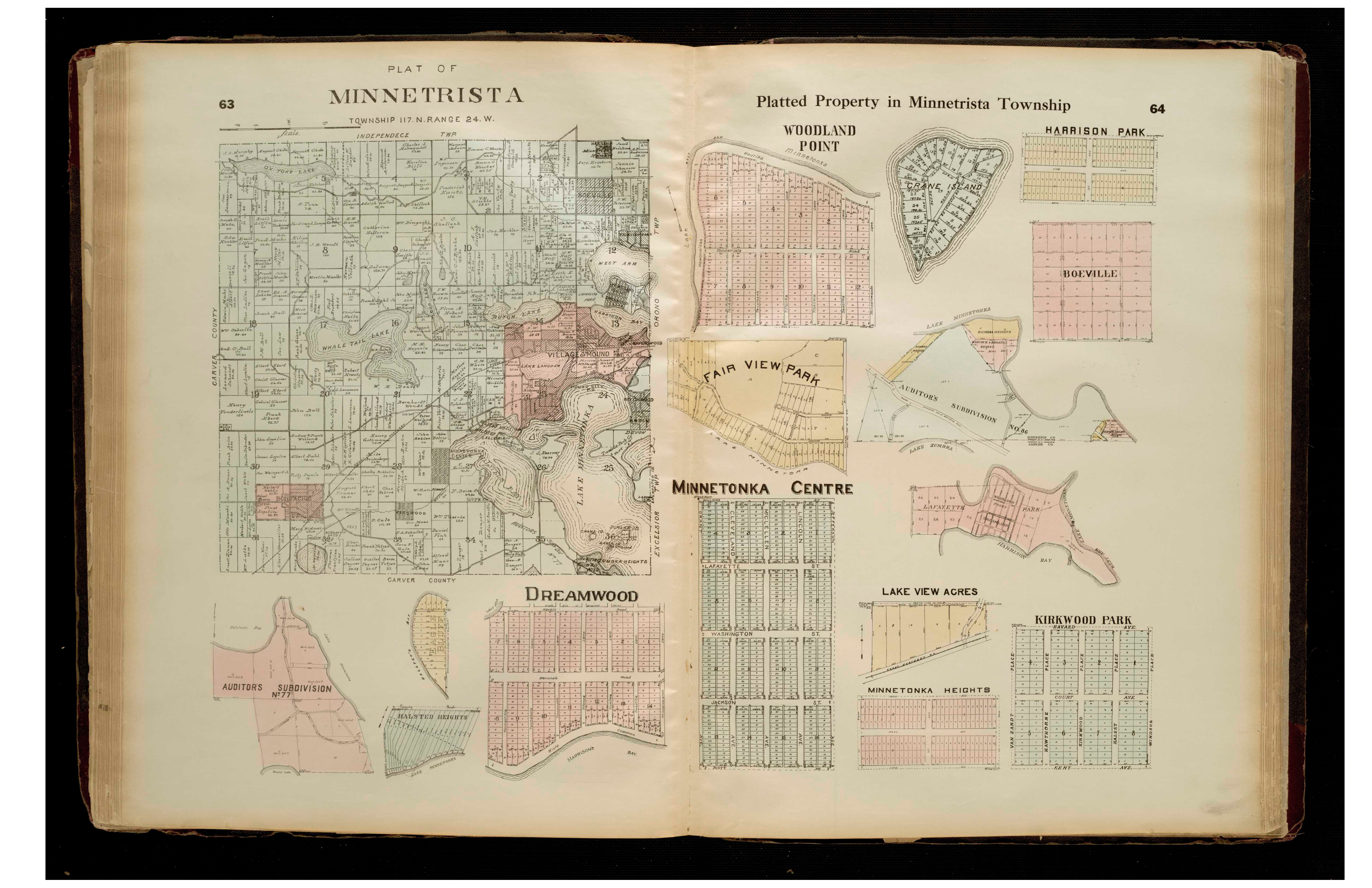
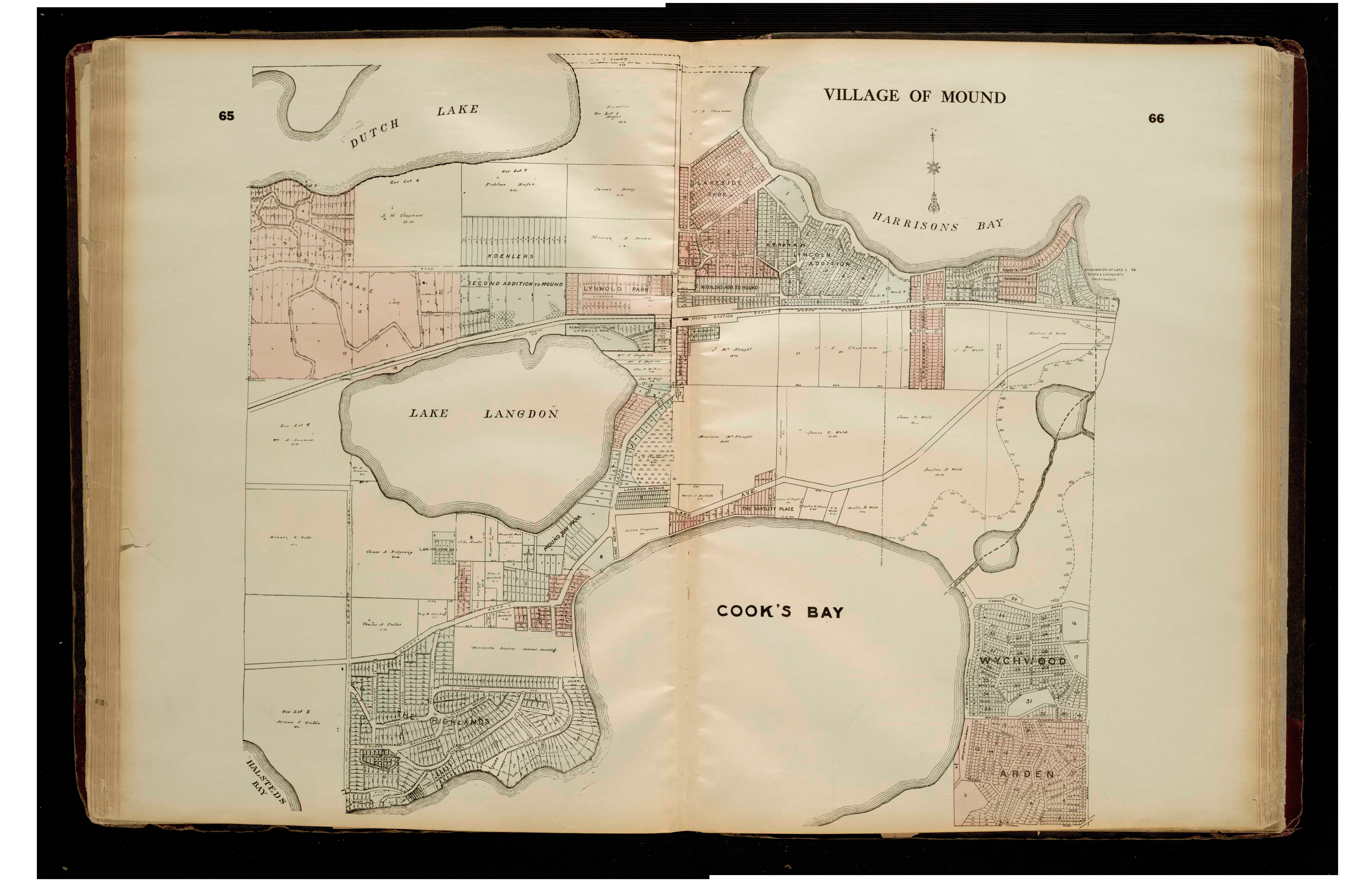
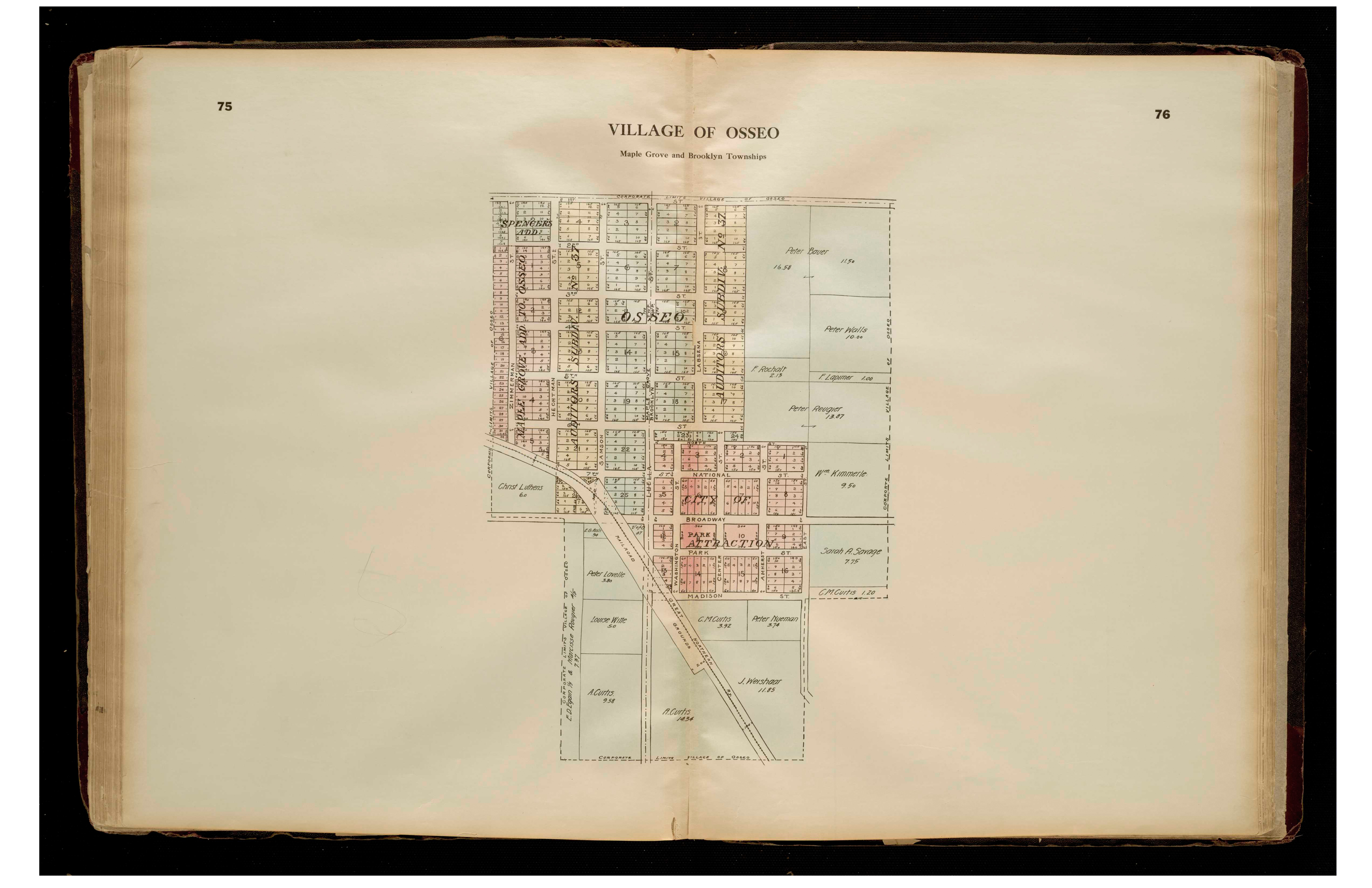
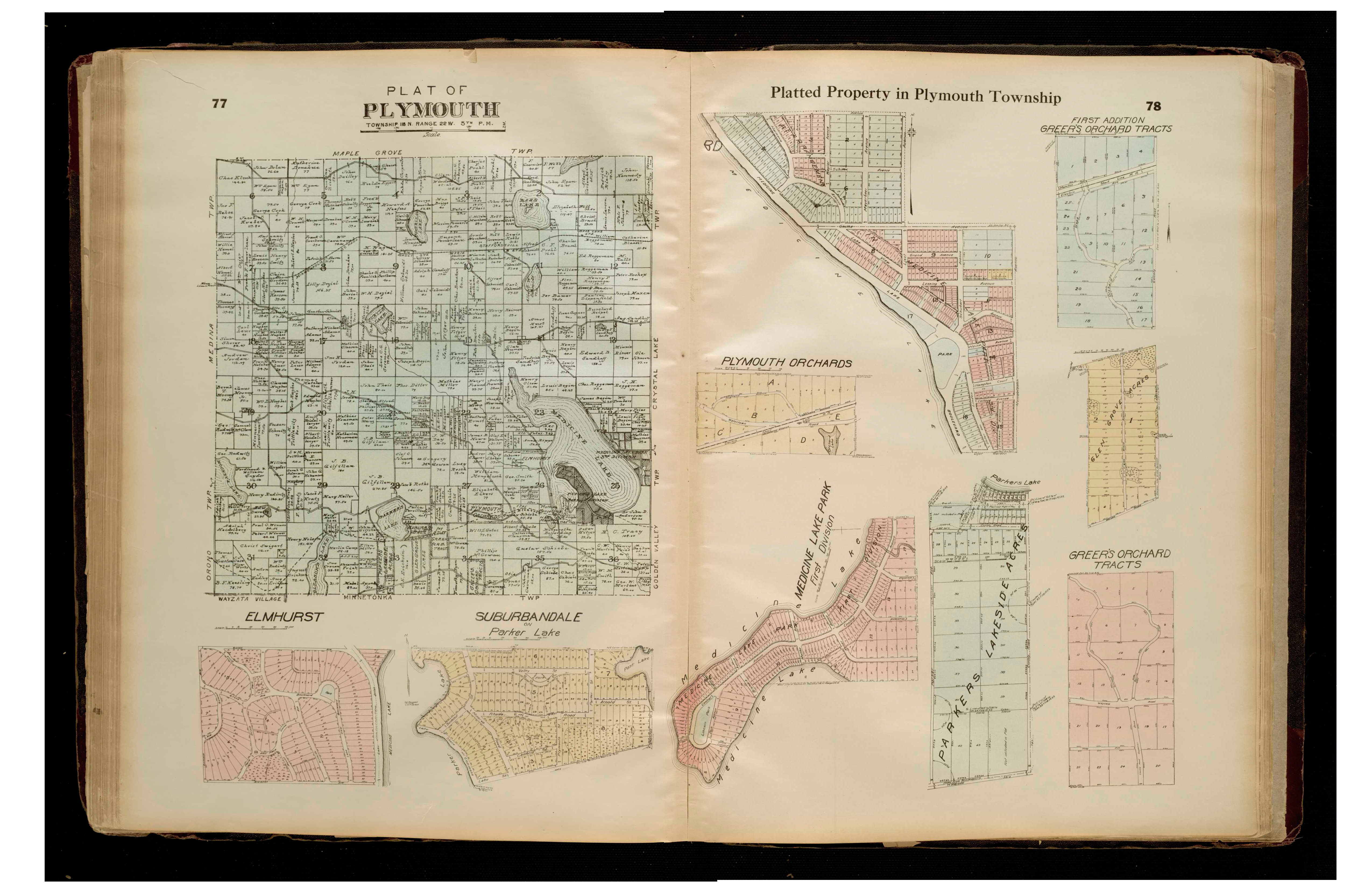
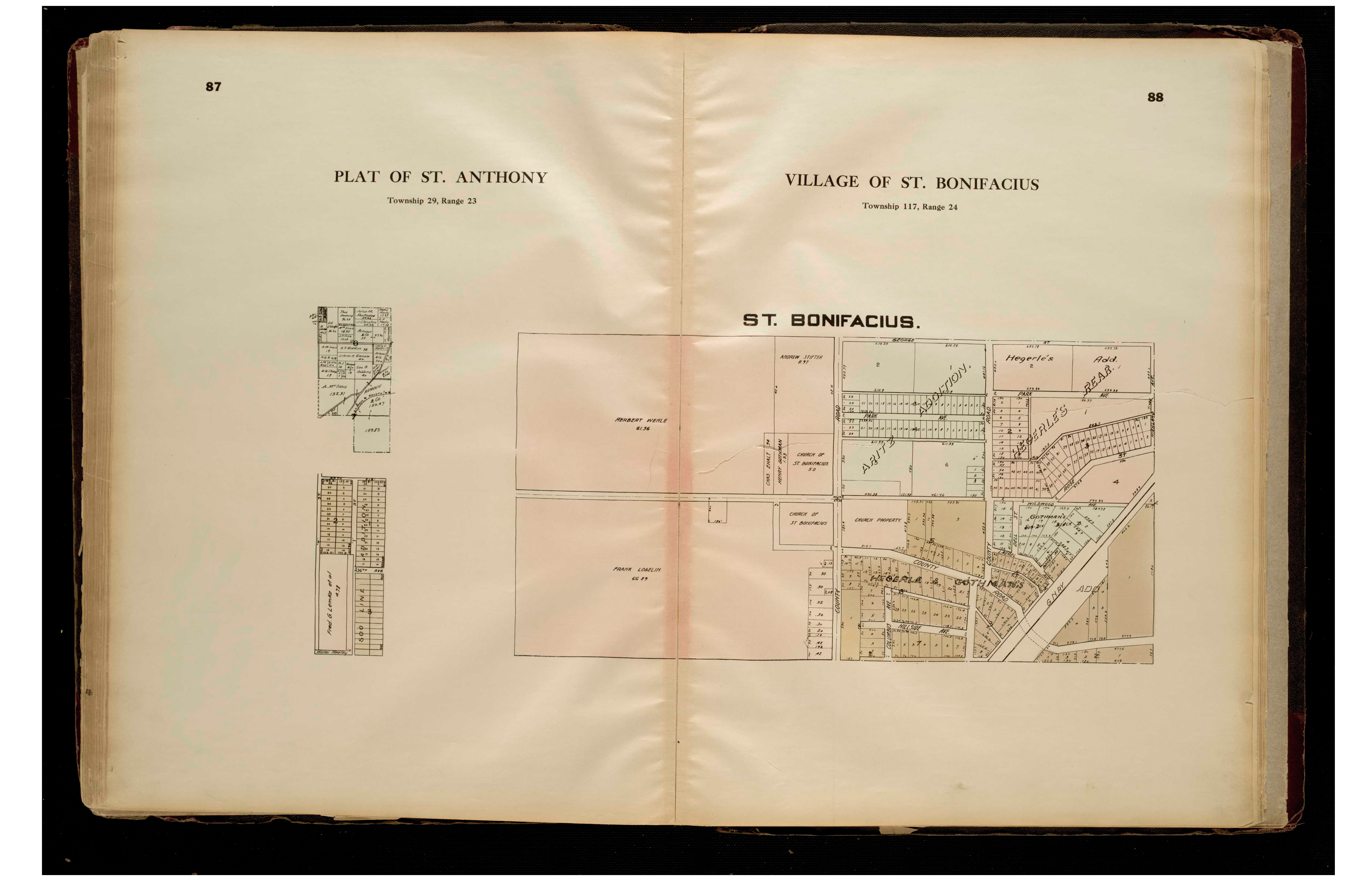
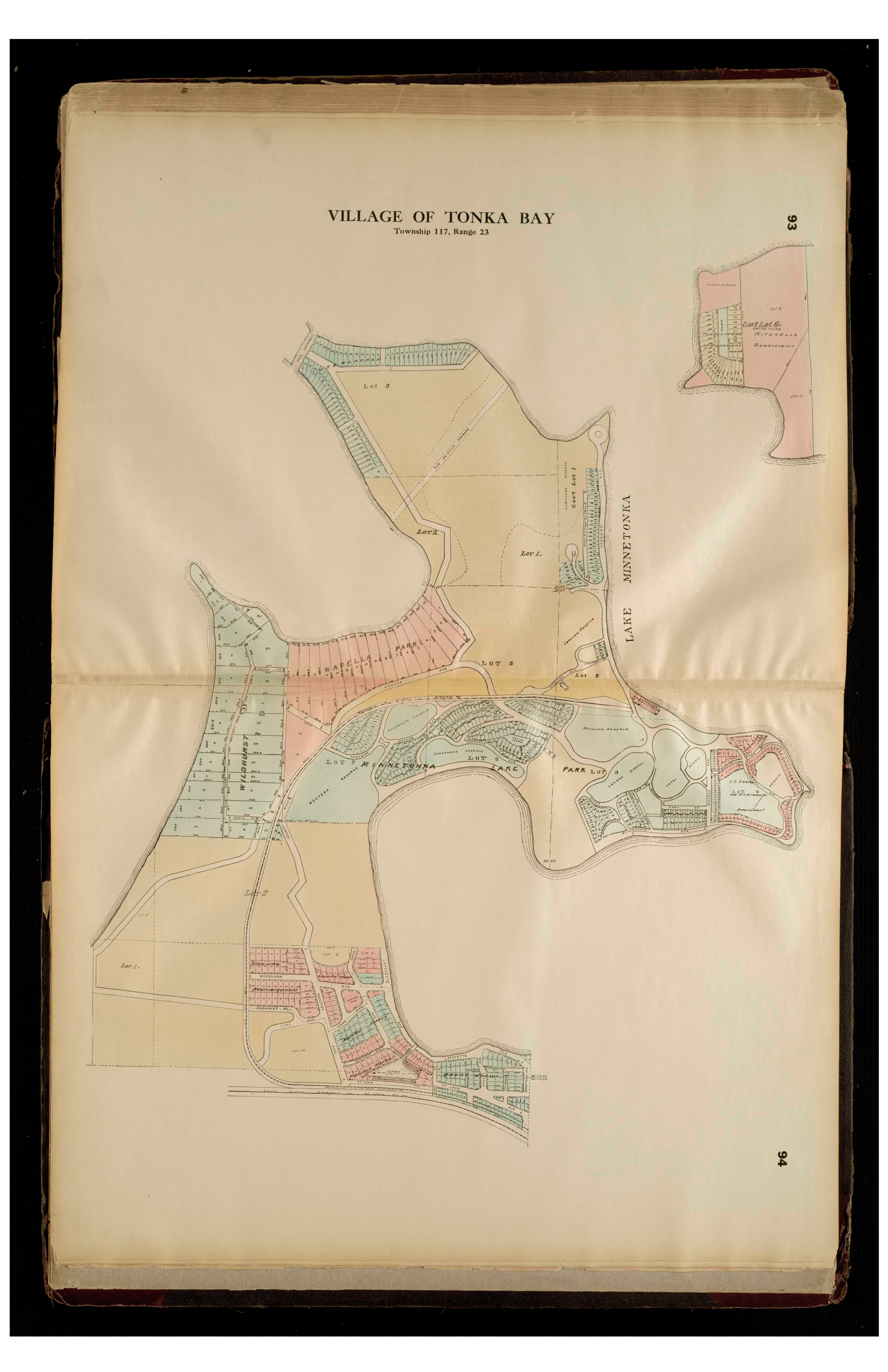
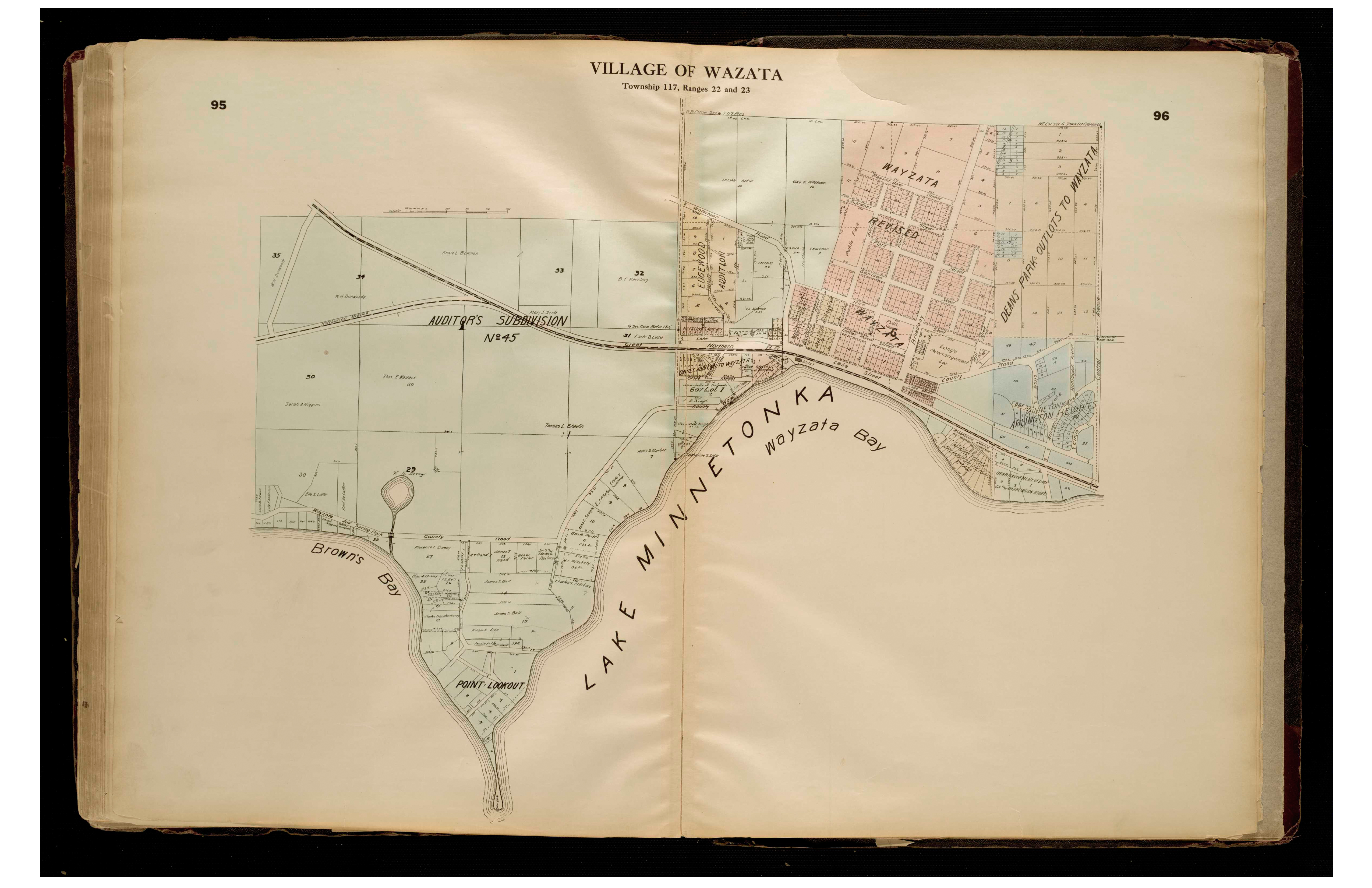
1913 - Hennepin County Interactive Hennepin Atlas and Publishing Co. mapFor individual 1913 plats of cities and towns, select the name of the city/ town of interest: Big Island Bloomington Brooklyn Center Brooklyn Champlin Corcoran Crystal Dayton Deephaven Eden Prairie Edina Excelsior Golden Valley Greenwood Hanover Hassan Independence Long Lake Loretto Maple Grove Maple Plain Medina Minneapolis (west) Minnetonka Minnetonka Beach Minnetrista Mound Orono ;Osseo Plymouth Richfield Robbinsdale St. Anthony St. Bonifacius St. Louis Park Tonka Bay Wayzata
Hennepin County
1914 - Hennepin County - City of Minneapolis only Digitized Minneapolis Real Estate Board mapPlease note: this is a MN Historical Society copy, it is not available at Borchert Map Library
Hennepin County
1916 - Hennepin County Plat Book of the State of MinnesotaHouston County
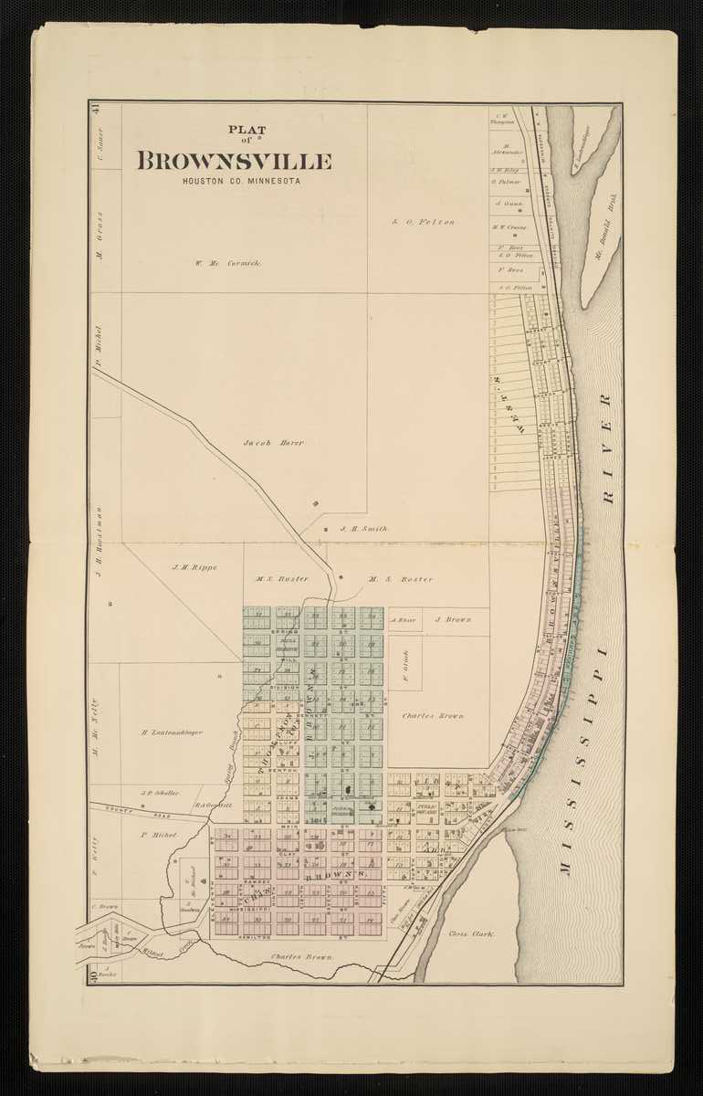
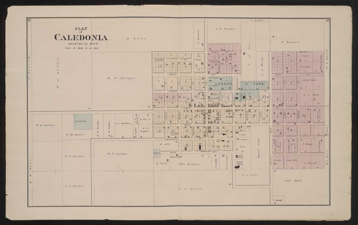
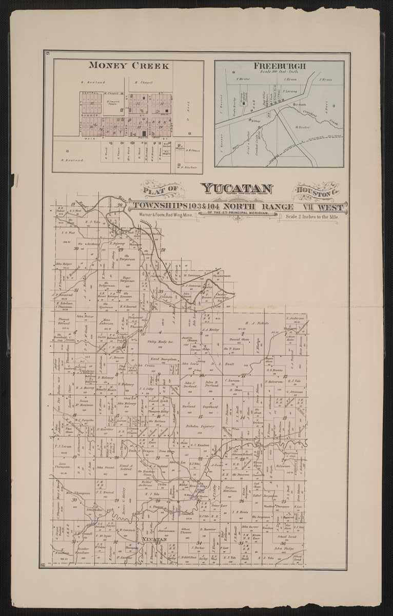
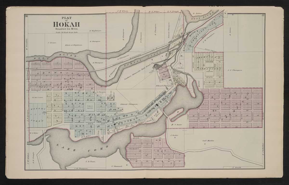
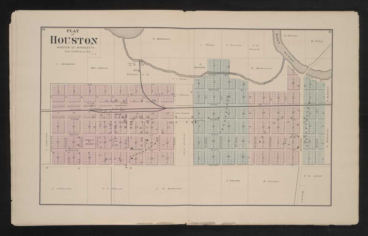
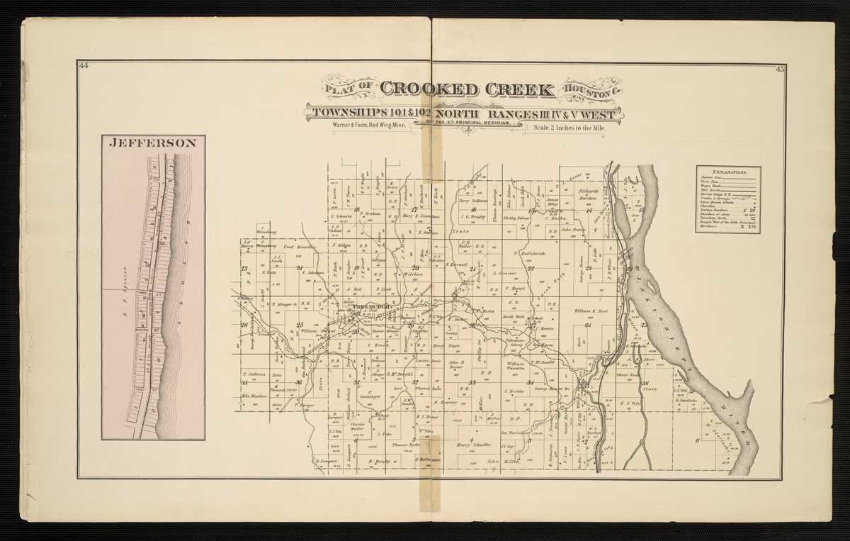
1878 - Houston County Interactive Warner & Foote mapFor individual 1878 plats of cities and towns, please click on the name of the city/ town of interest: Brownsville Caledonia Freeburgh Hokah Houston Jefferson La Crescent Money Creek Riceford Sheldon Spring Grove
Houston County
1916 - Houston County Plat Book of the State of MinnesotaHubbard County
1916 Houston County Plat Book of the State of MinnesotaCounties Beginning with I
Isanti County
1916- Isanti County Plat Book of the State of MinnesotaItasca County
1916 - Itasca County Plat Book of the State of MinnesotaCounties Beginning with J
Counties Beginning with K
Kanabec County
1916 - Kanabec County Plat Book of the State of MinnesotaKandiyohi County
1916 - Kandiyohi County Plat Book of the State of MinnesotaKittson County
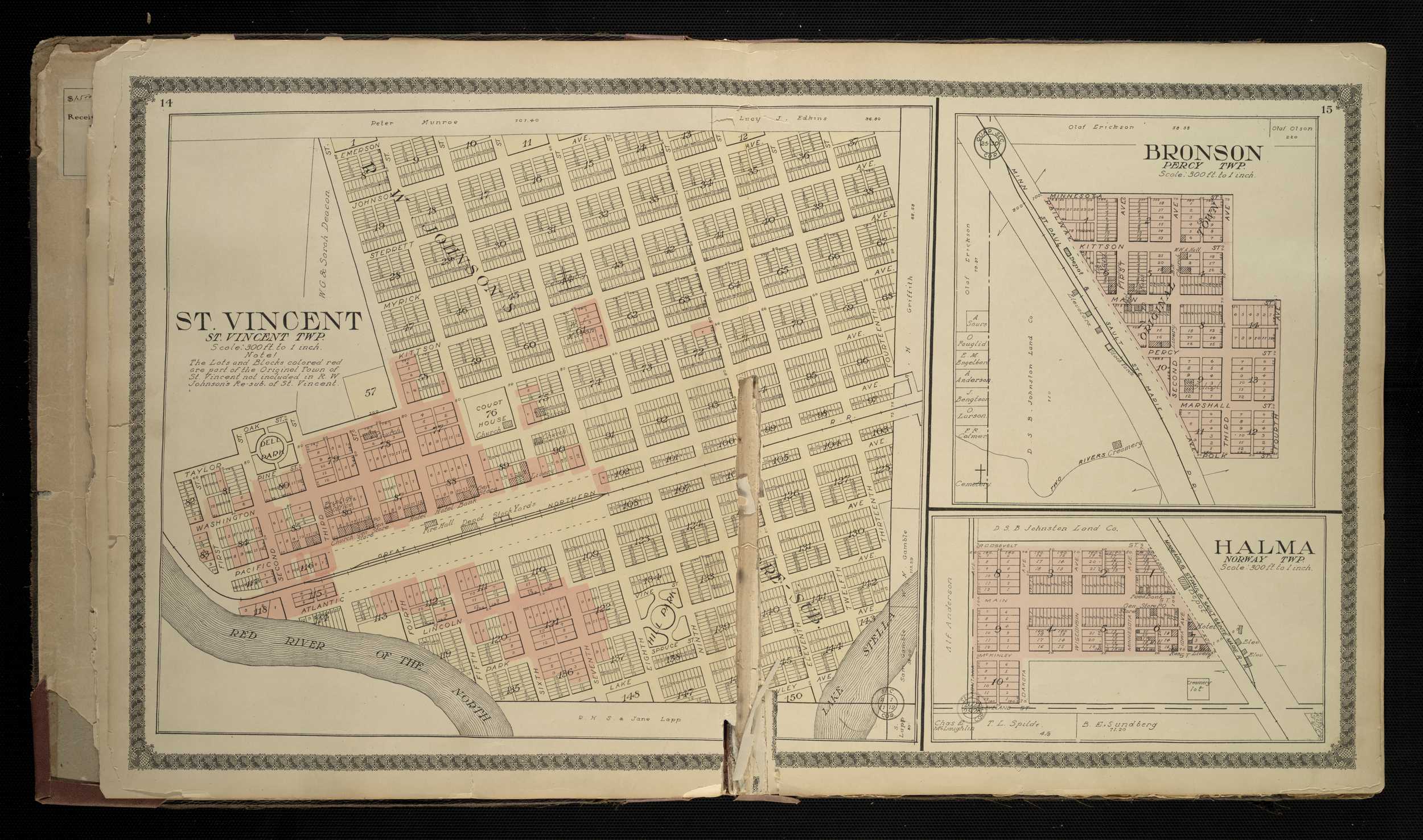
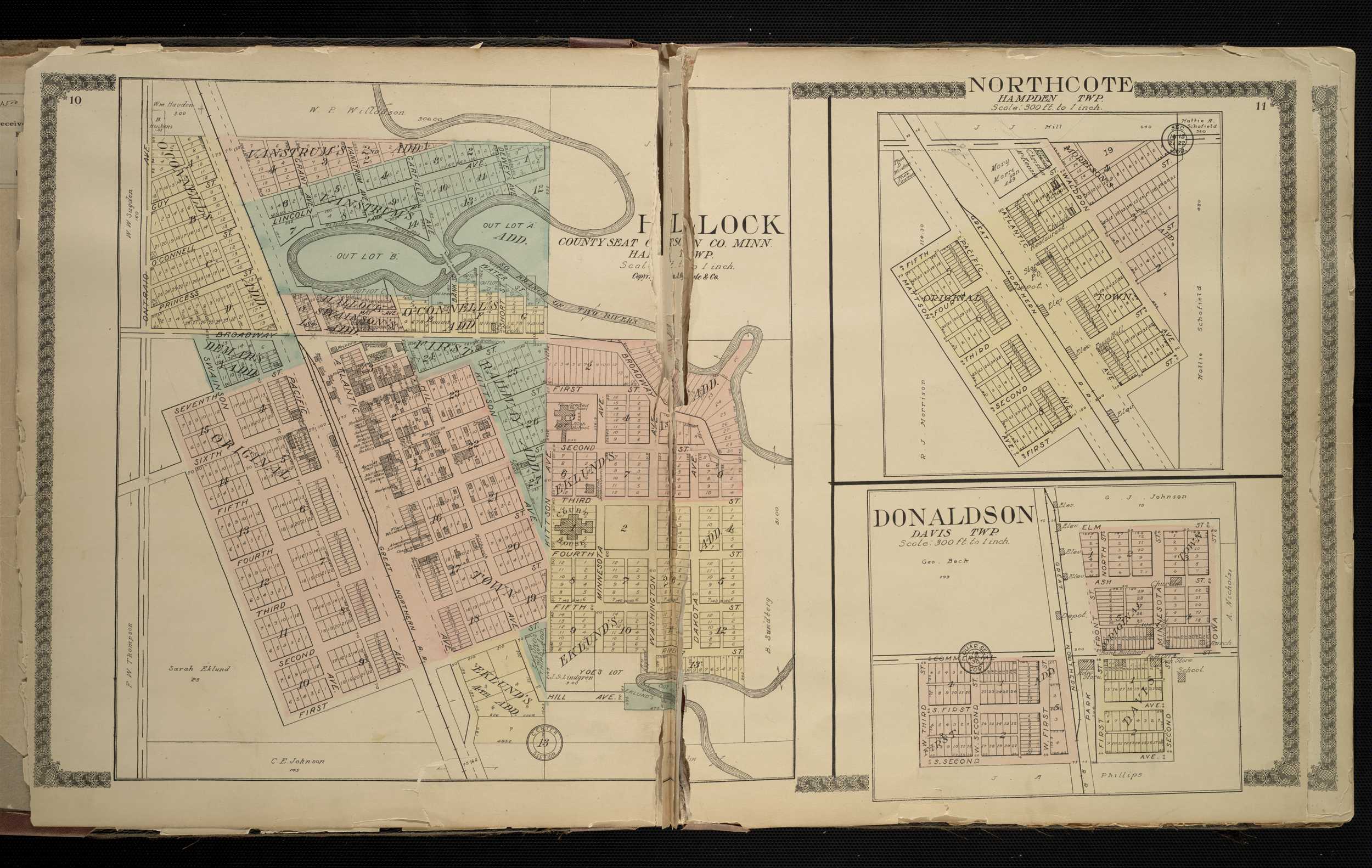
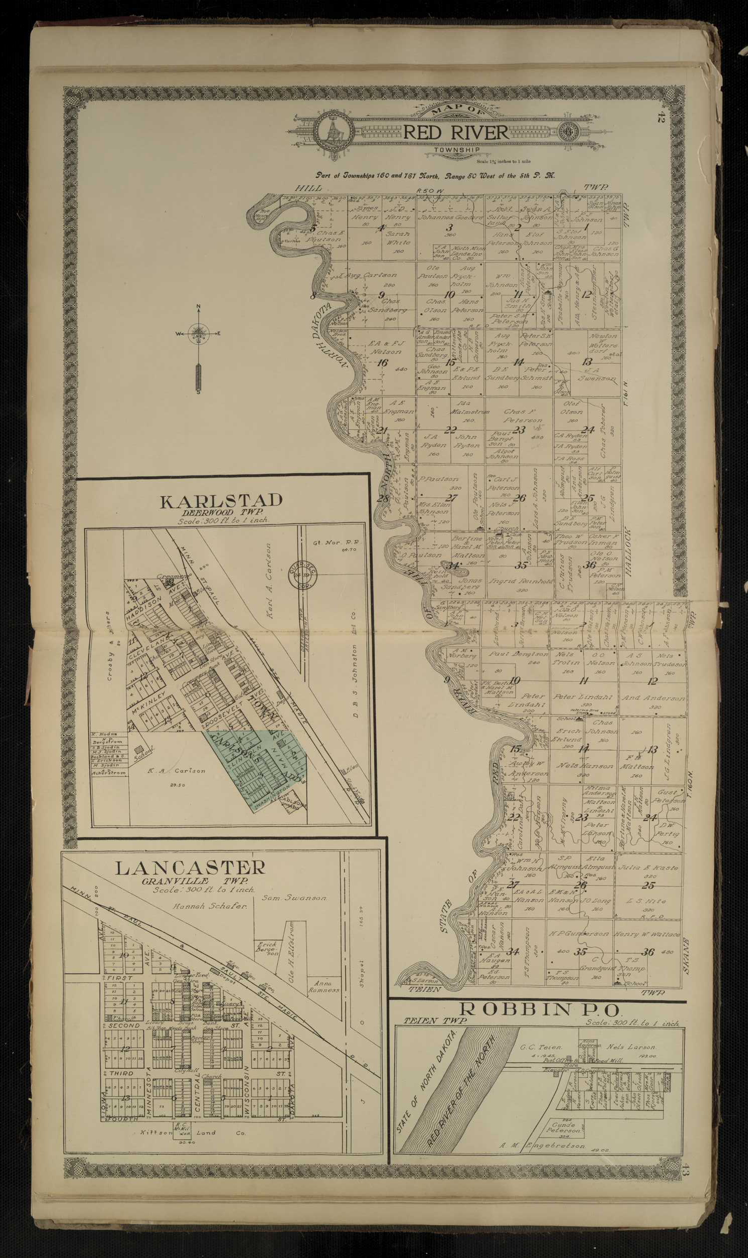
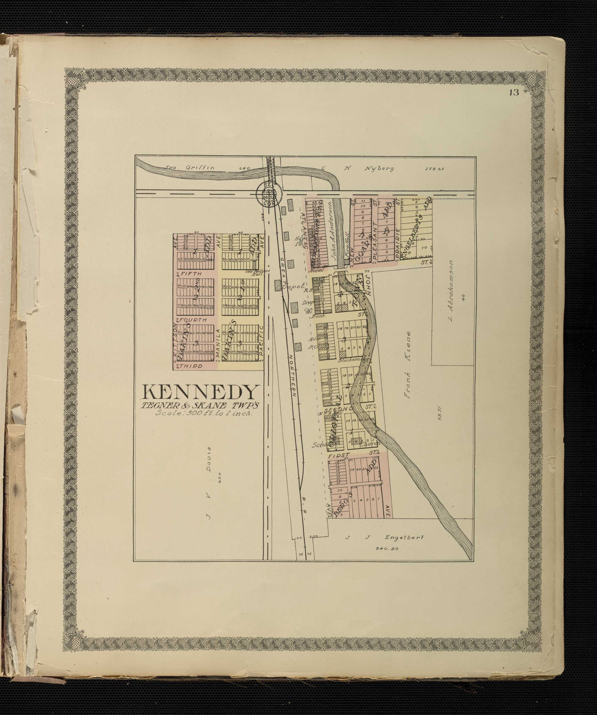
1912 - Kittson Country Digitized interactive Geo. A. Ogle & Co. mapFor individual plats of cities and towns, please click on the name of the city/ town of interest:Bronson Davis Donaldson Hallock Halma Humboldt Karlstad Kennedy Lancaster Northcote Orleans Pelan Robbin St.Vincent Twin Lake City
Kittson County
1916 - Kittson County Plat Book of the State of MinnesotaKoochiching County
1916 - Koochiching County Plat Book of the State of MinnesotaCounties Beginning with L
Lac Qui Parle County
1916 - La Qui Parle County Plat Book of the State of MinnesotaLake of the Woods County
1916 - Lake of the Woods County Plat Book of the State of MinnesotaLe Sueur County
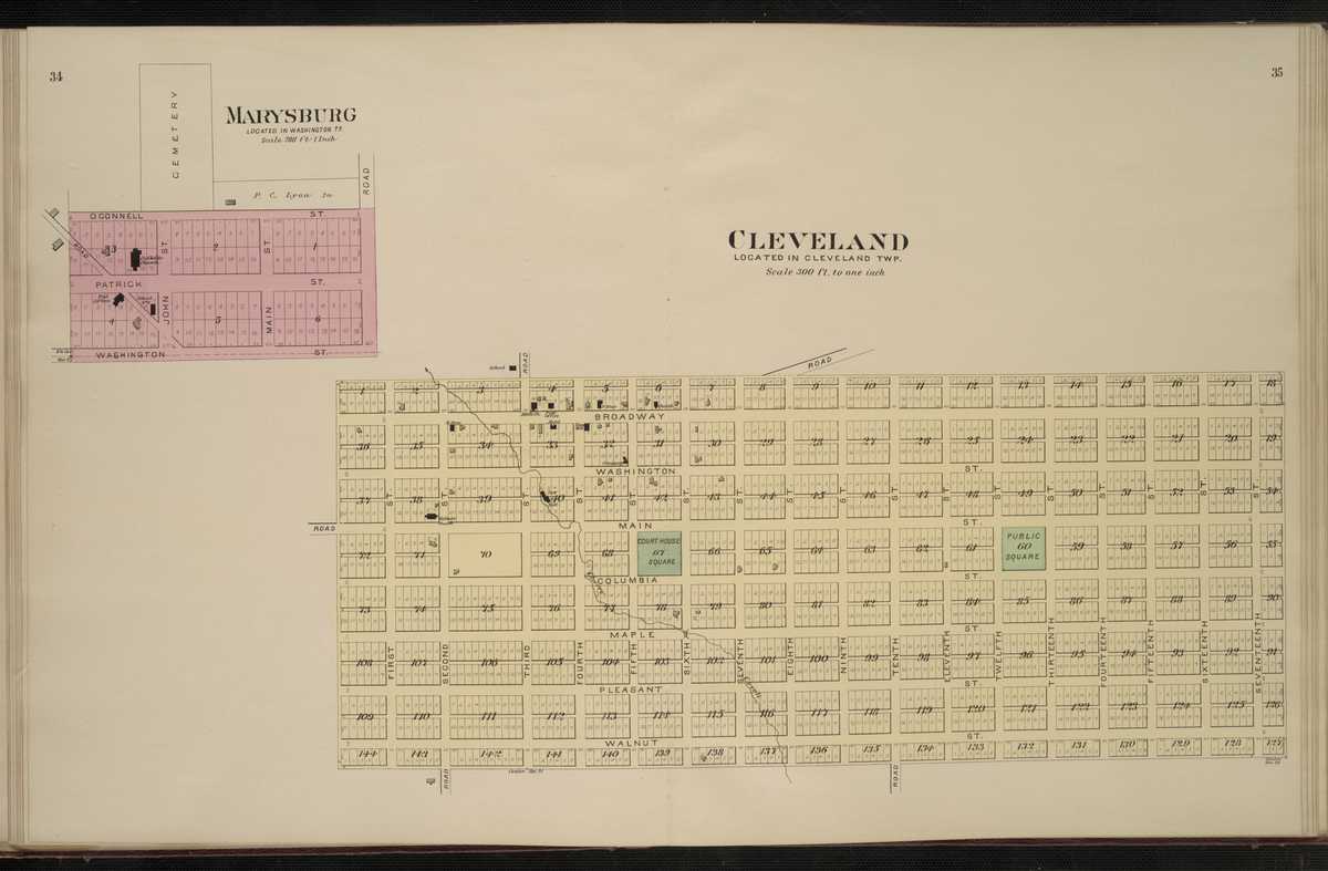
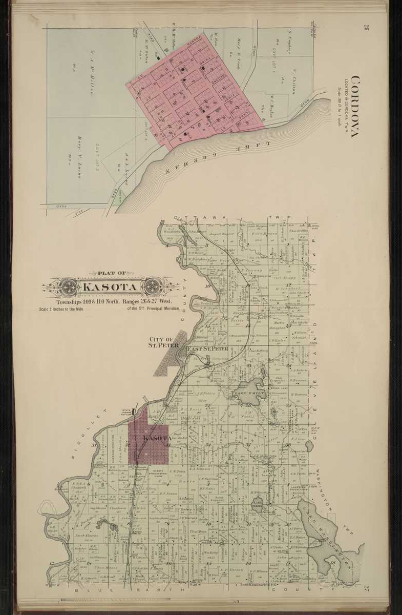
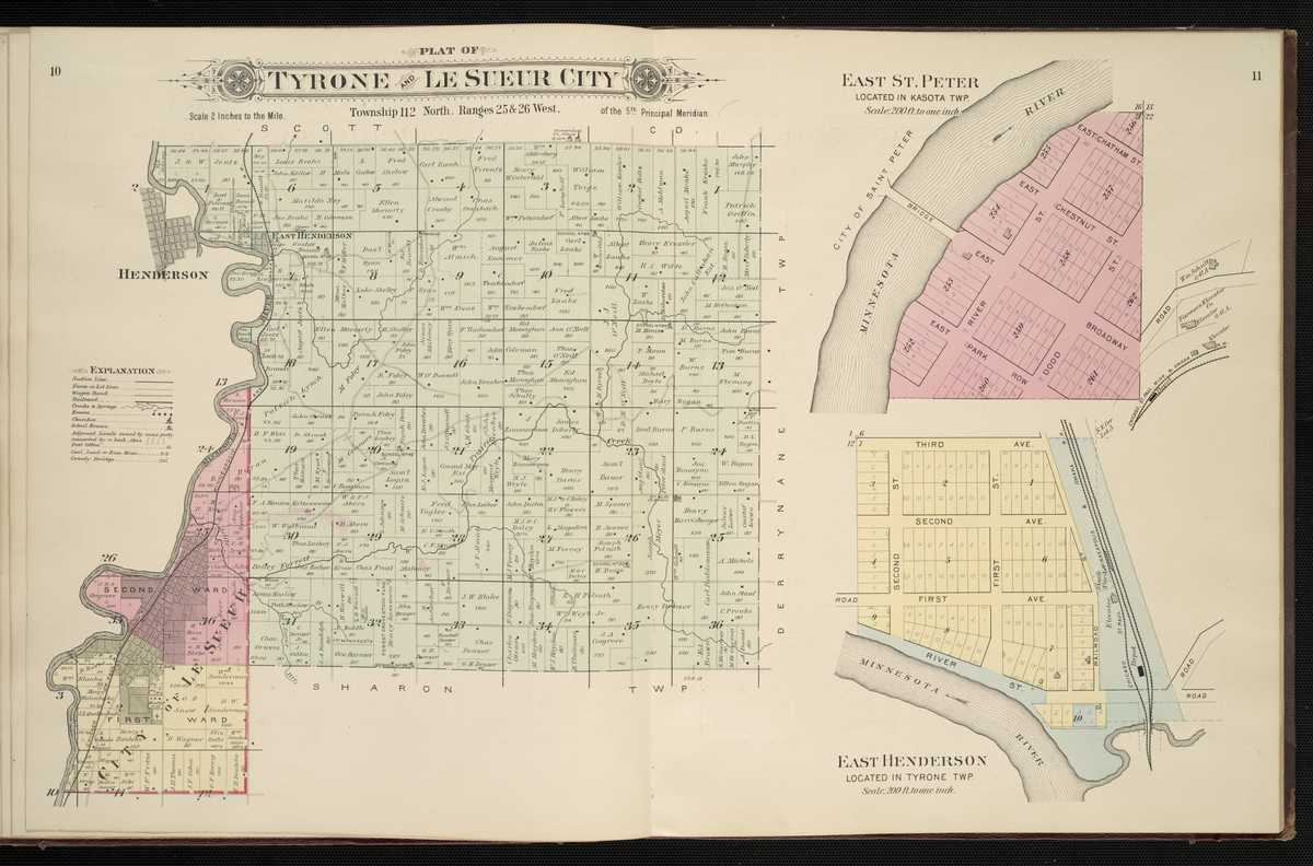
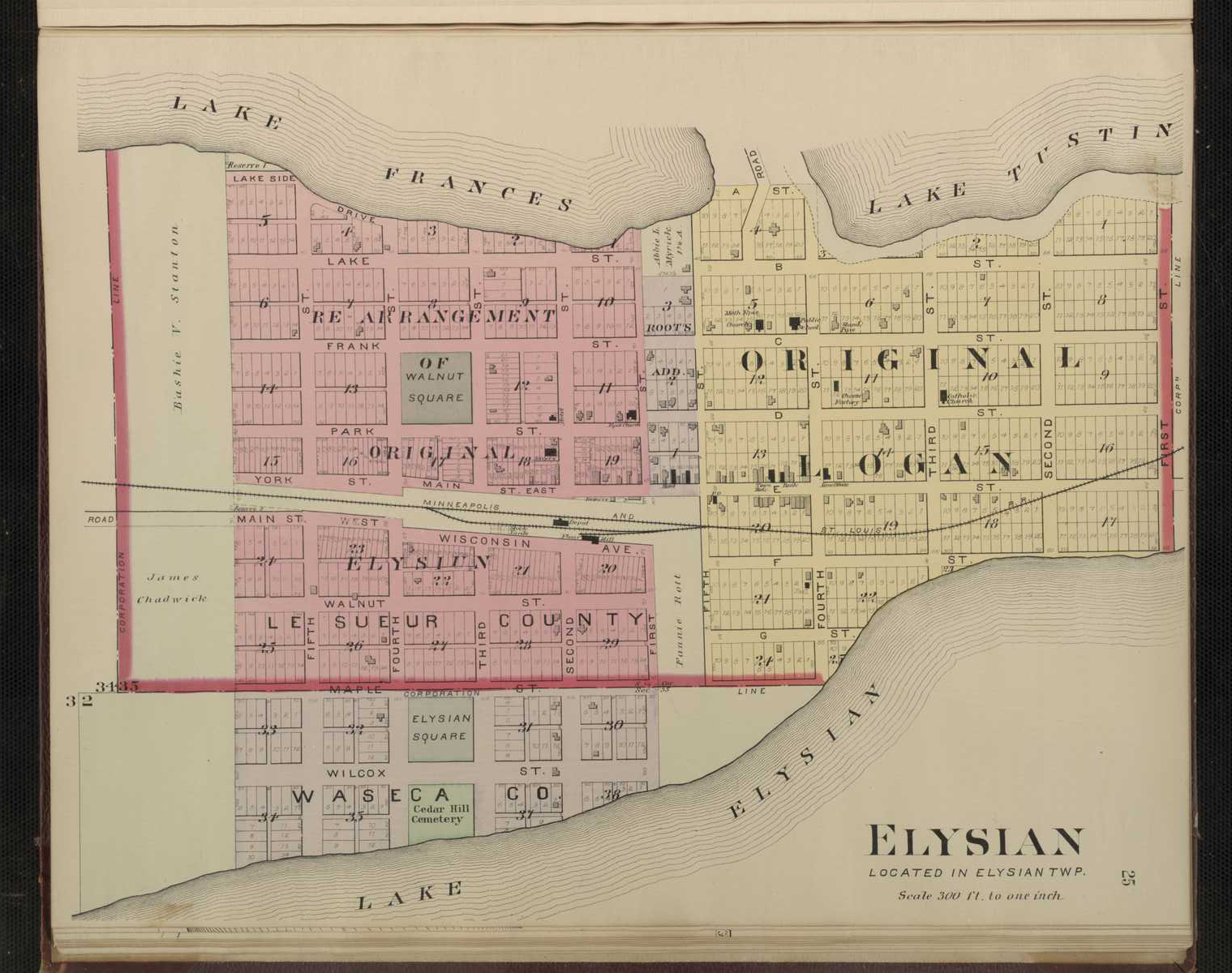
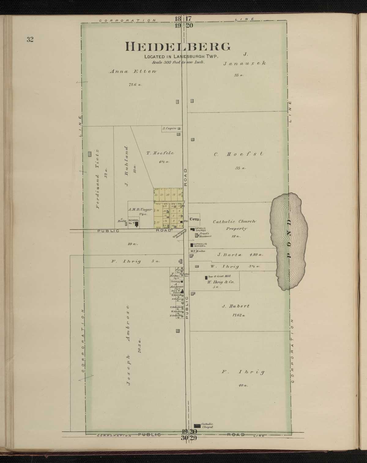
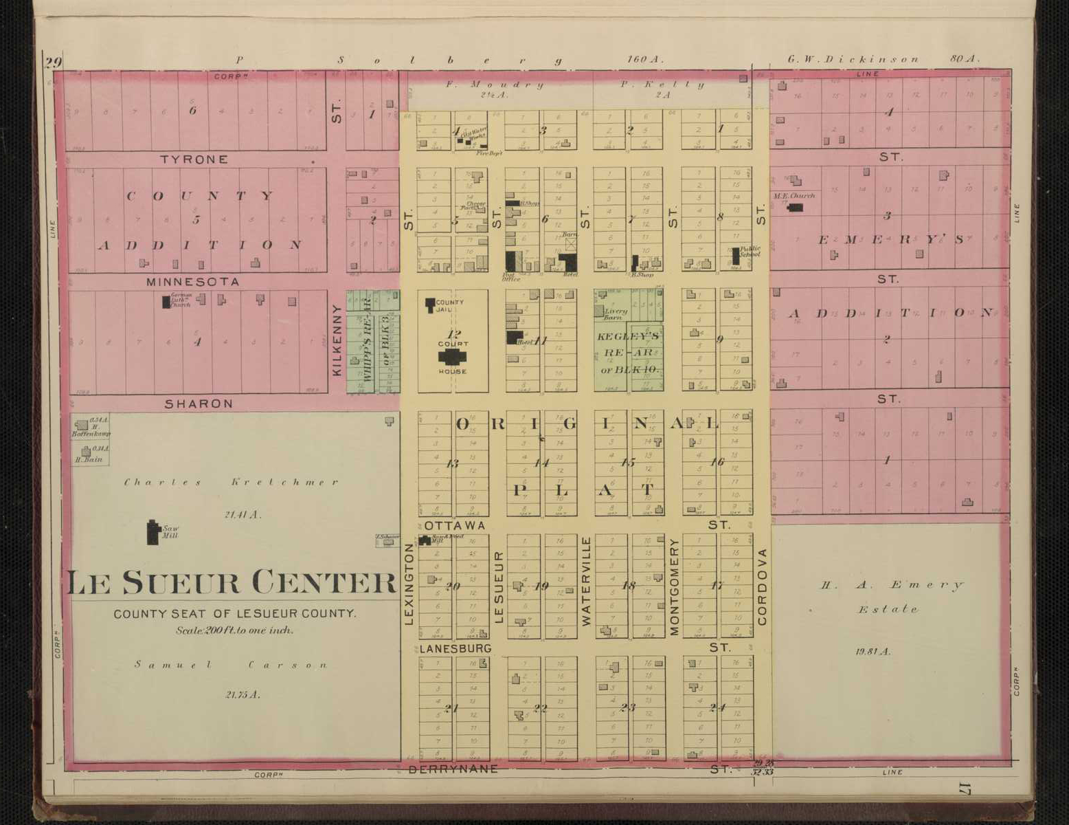
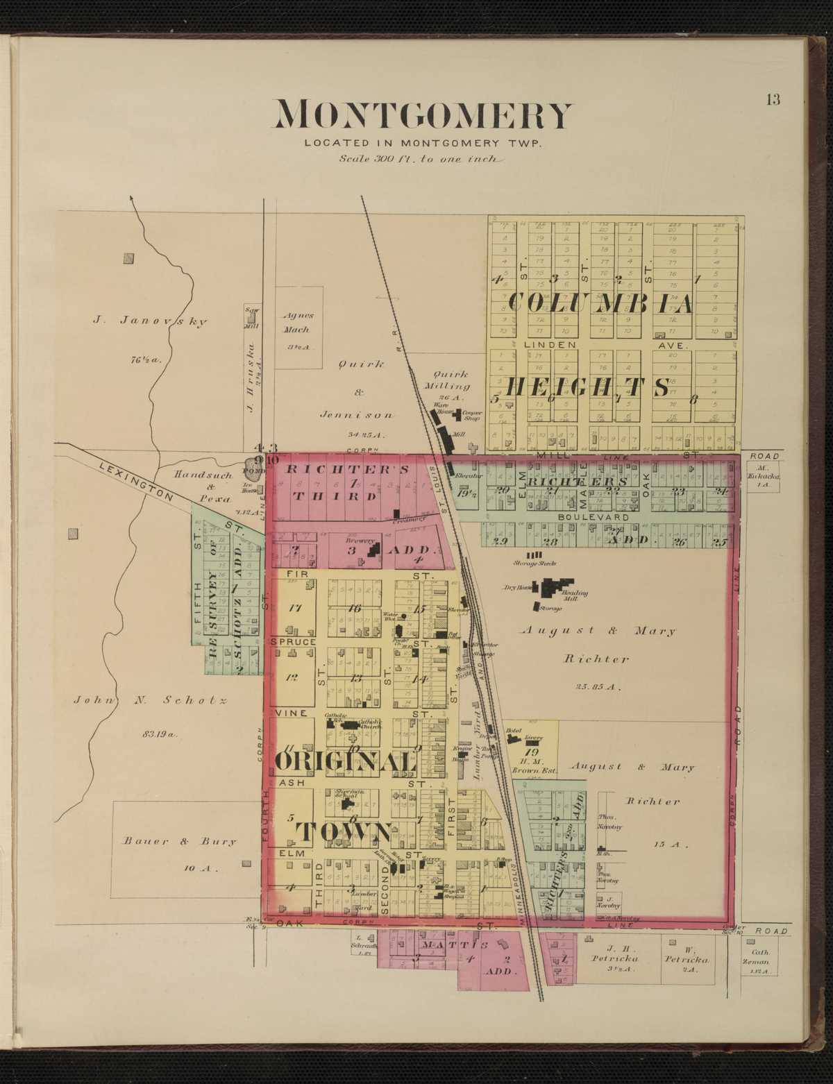
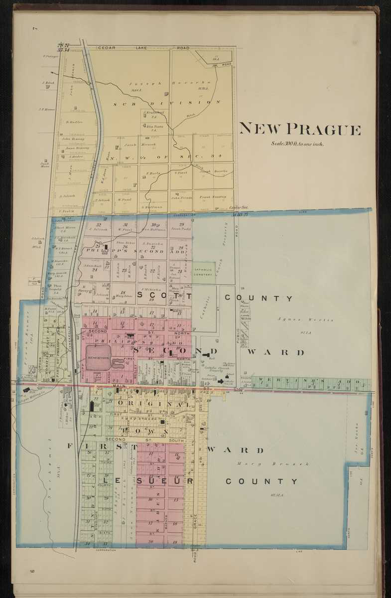
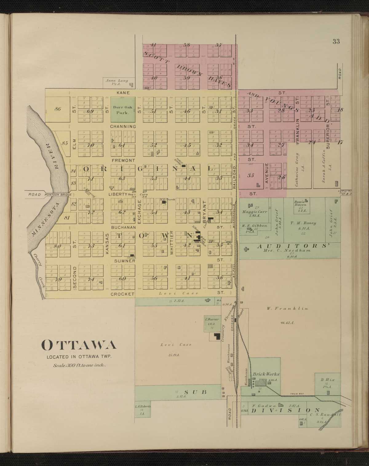
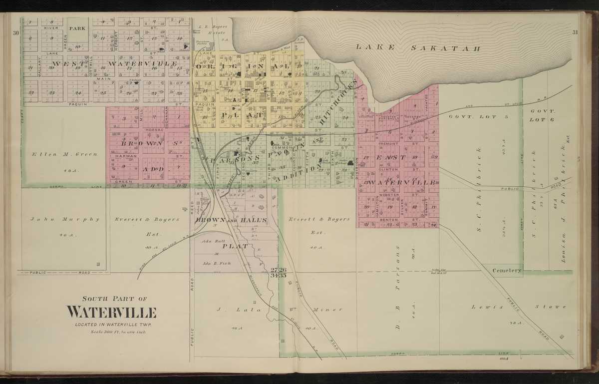
1898 - Le Sueur County Digitized interactive Northwest Publishing company mapFor individual plats of cities and towns, please click on the name of the city/ town of interest: Cleveland Cordova East Henderson East St. Peter Elysian Heidelberg Kasota Kilkenny Le Sueur City Le Sueur Center Lexington Marysburg Montgomery New Prague Ottawa Waterville, North Waterville, South
Le Sueur County
Le Sueur County - 1916 Plat Book of the State of MinnesotaLincoln County
1916 - Lincoln County Plat Book of the State of MinnesotaCounties Beginning with M
McLeod County
1916 - McLeod County Plat Book of the State of MinnesotaMahnomen County
1916 - Mahnomen County Plat Book of the State of MinnesotaMarshall County
1916 - Marshall County Plat Book of the State of MinnesotaMarshall County
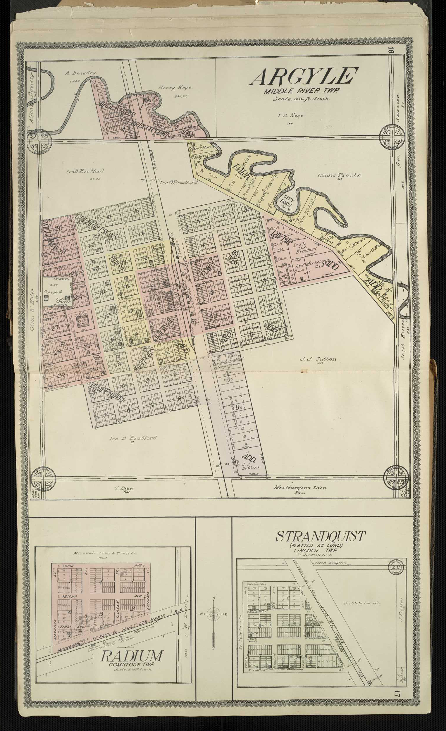
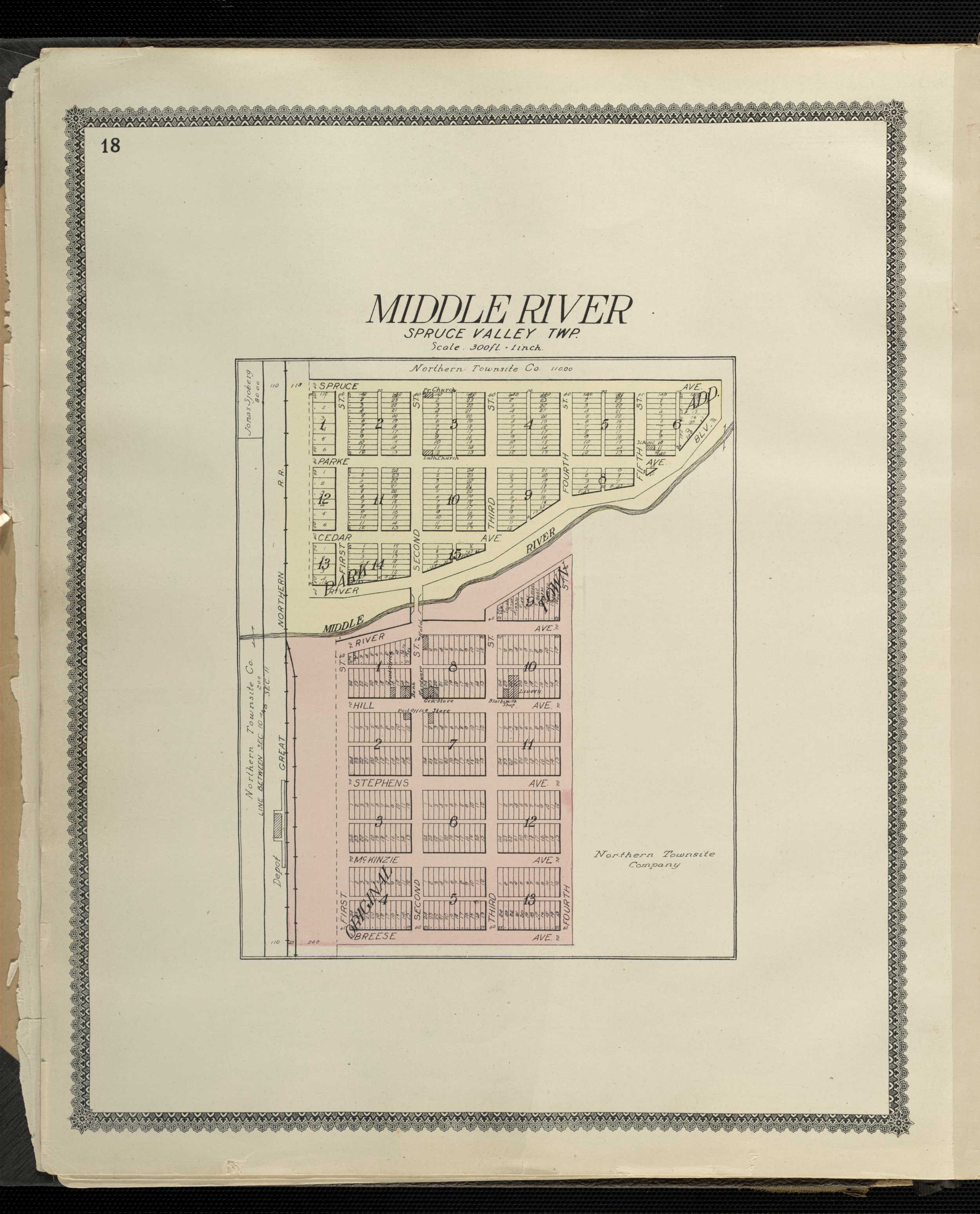
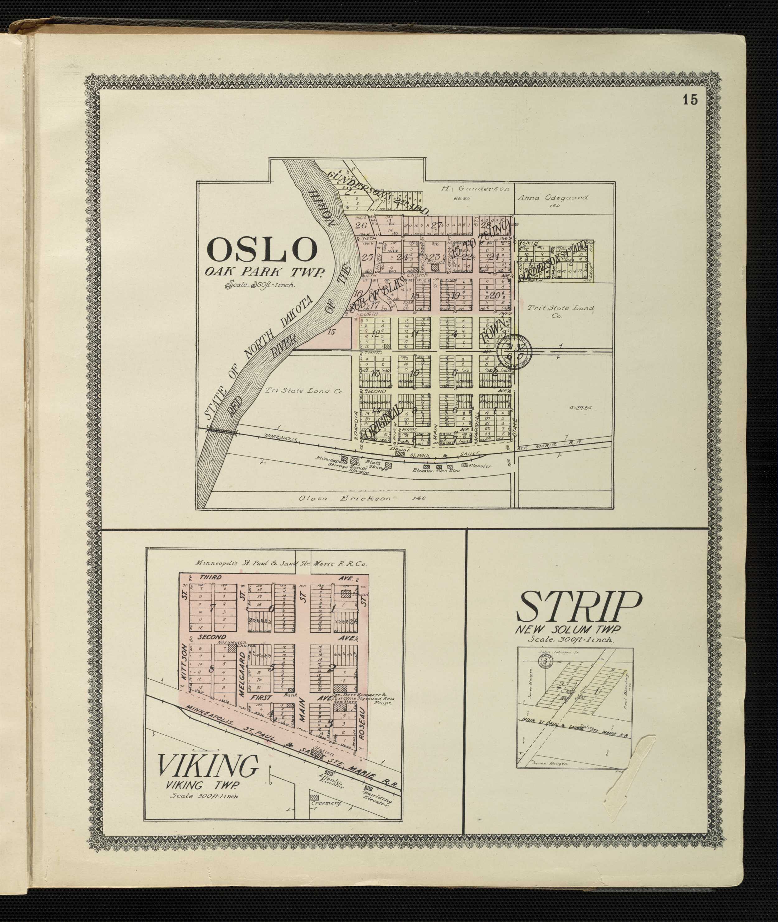
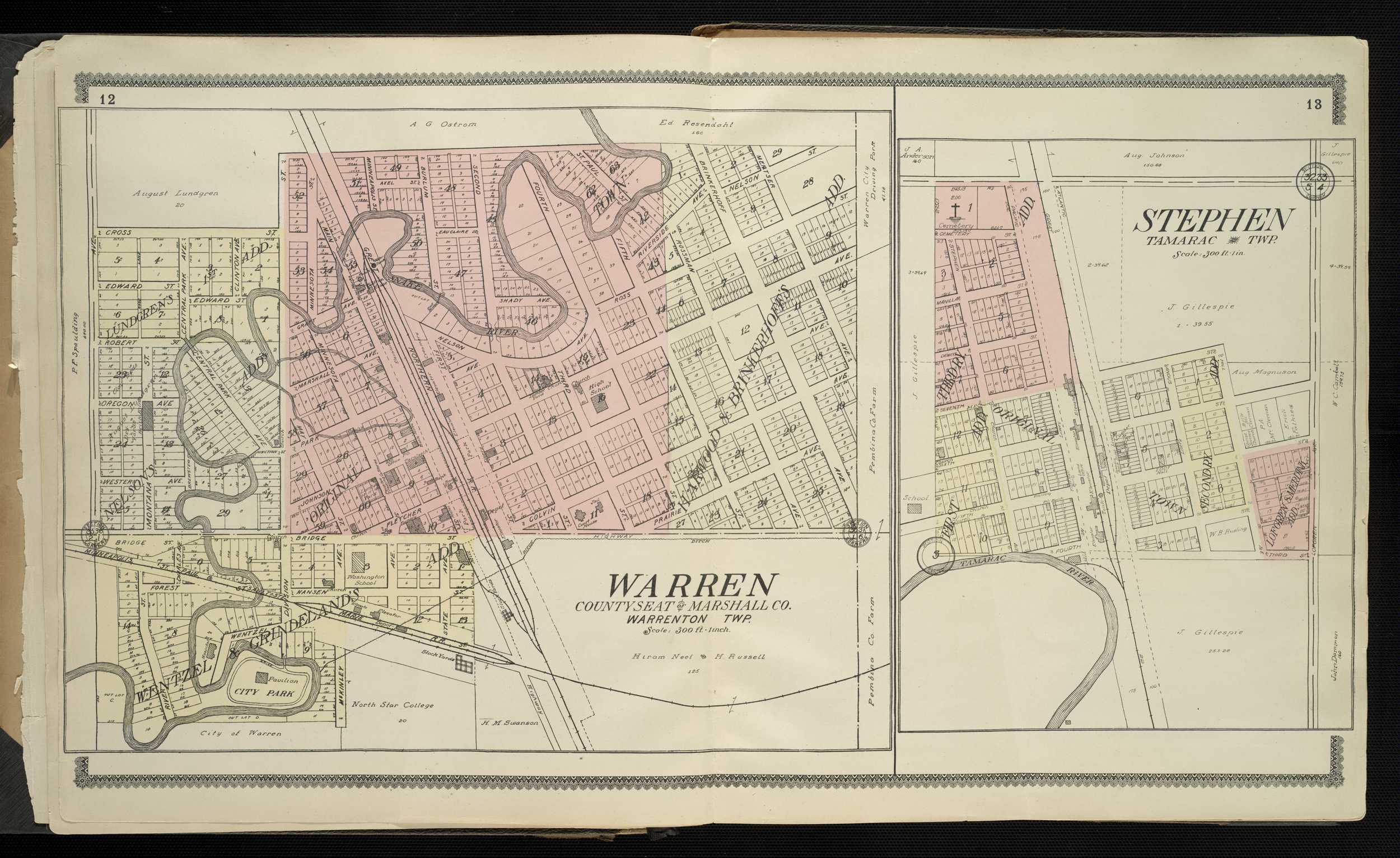
1909 - Marshall County Digitized interactive Alden Publishing company mapFor individual plats of cities and towns, please click on the name of the city/ town of interest: Alvarado Argyle Holt Lund Middle River New Folden Oslo Radium Sandridge Station Stephen Strandquist Strip Viking Warren
Martin County
1916 - Martin County Plat Book of the State of MinnesotaMeeker County
1916 - Meeker County Plat Book of the State of MinnesotaMille Lacs County
1916 - Mille Lacs County Plat Book of the State of MinnesotaMorrison County
1916 - Morrison County Plat Book of the State of MinnesotaMurray County
1916 - Murray County Plat Book of the State of MinnesotaCounties beginning with N
Nicollet County
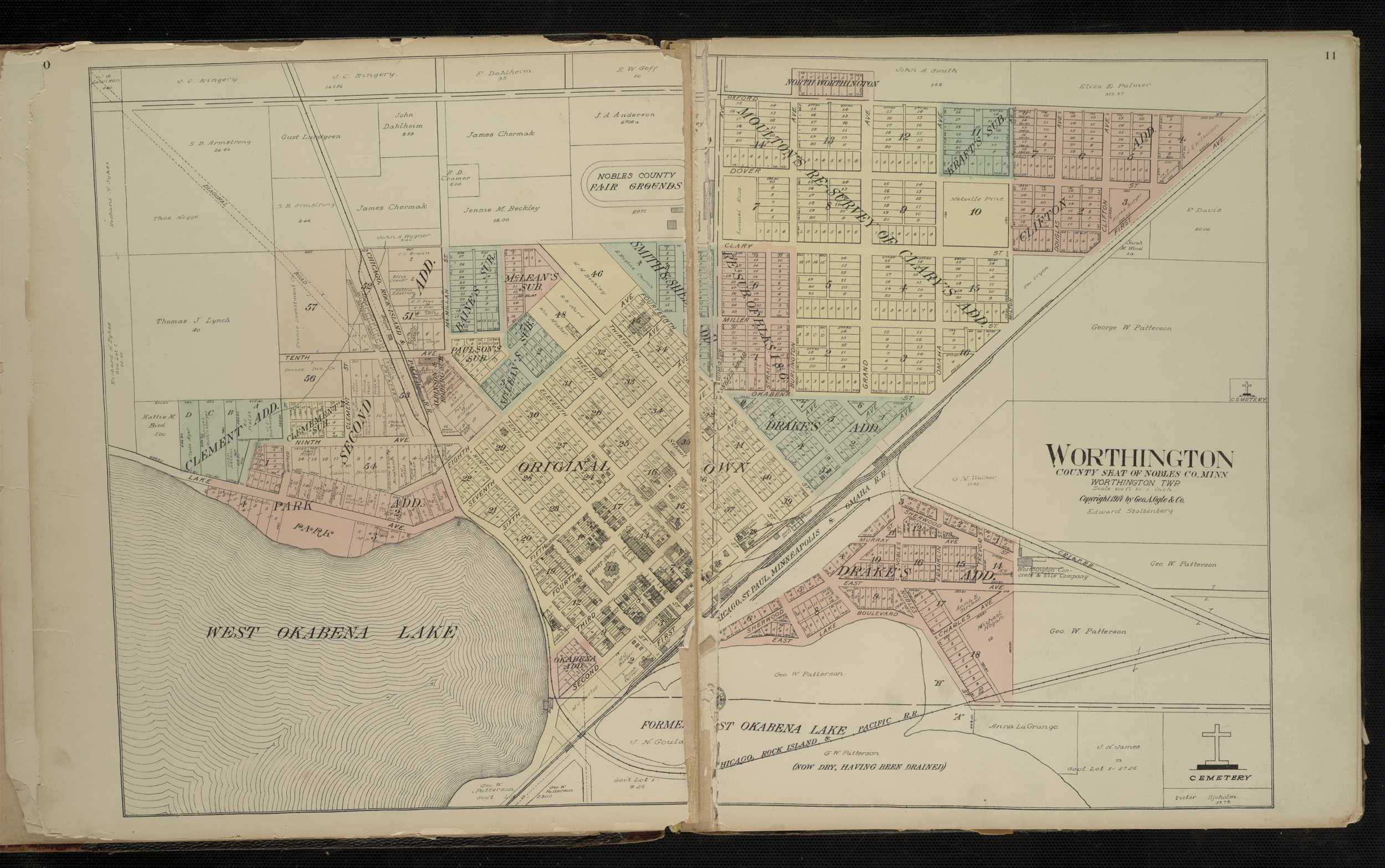
1916- Nicollet County Plat Book of the State of MinnesotaNobles County
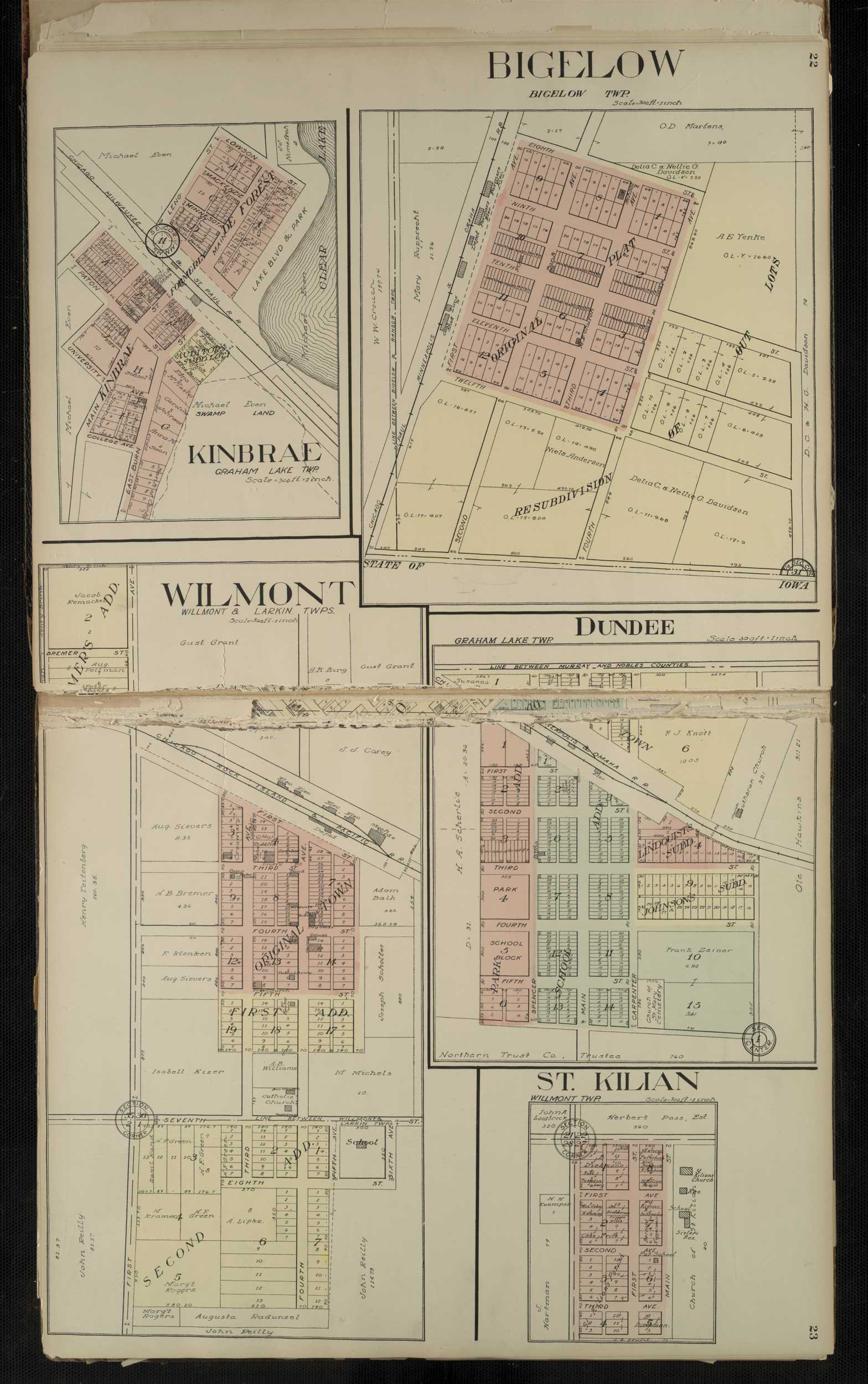
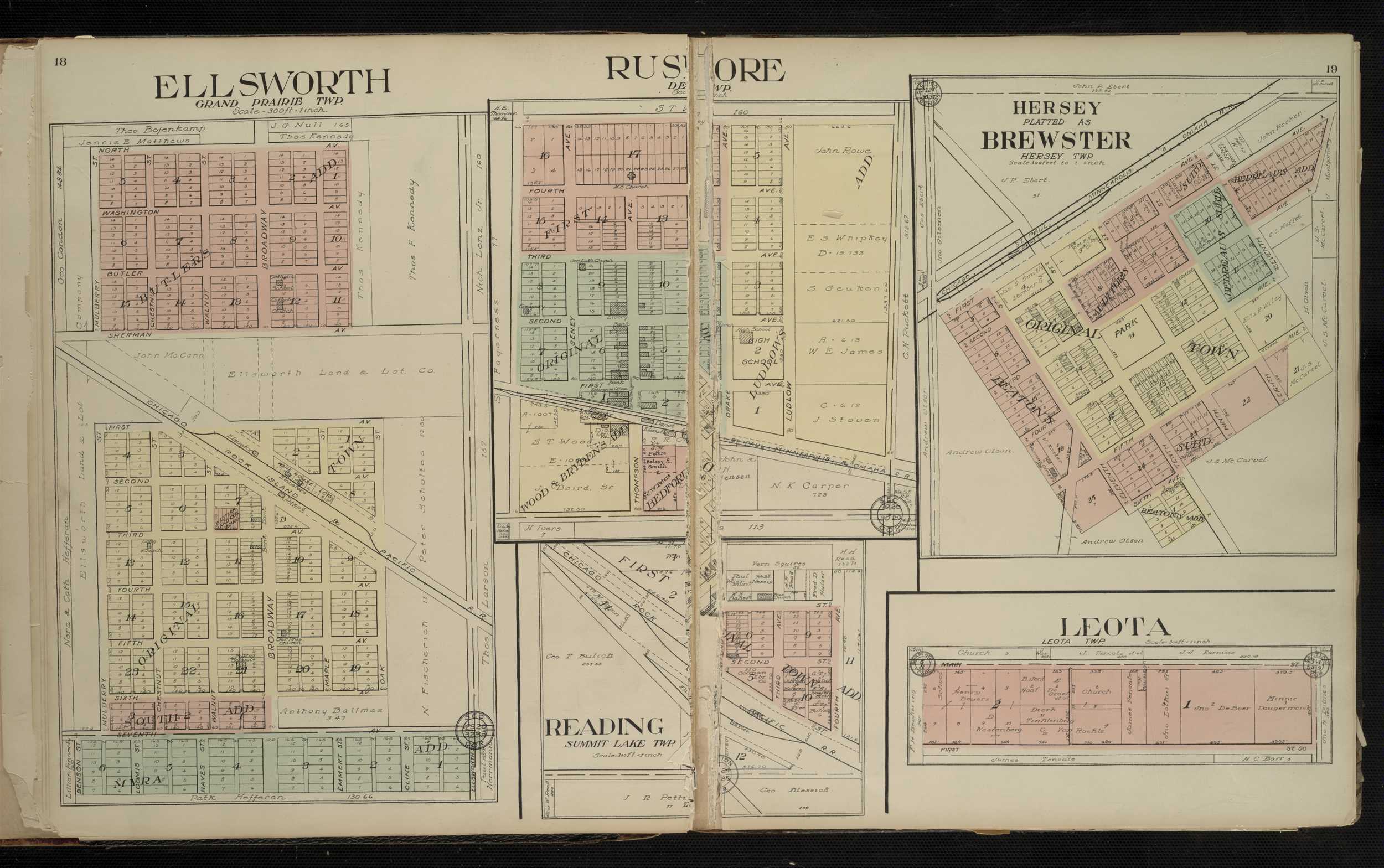
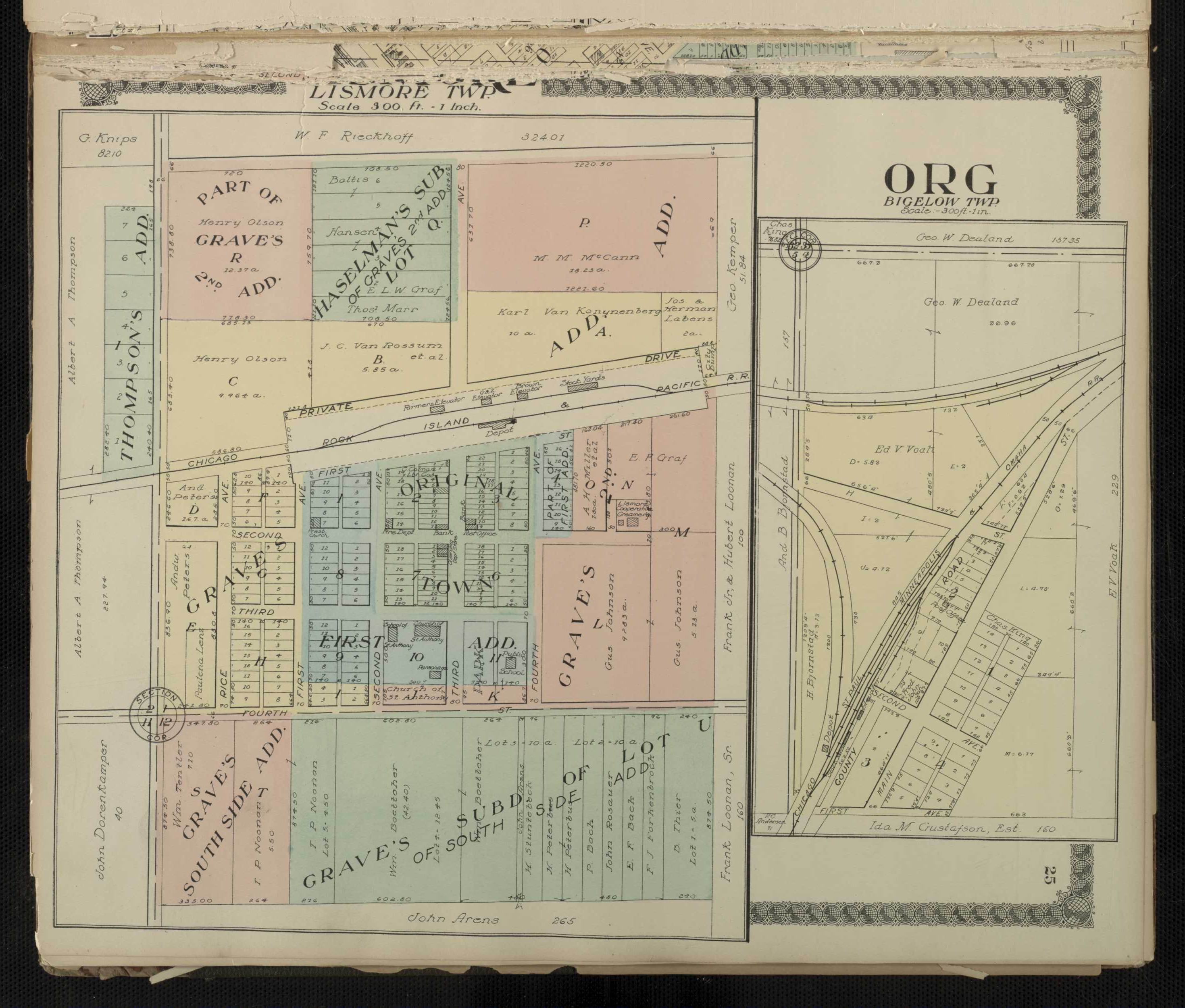
1914 - Nobles County Digitized interactive Geo. A. Ogle & Co. mapFor individual plats of cities and towns, please click on the name of the city/ town of interest: Adrian Bigelow Brewster De Forest Dundee Ellsworth Hersey Kinbrae Leota Lismore Org Reading Round Lake Rushmore St. Killian Wilmont Worthington
Nobles County
1916 - Nobles County Plat Book of the State of MinnesotaNorman County
1916 - Norman County Plat Book of the State of MinnesotaCounties beginning with O
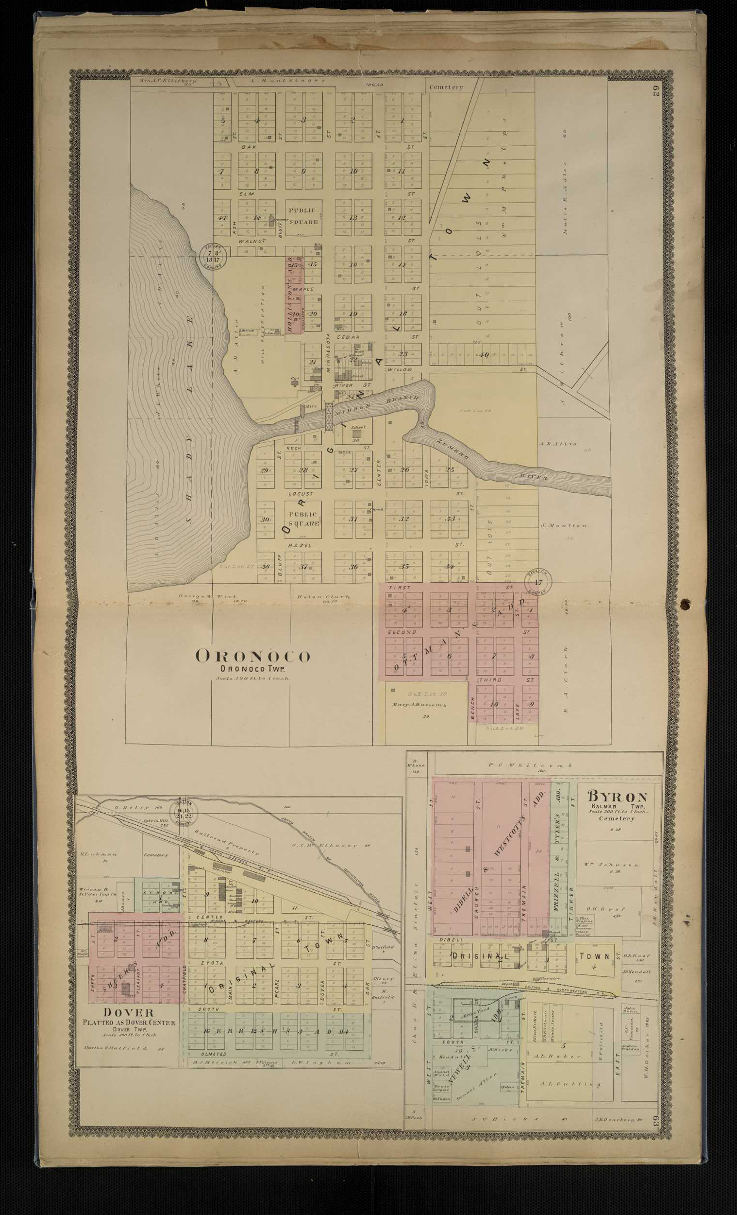
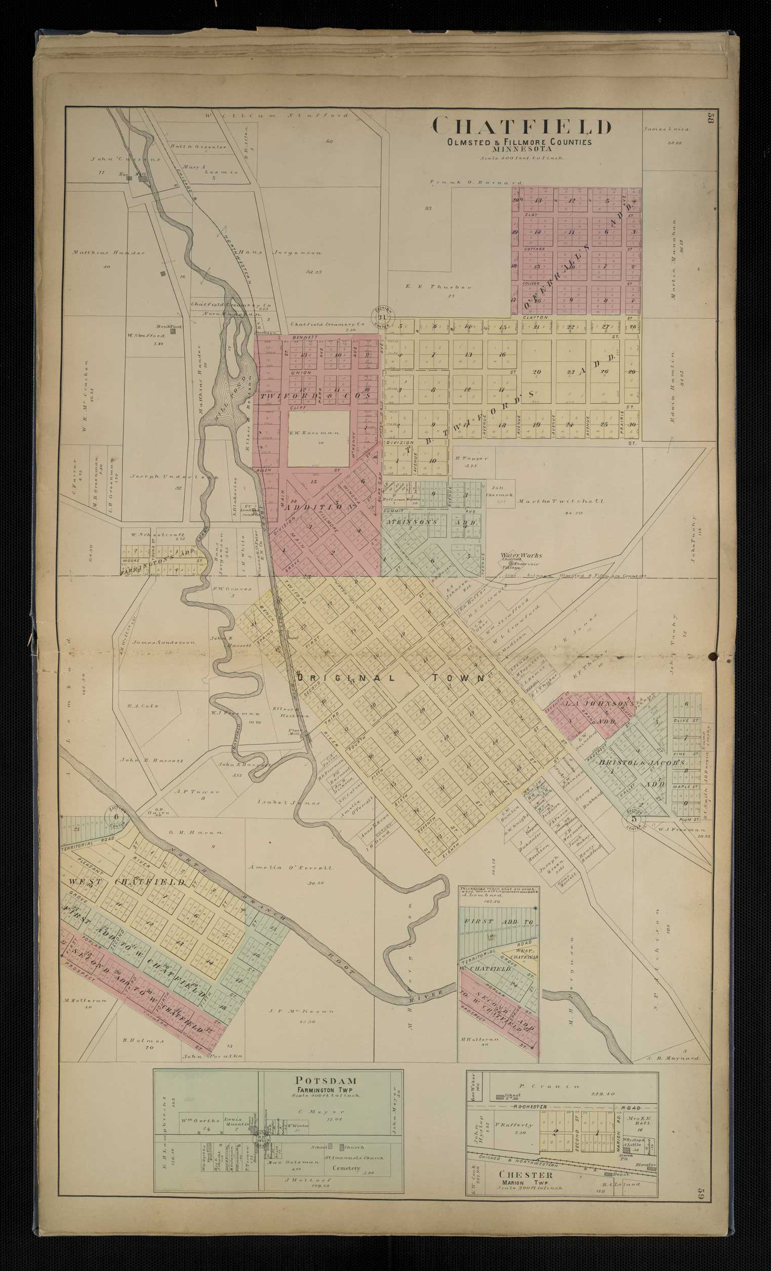
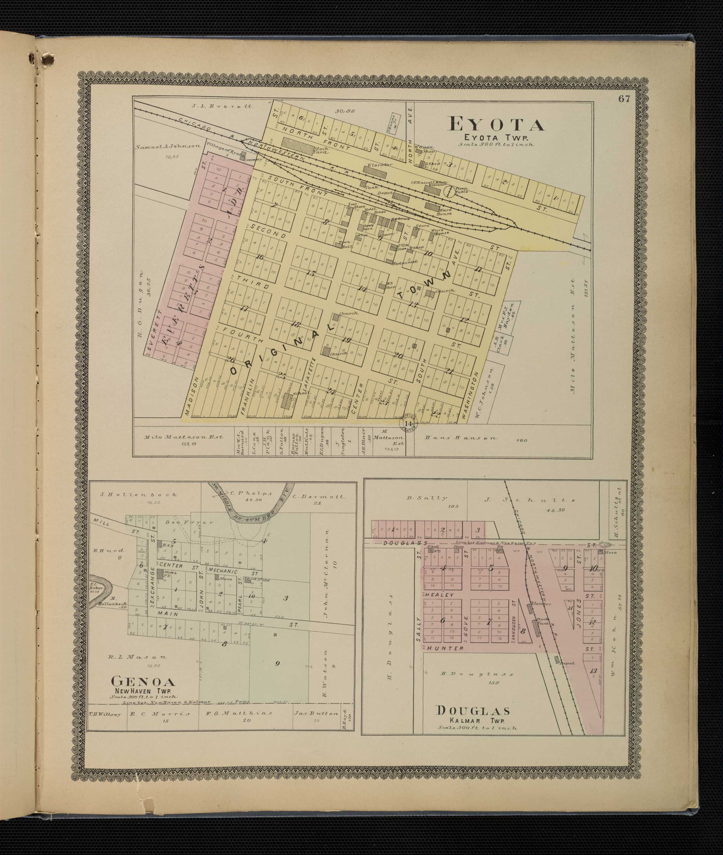
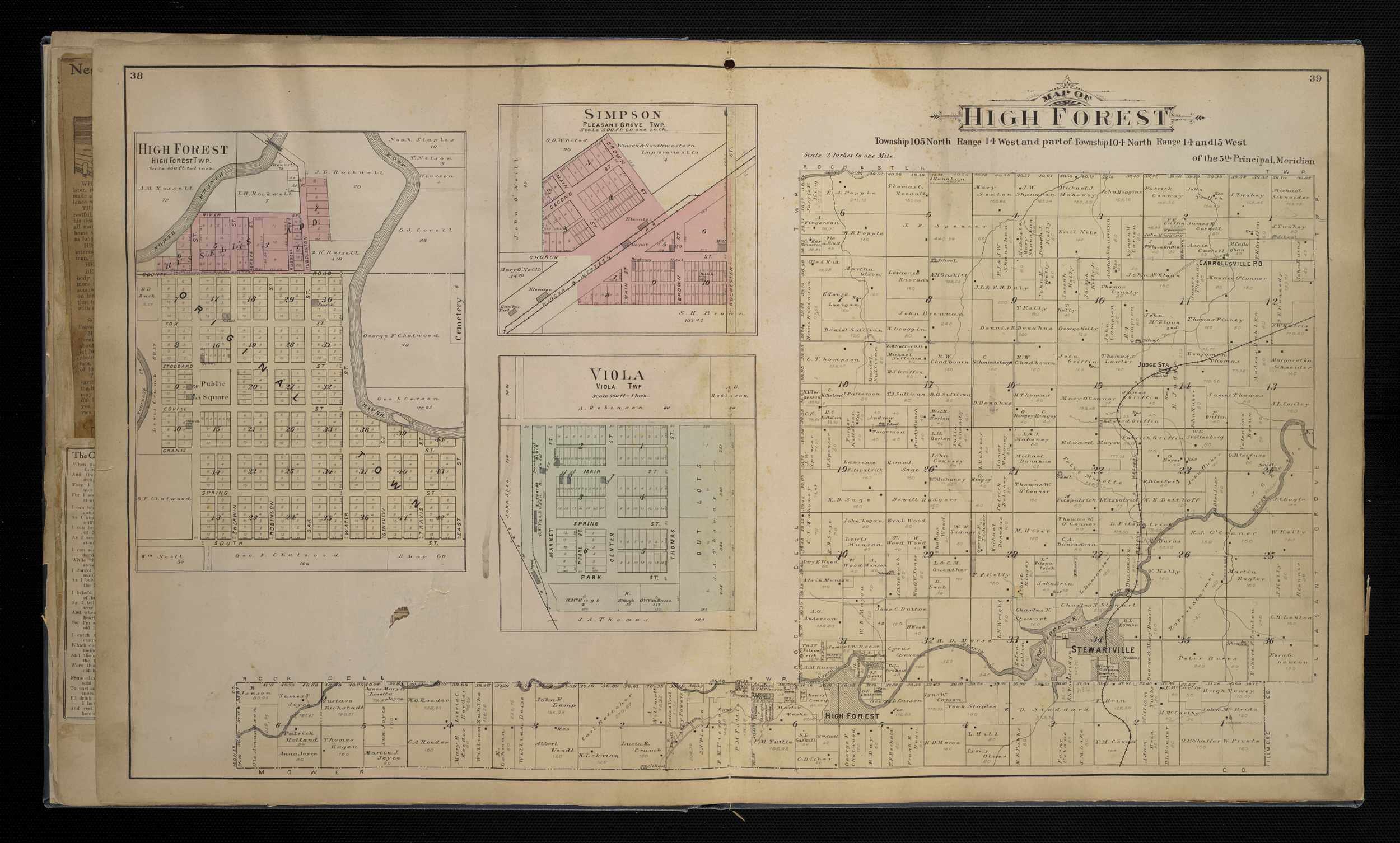
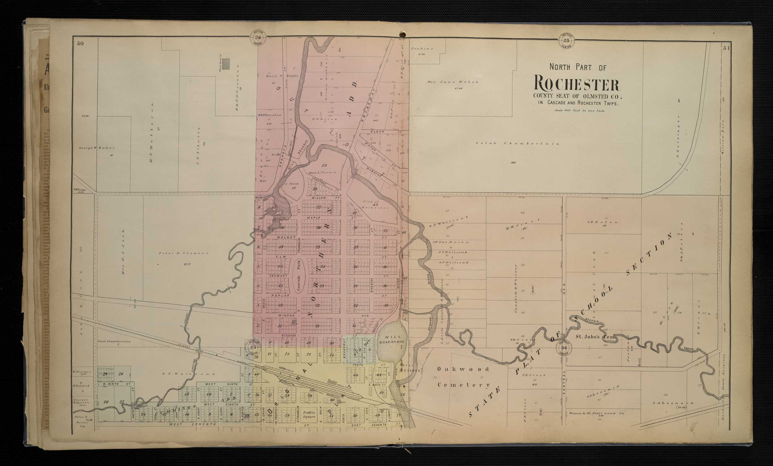
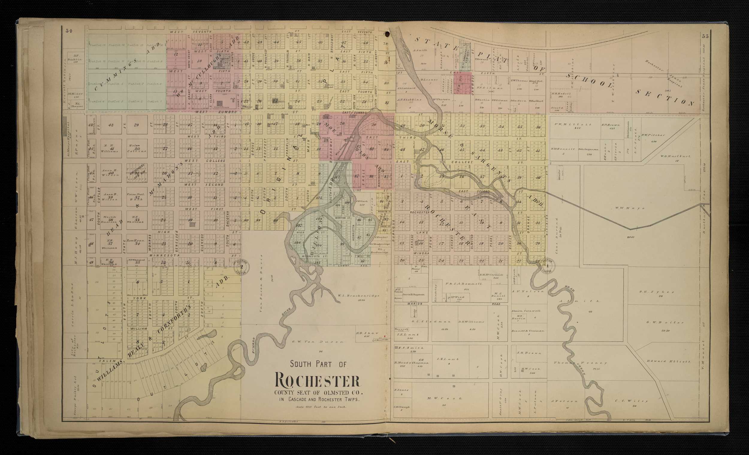
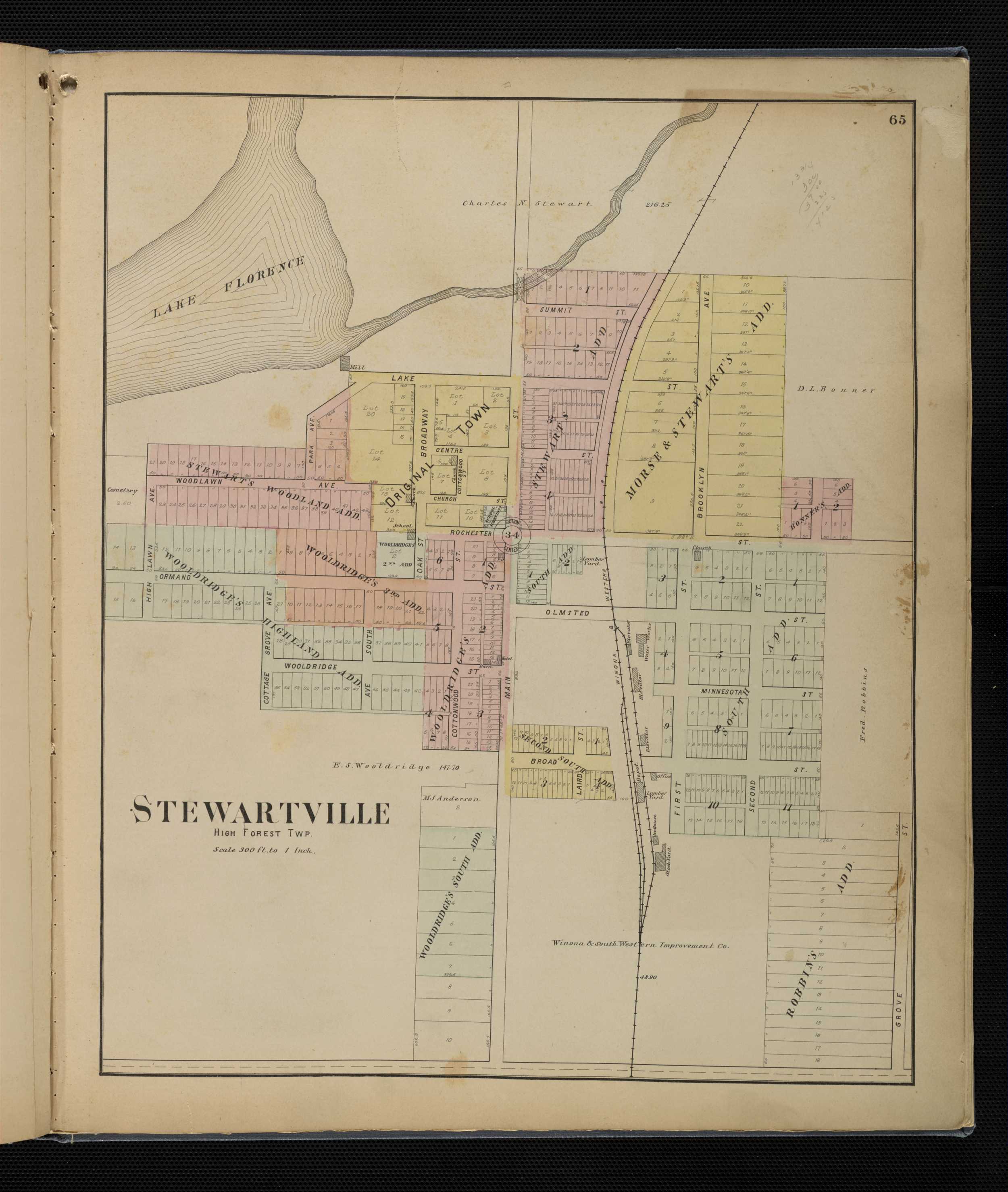
Olmsted County
1896 - Olmsted County Digitized interactive Geo. A. Ogle & Co. mapFor individual plats of cities and towns, please click on the name of the city/ town of interest: Byron Chatfield Chester Cummingsville Douglas Dover Dover Center Eyota Genoa High Forest Marion Oronoco Pleasant Grove Potsdam Rochester, North Rochester, South Simpson Stewartville Viola
Olmsted County
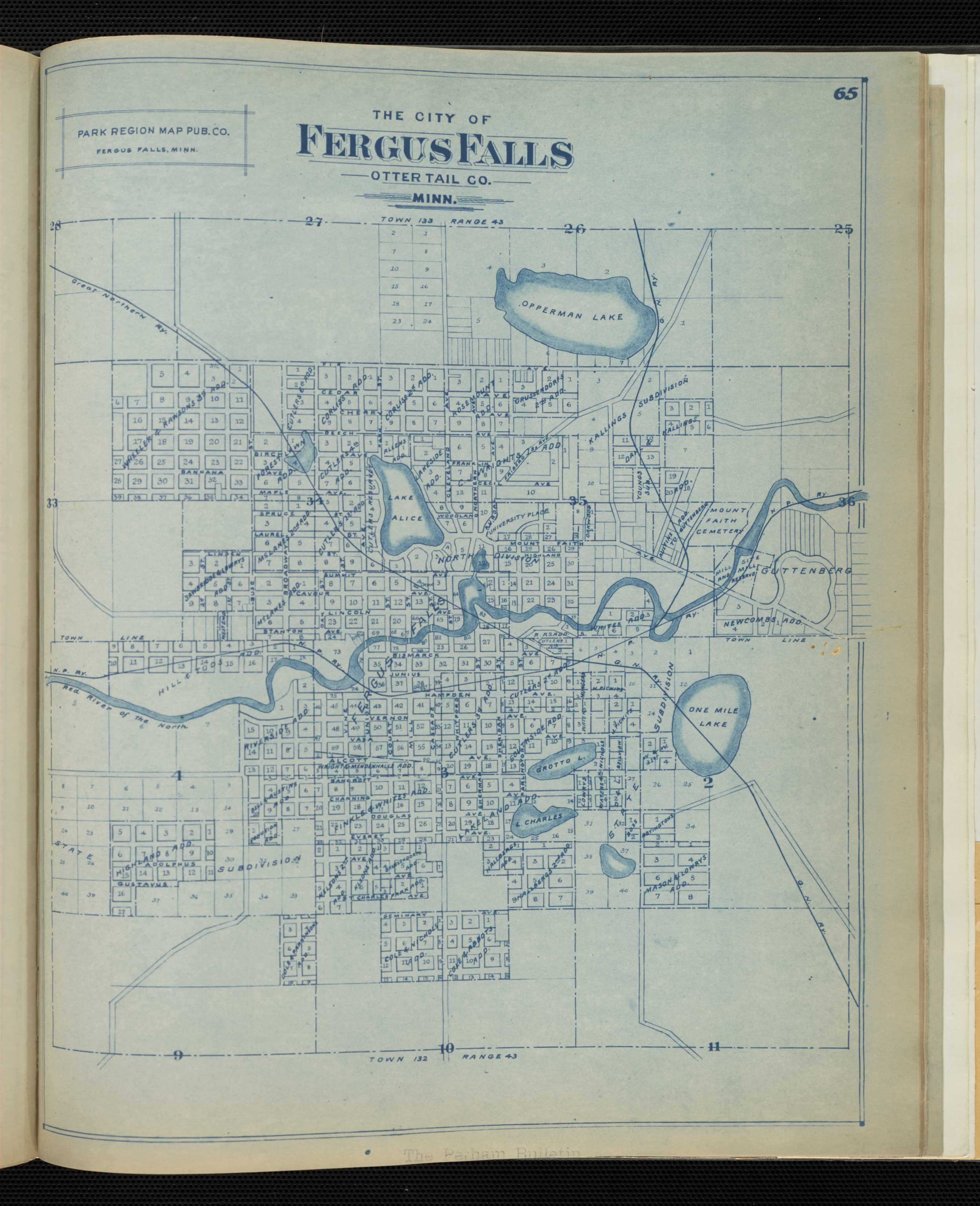
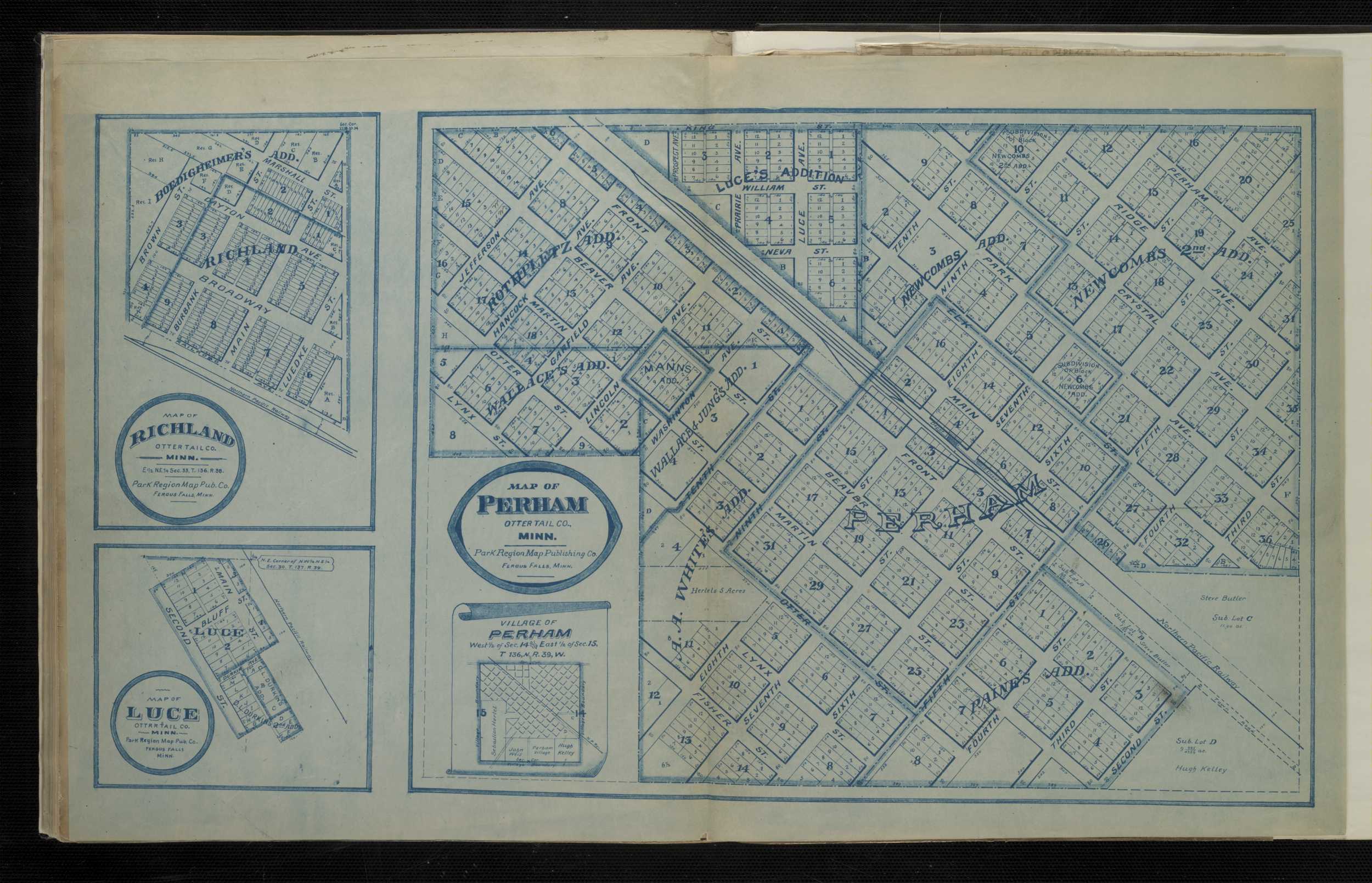
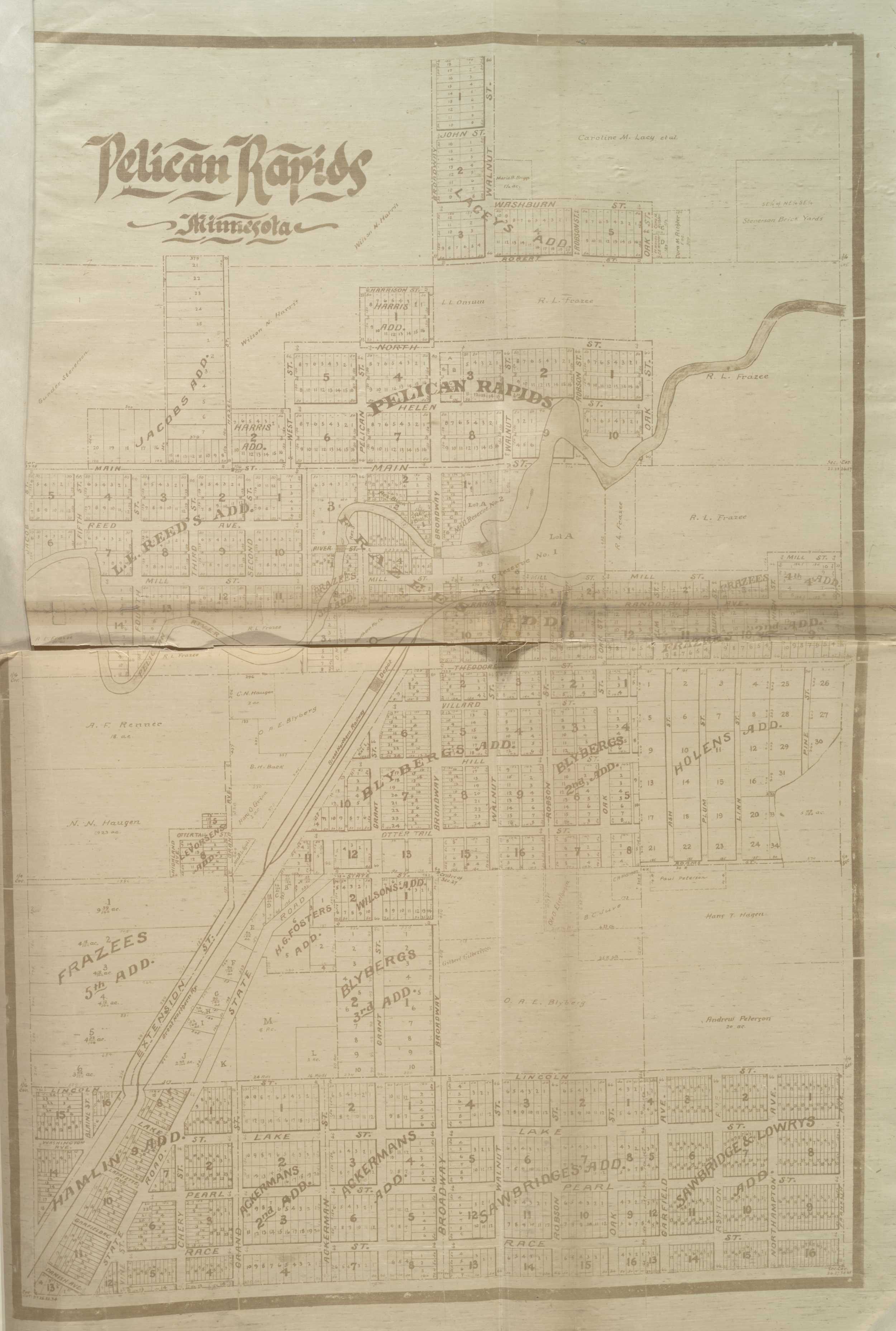
1916 - Olmsted County Plat Book of the State of MinnesotaOtter Tail County
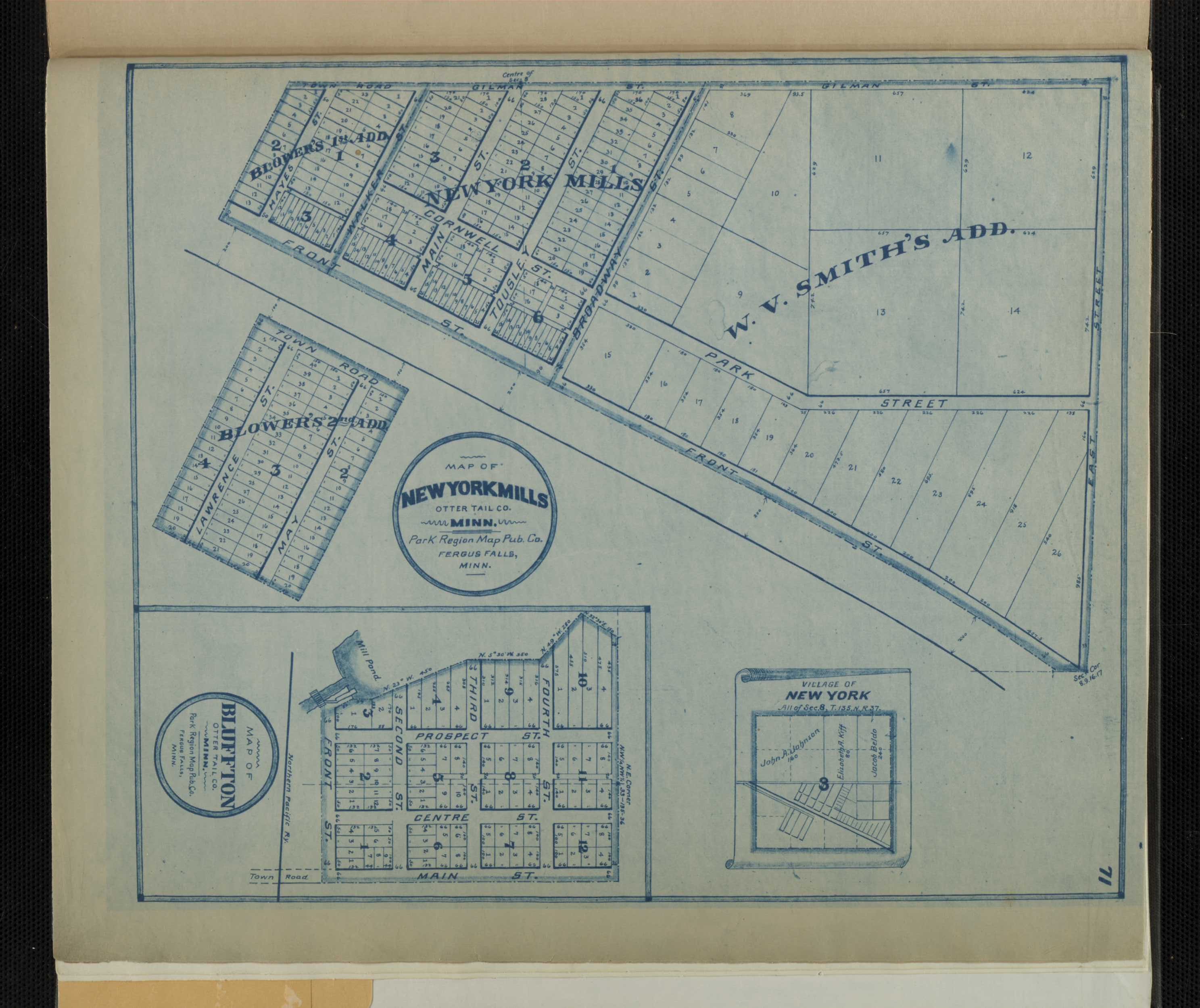
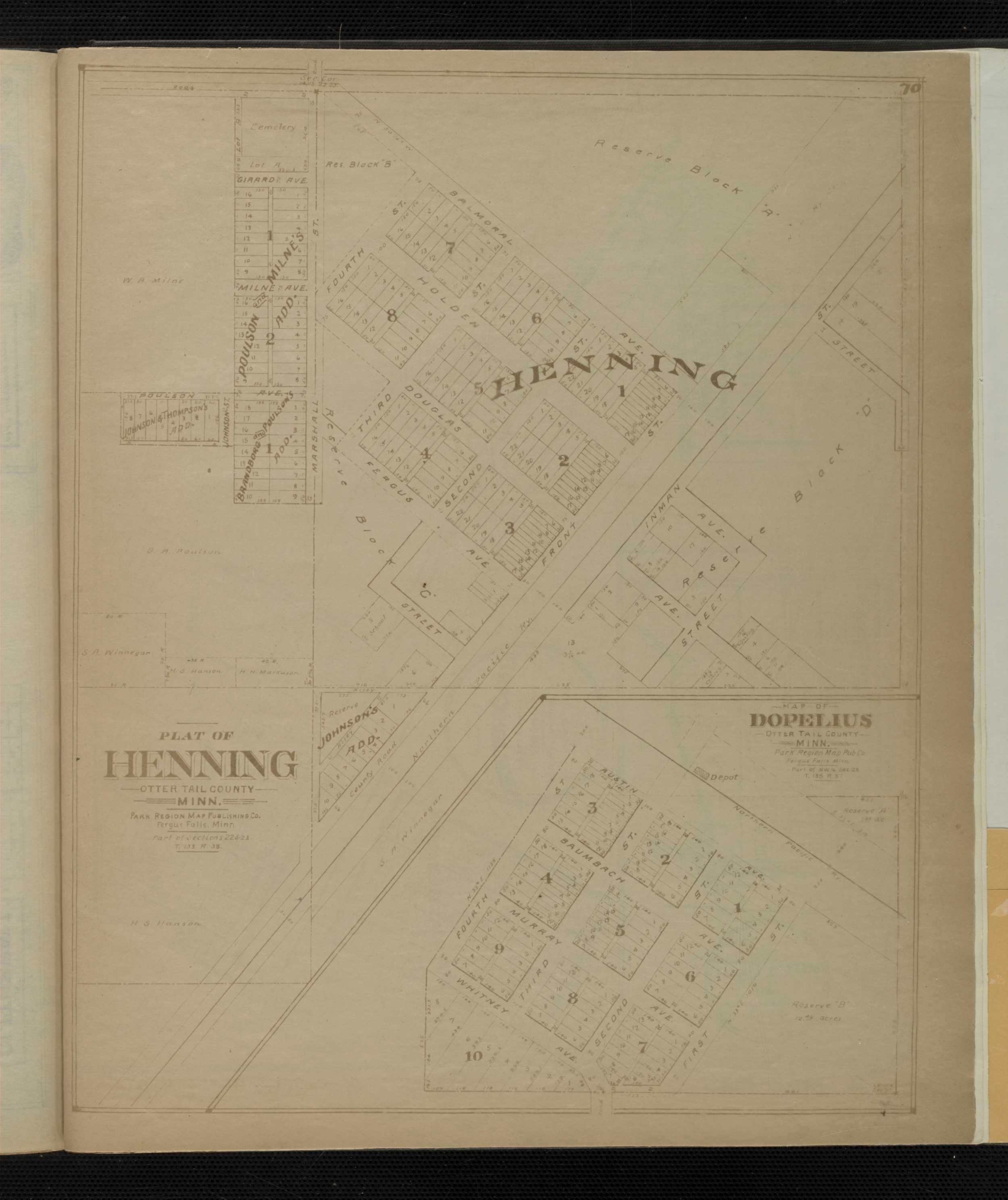
1902 - Otter Tail County Interactive Park Region Map Publishing Company mapFor individual plats of cities and towns, please click on the name of the city/ town of interest: Battle Lake, Village Bluffton Carlisle Clearview Clitherall, Village Clitherall Lake and Vicinity Dalton Dopelius East Battle Lake and Vicinity Elizabeth, Village Erharts Fergus Falls Henning, Village Luce Mill Park New York, Village New York Mills Oh-Jib-Wa Otter Tail City Pelican Rapids, Village Perham, Village Richland Underwood Vining
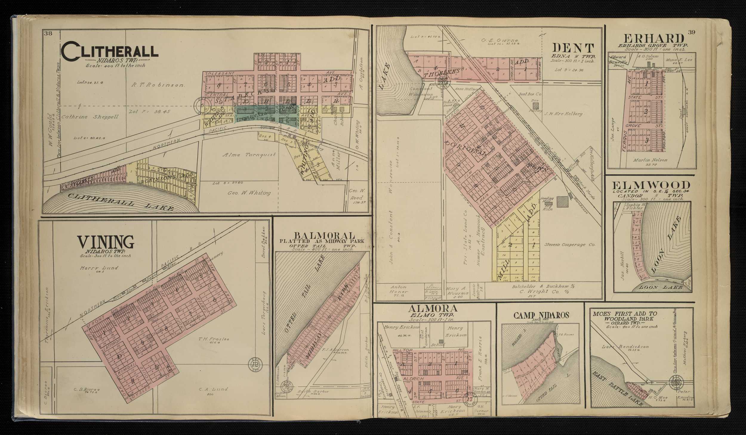
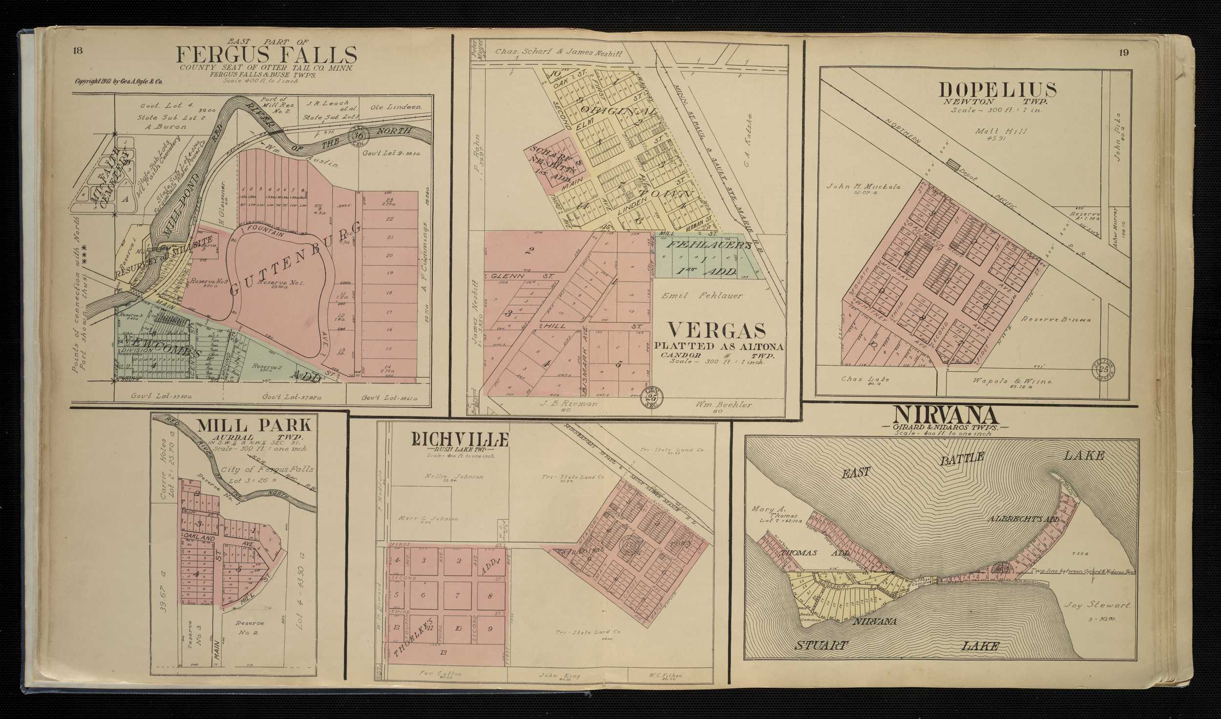
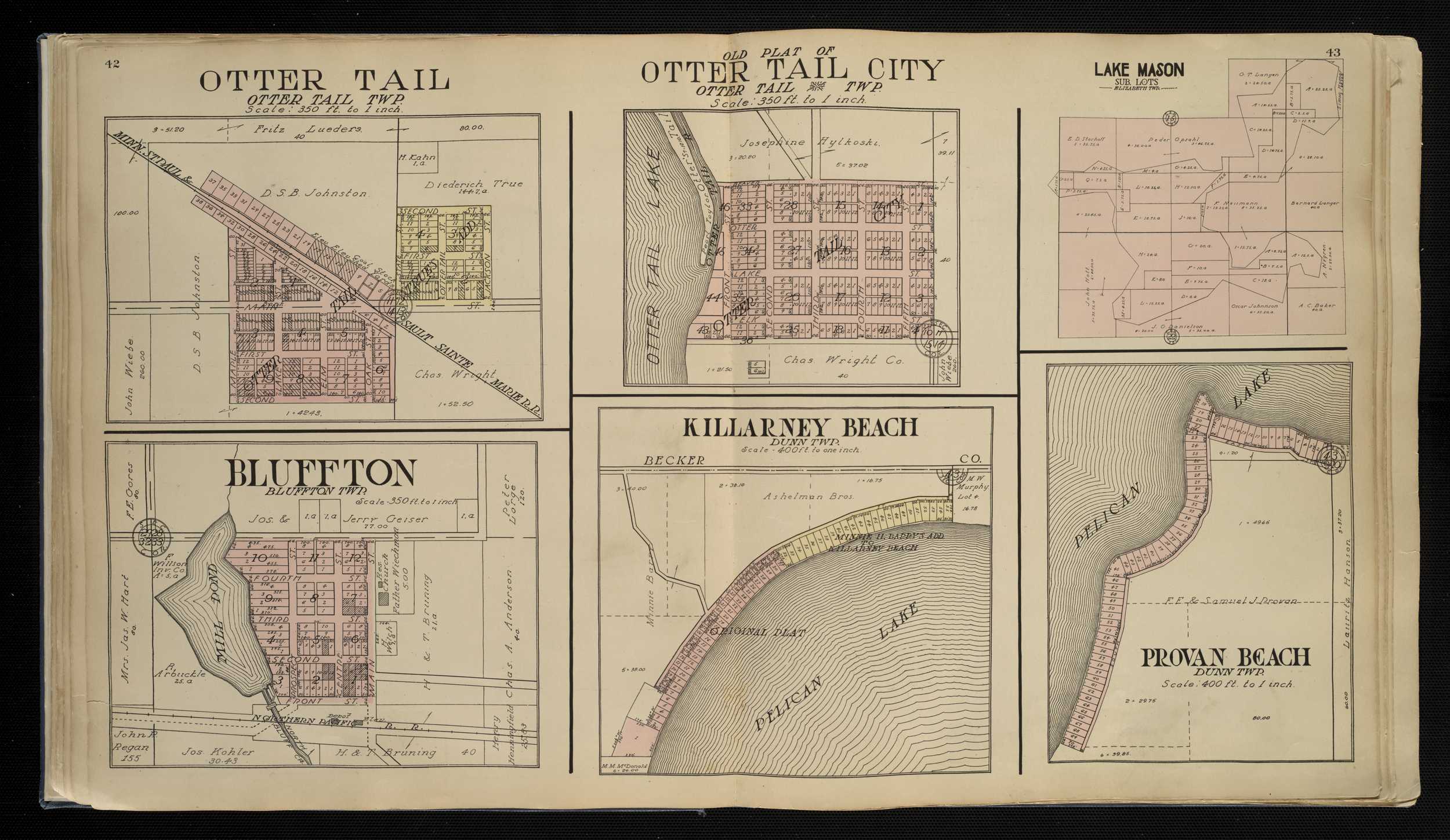
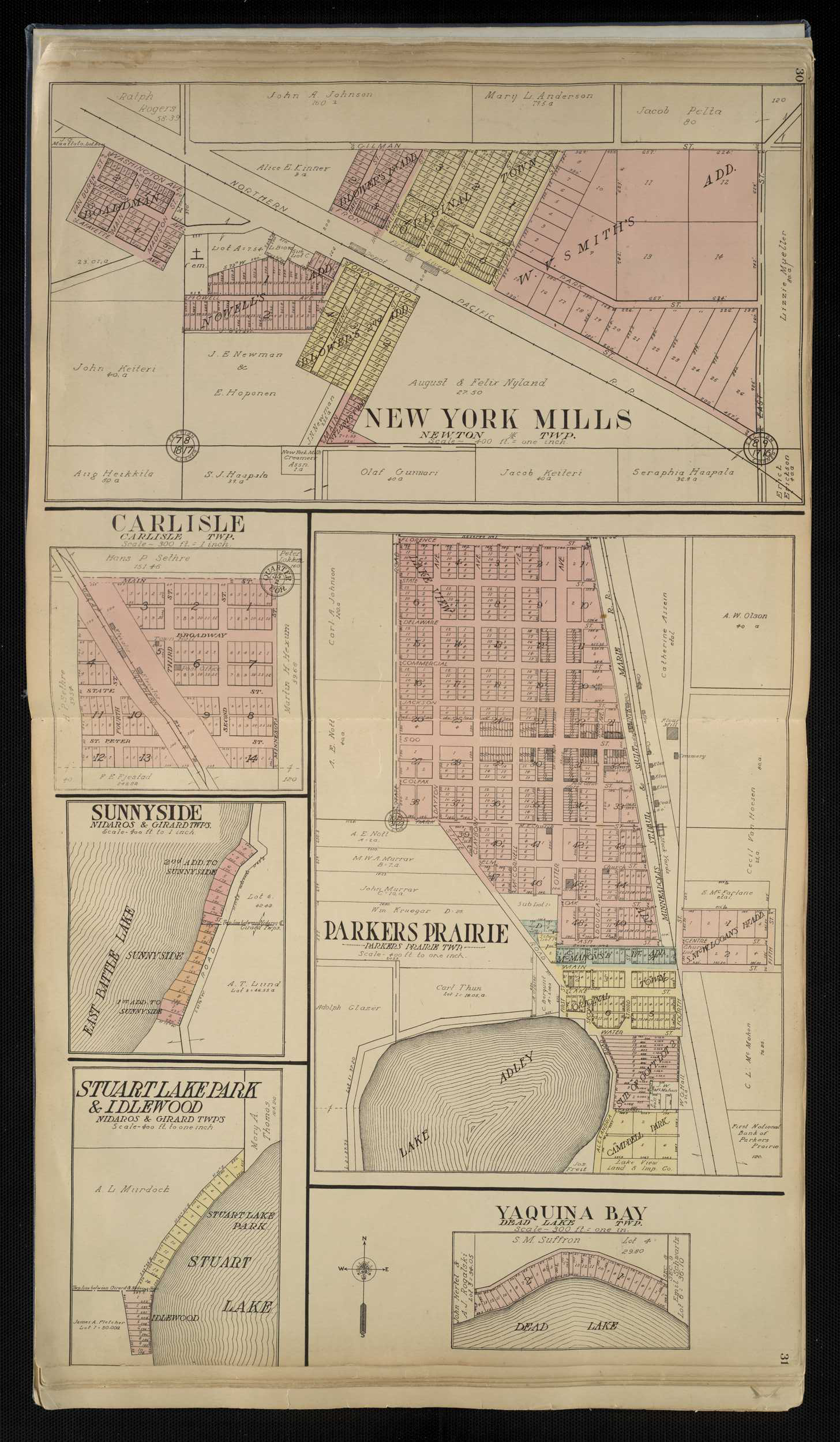
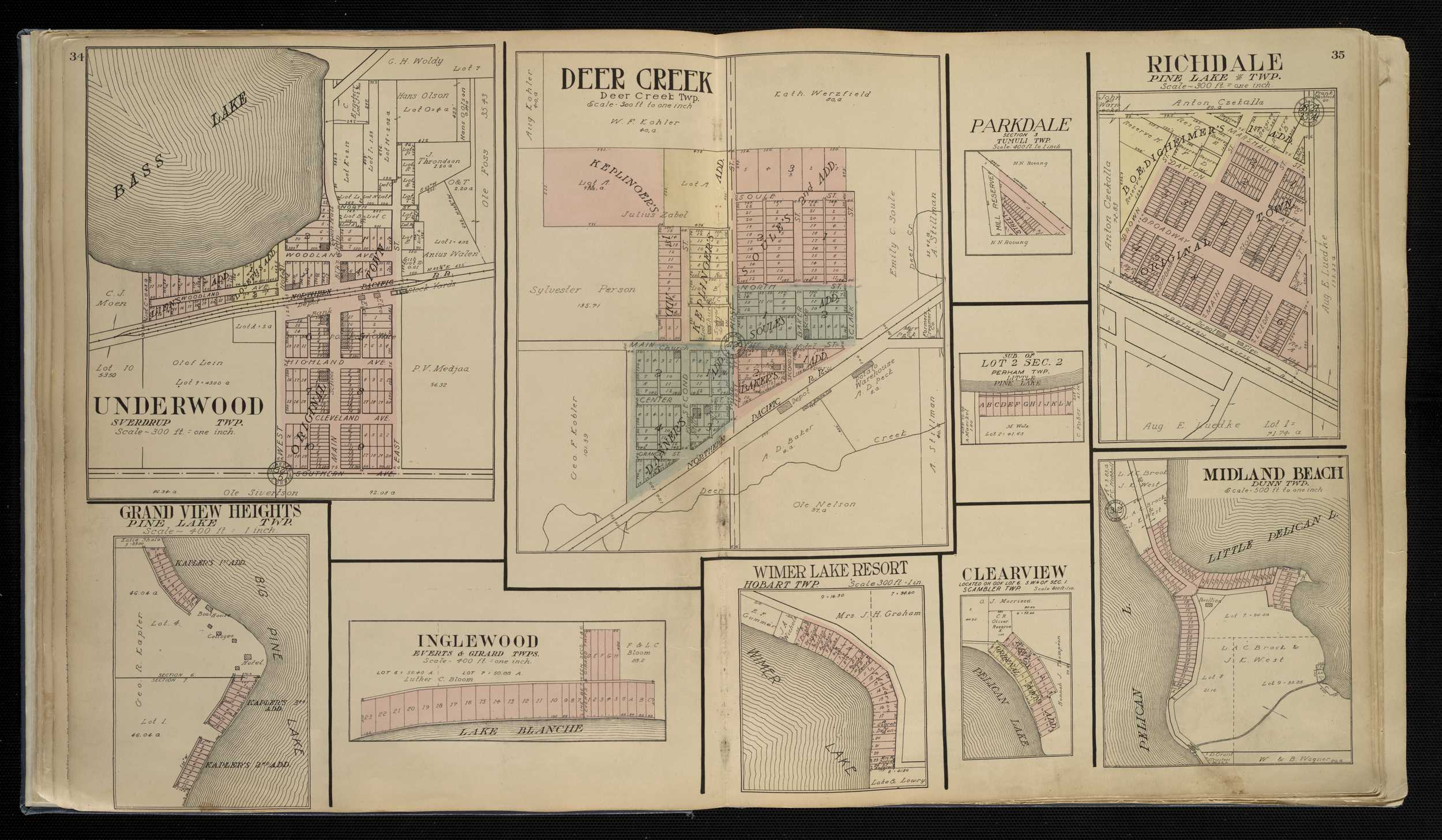
Otter Tail County
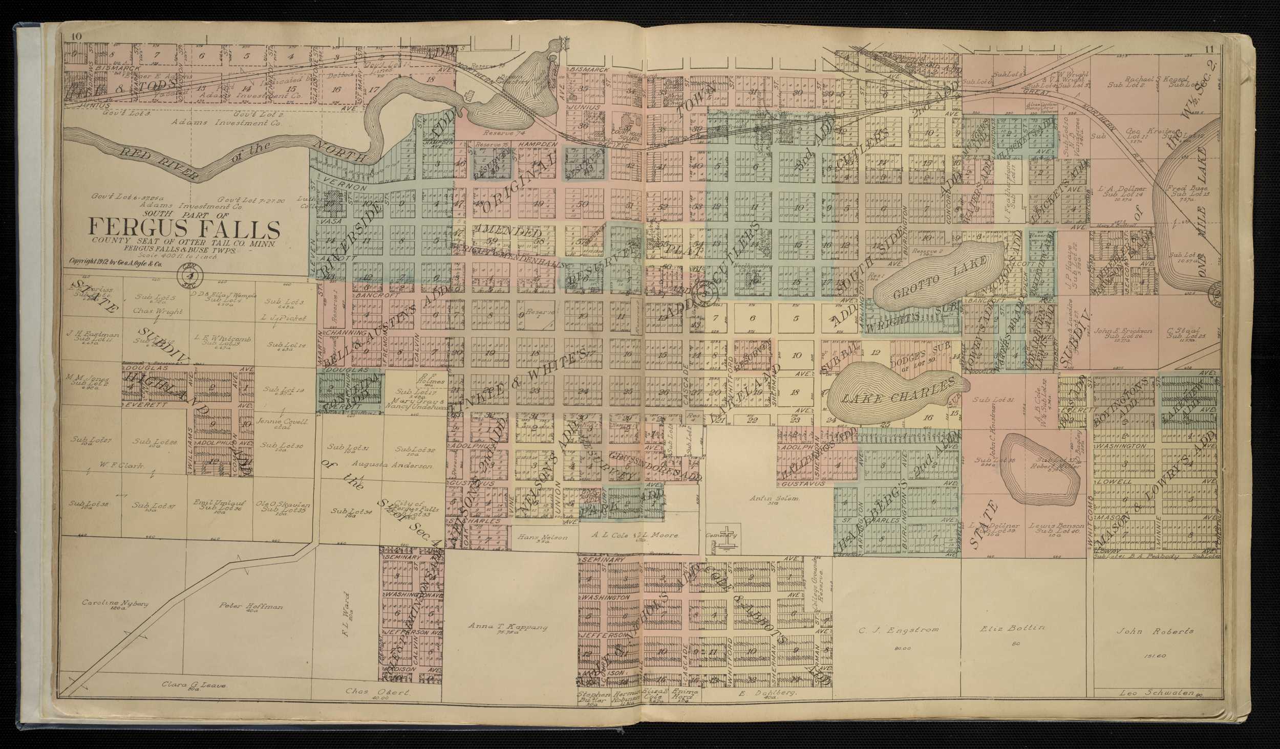
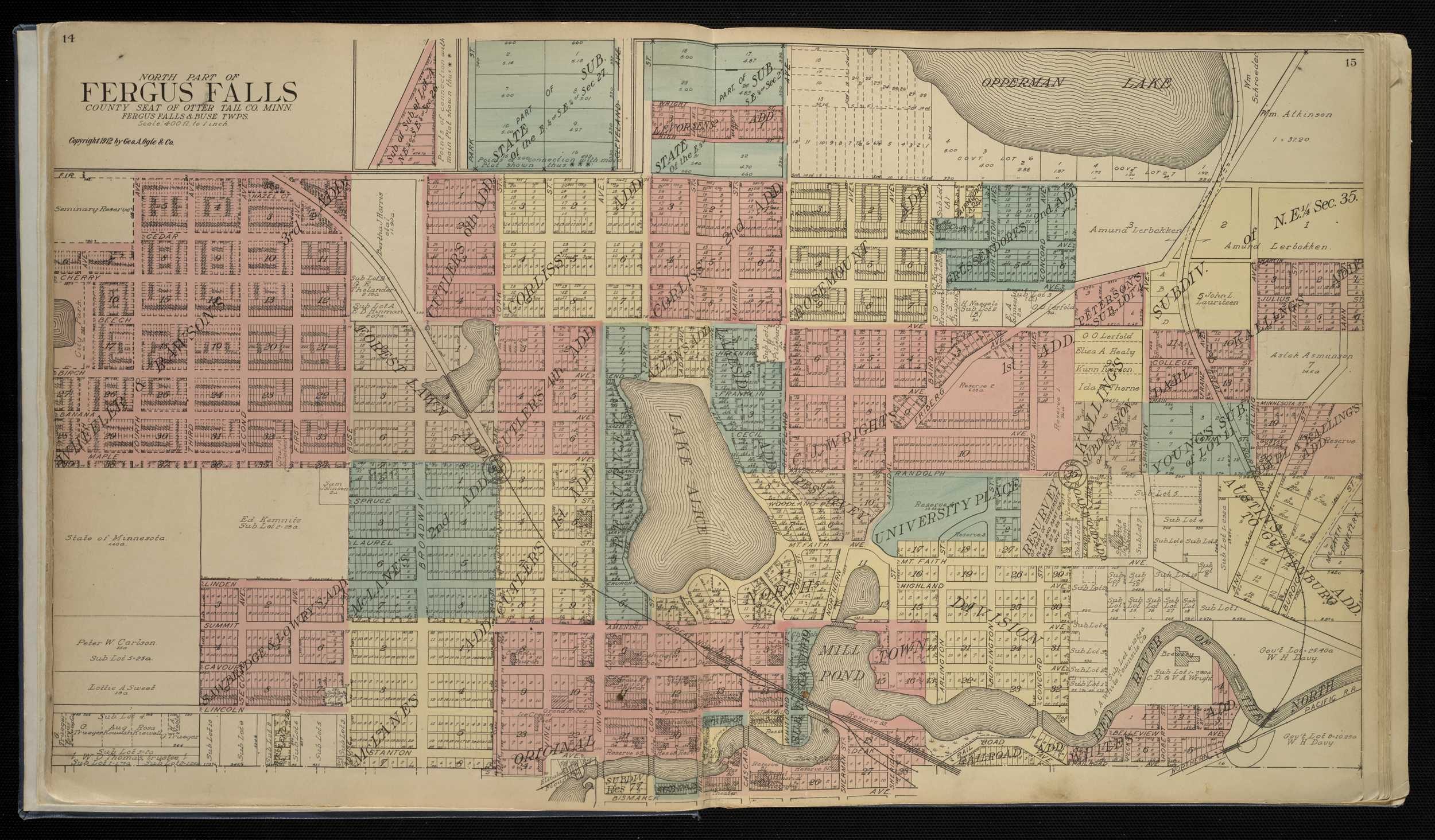
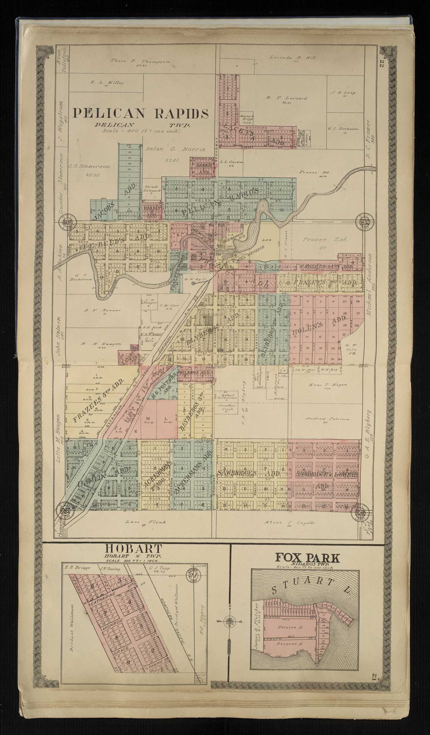
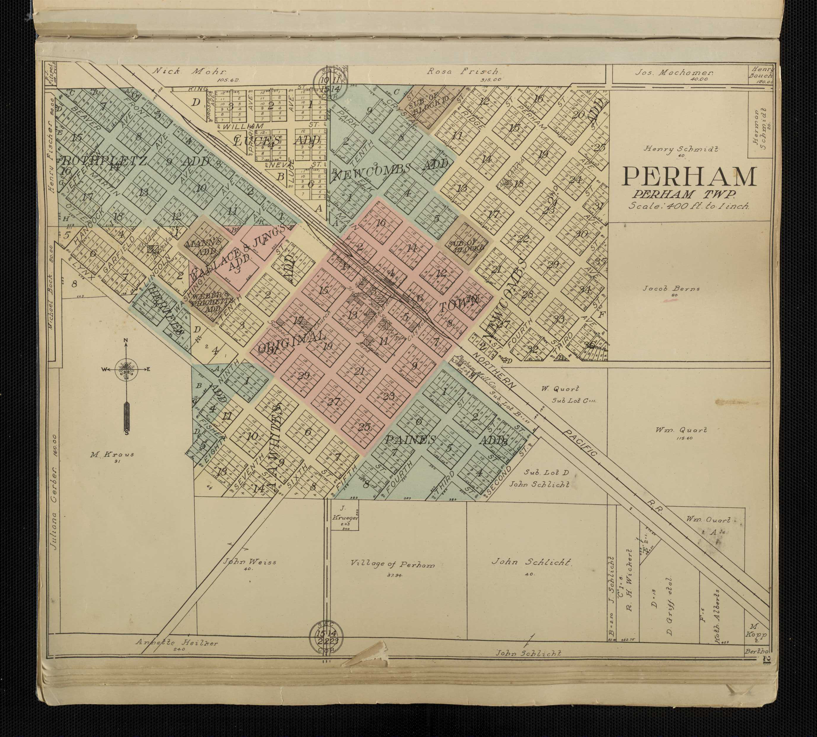
1912 - Otter Tail County Digitized Geo. A. Ogle & Co. mapFor individual plats of cities and towns, please click on the name of the city/ town of interest: Almora Altona Balmoral Battle Lake Bluffton Boardman Camp Nidaros Carlisle Clearview Clitherall Dalton Deer Creek Dent Dopelius Elizabeth Elmwood Erhard Fergus Falls City, South Fergus Falls City, North Fergus Falls City, East Fox Park Grand View Heights Guttenburg Henning Hobart Idlewood Inglewood Killarney Beach Lake Mason Sub. Lots Leafside Luce Midland Beach Midway Park Mill Park Moe's First Add to Woodland Park New York Mills Nirvana Ottertail Ottertail City Parkdale Parkers Prairie Pelican Rapids Perham Provan Beach Richdale Richville Stuart Lake Park Sub. Lots 1 to 15, Dunn Township Sub. of Lot 2, Section 2, Perham Township Sunnyside Underwood Vergas Vining Wall Lake Point Wimer Lake Resort Yaquina Bay
Otter Tail County
1916 - Otter Tail County Plat Book of the State of MinnesotaCounties beginning with P
Pennington County
1916 - Pennington County Plat Book of the State of MinnesotaPipestone County
1916 - Pipestone County Plat Book of the State of MinnesotaCounties beginning with R
Ramsey County
1874 - Ramsey County Digitized A.T. Andreas map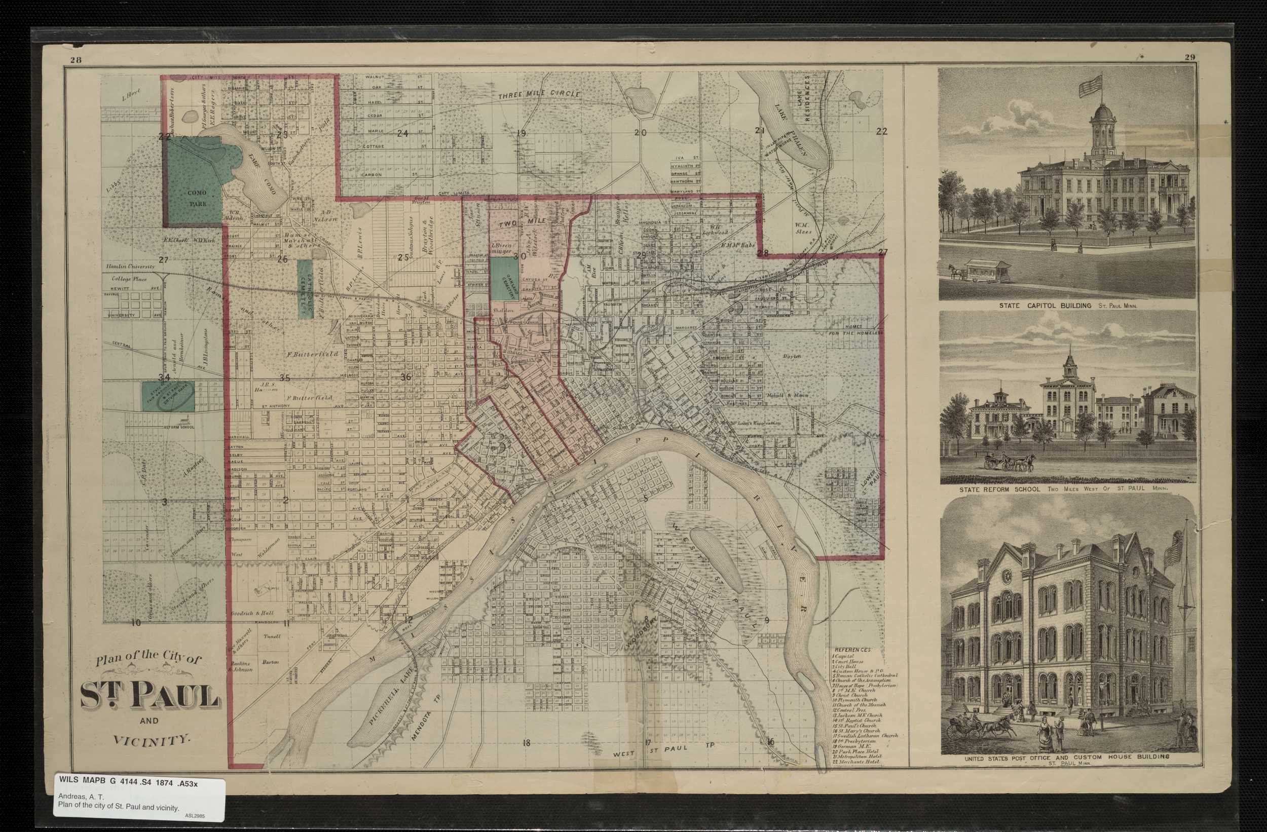
Ramsey County
1898 - Ramsey County Digitized interactive P.M. Dahl mapRamsey County
1916 - Ramsey County Plat Book of the State of MinnesotaRed Lake County
1916 - Ramsey County Plat Book of the State of MinnesotaRedwood County
1916 - Redwood County Plat Book of the State of MinnesotaRenville County
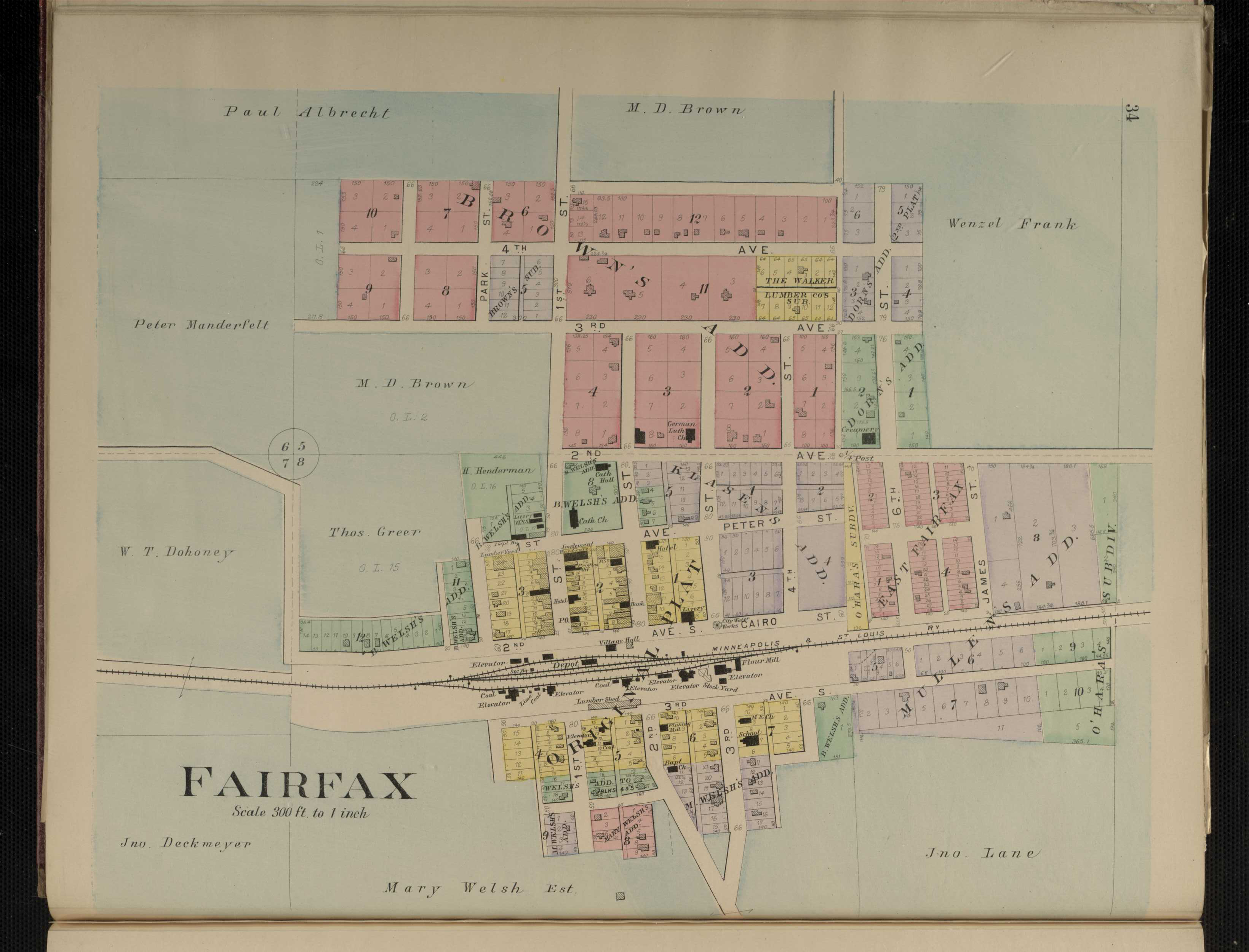
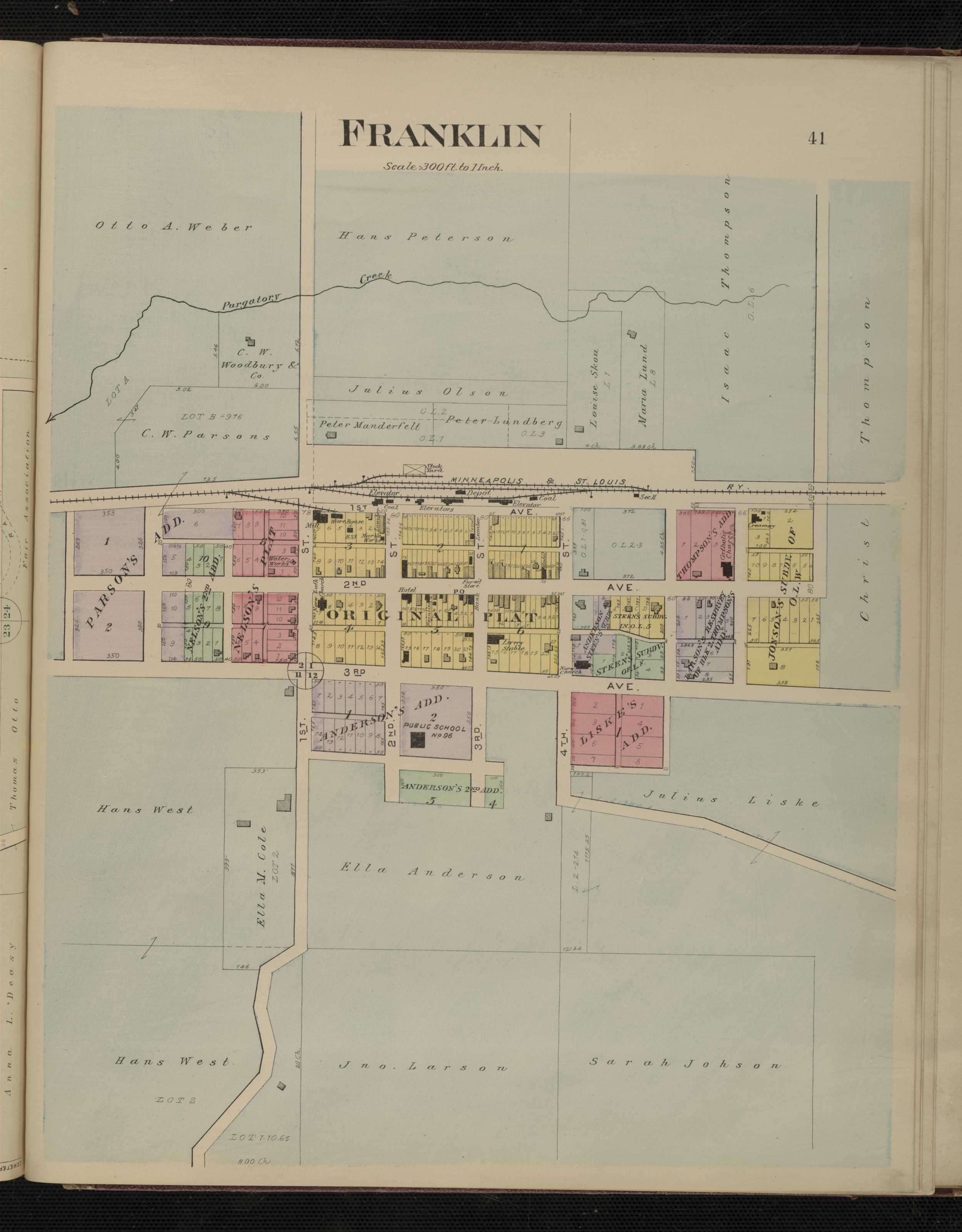
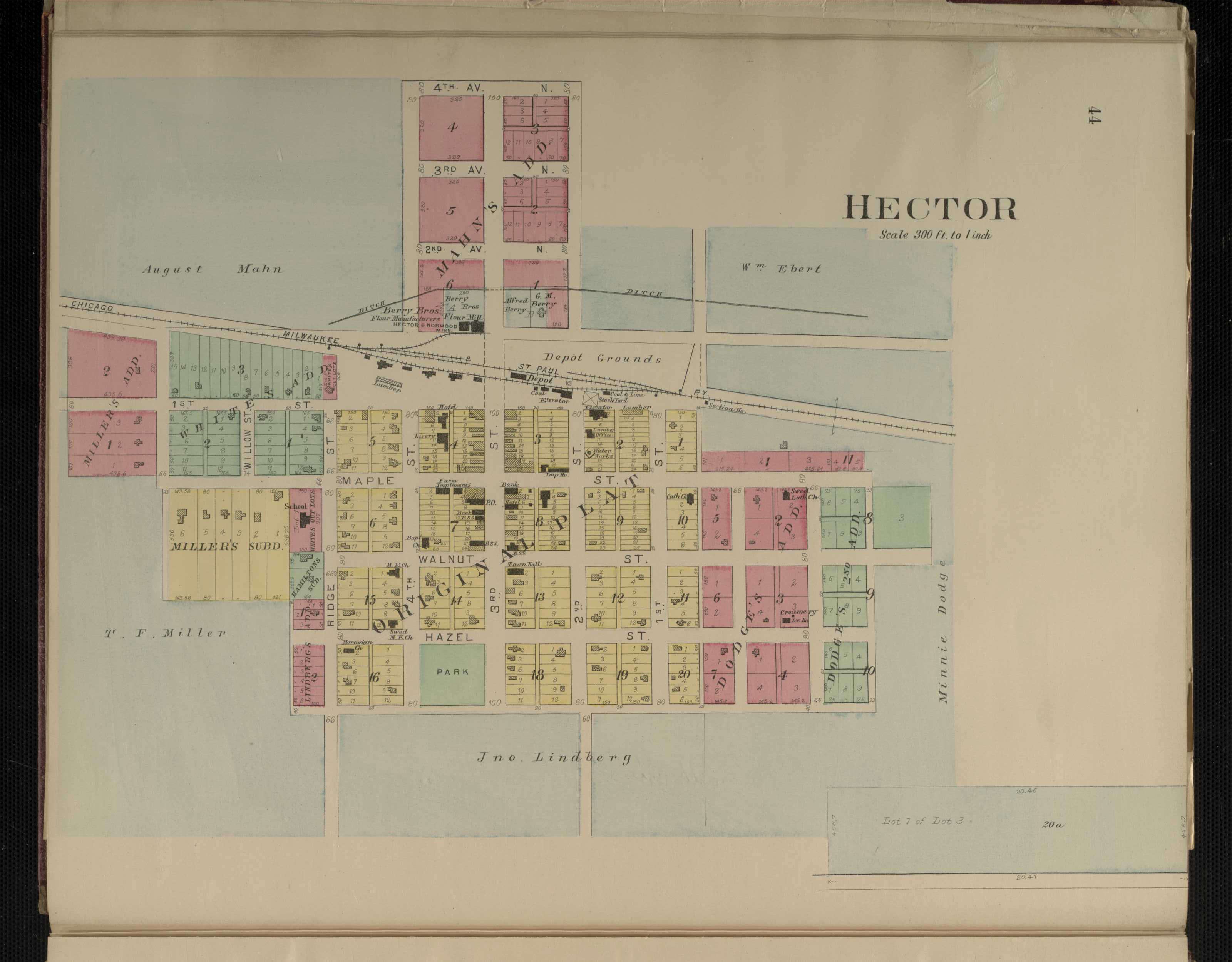
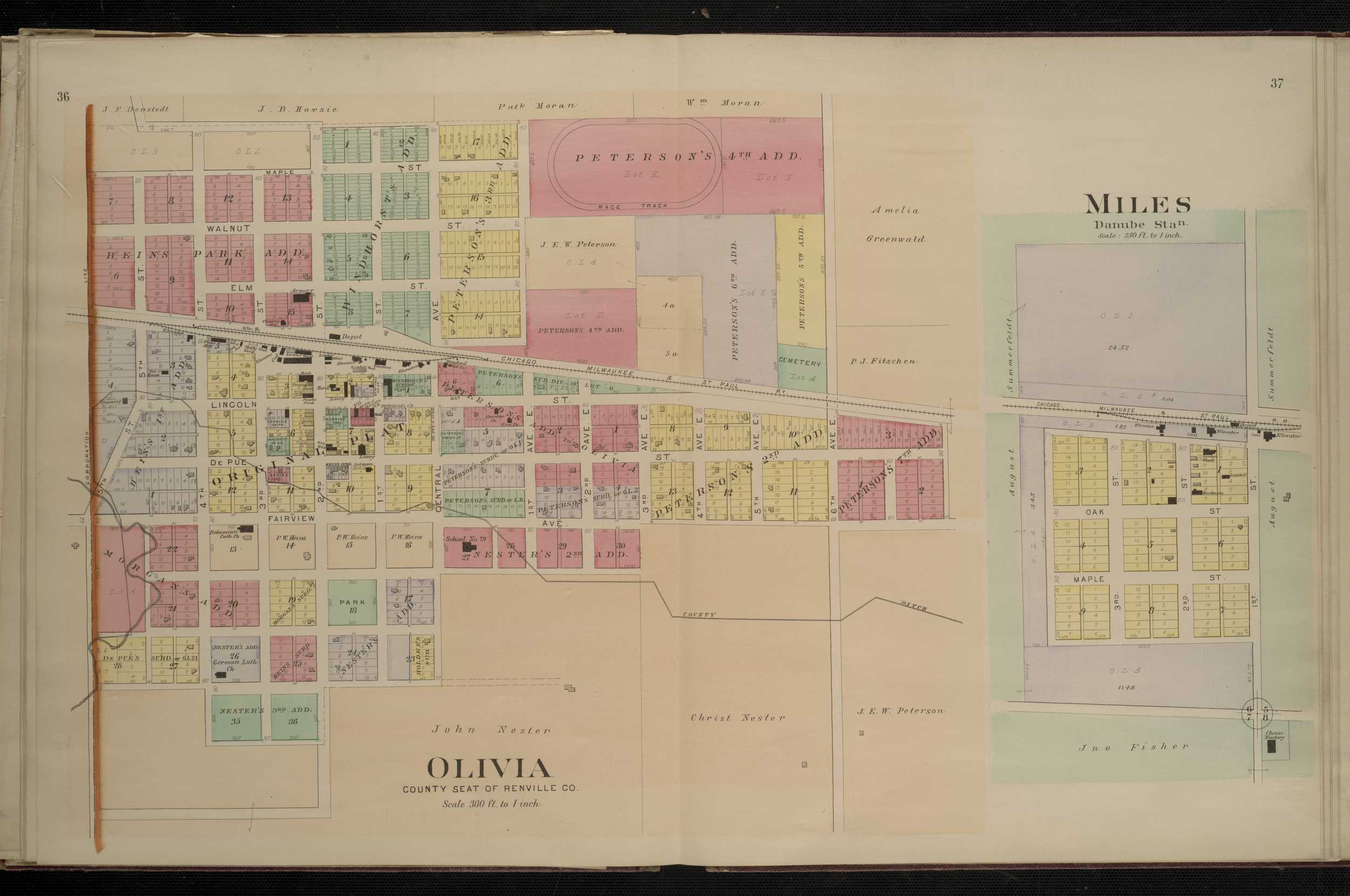
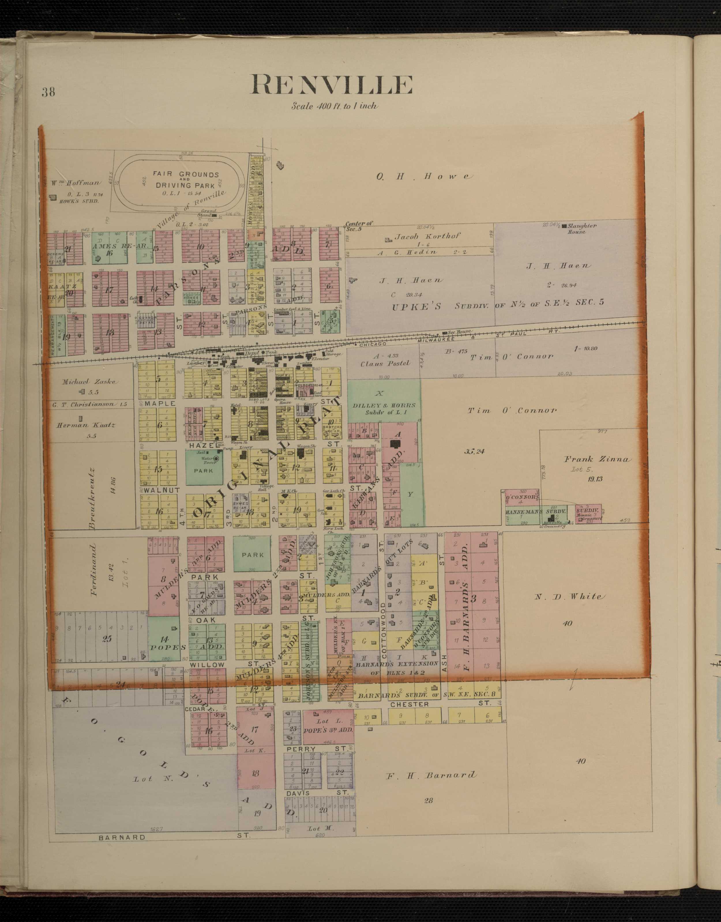
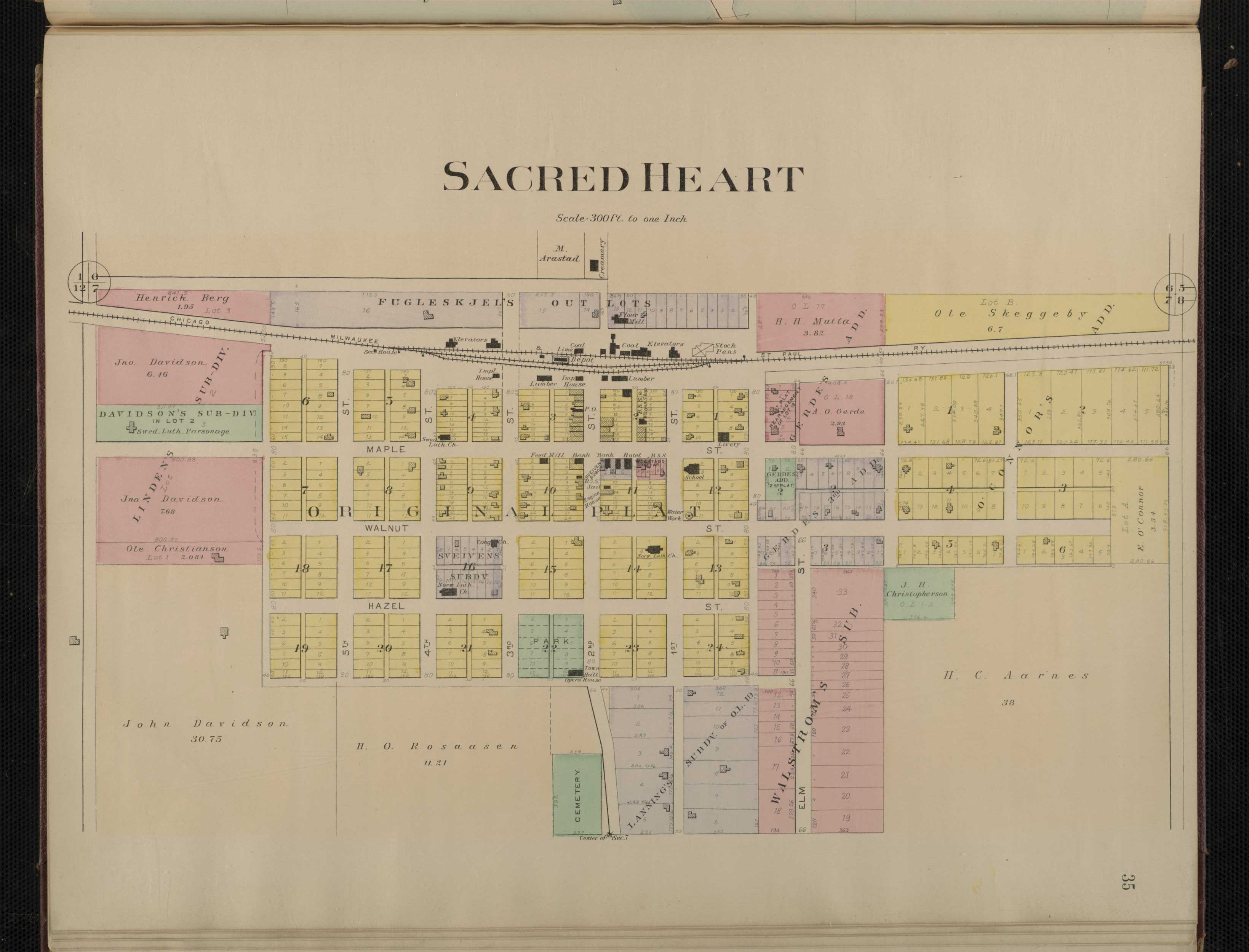
1900 - Renville County Digitized North West Publishing Co. mapFor individual plats of cities and towns, please click on the name of the city/ town of interest: Beaver Falls Bird Island Buffalo Lake Fairfax Franklin Hector Miles Morton Olivia Renville Sacred Heart
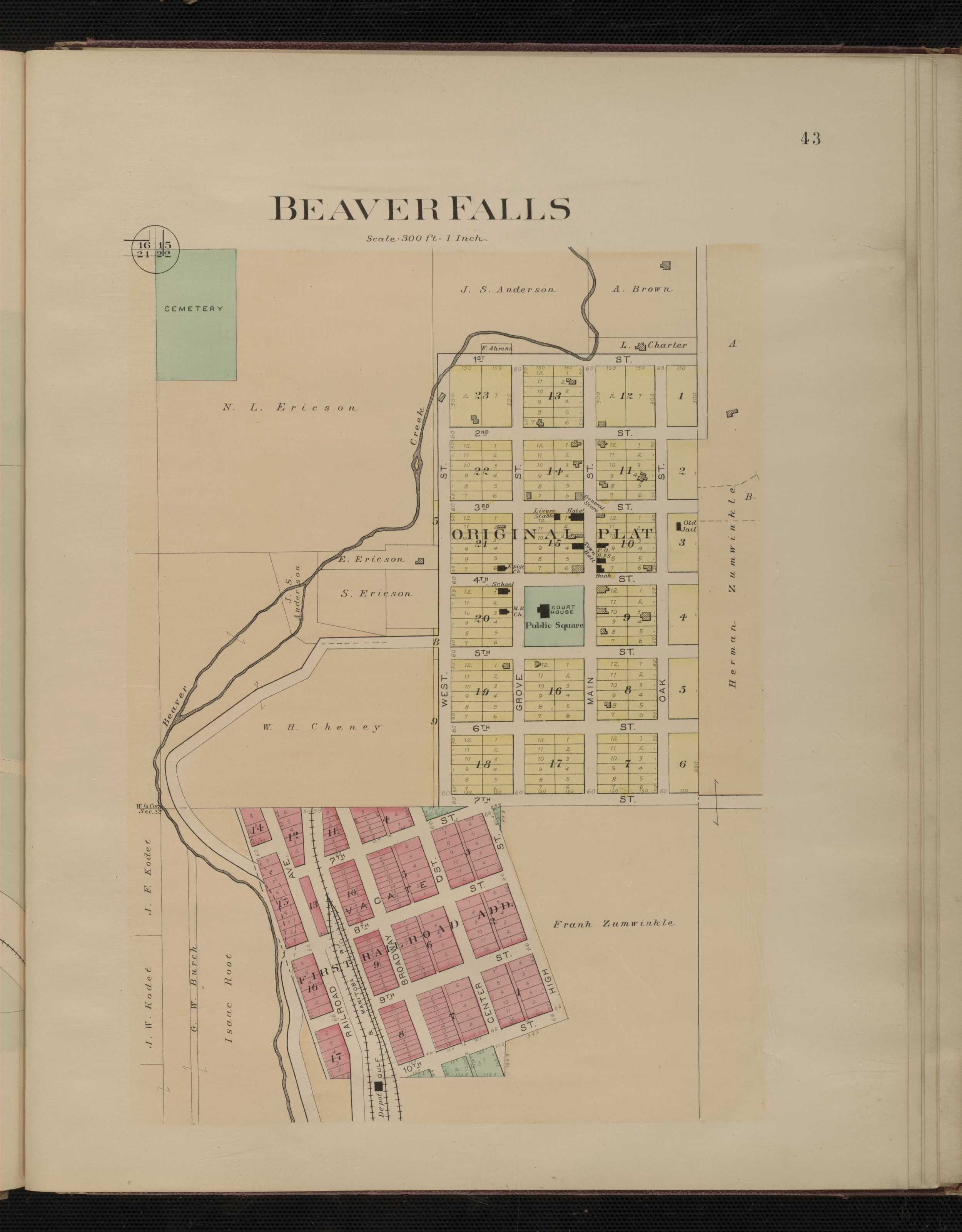
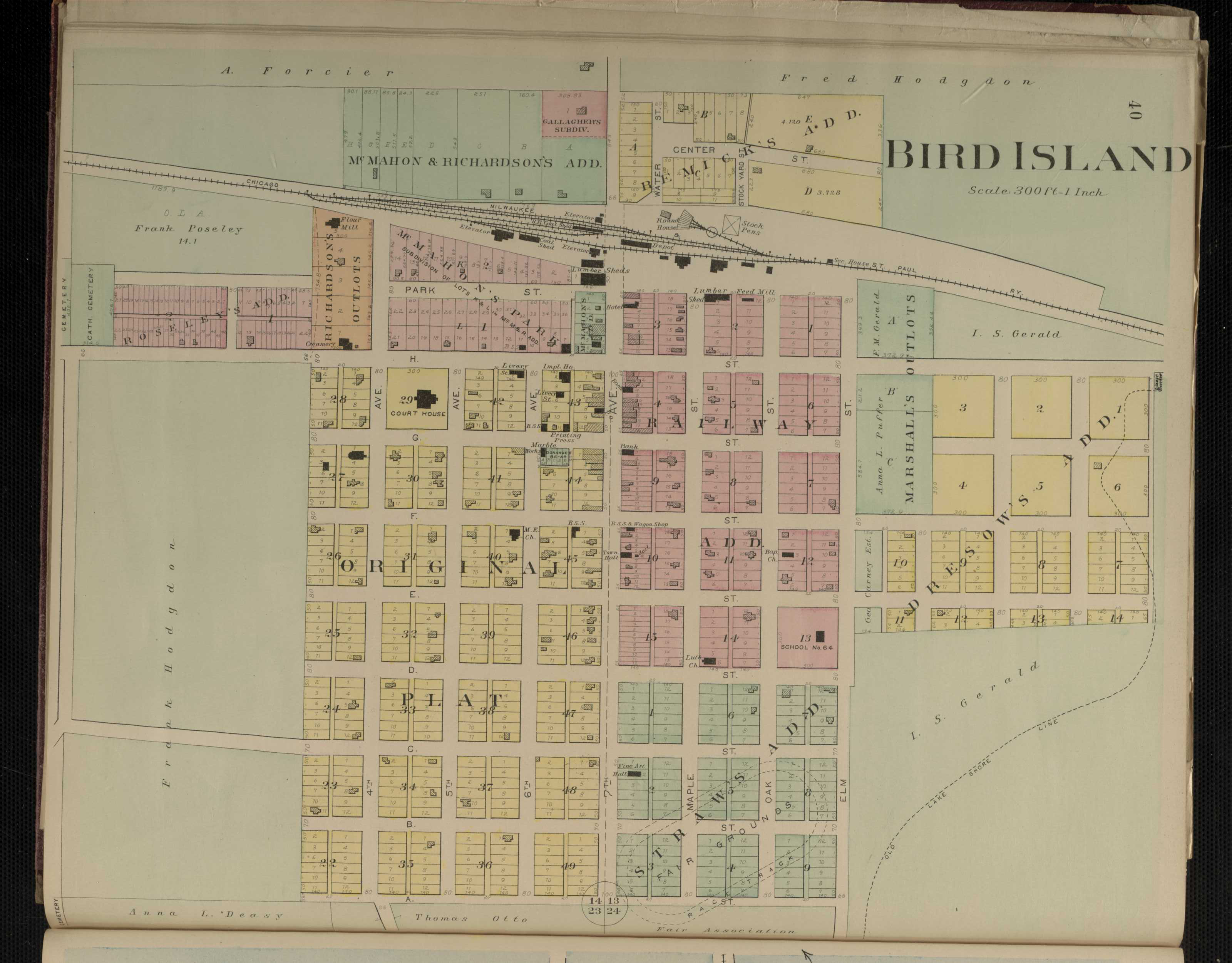
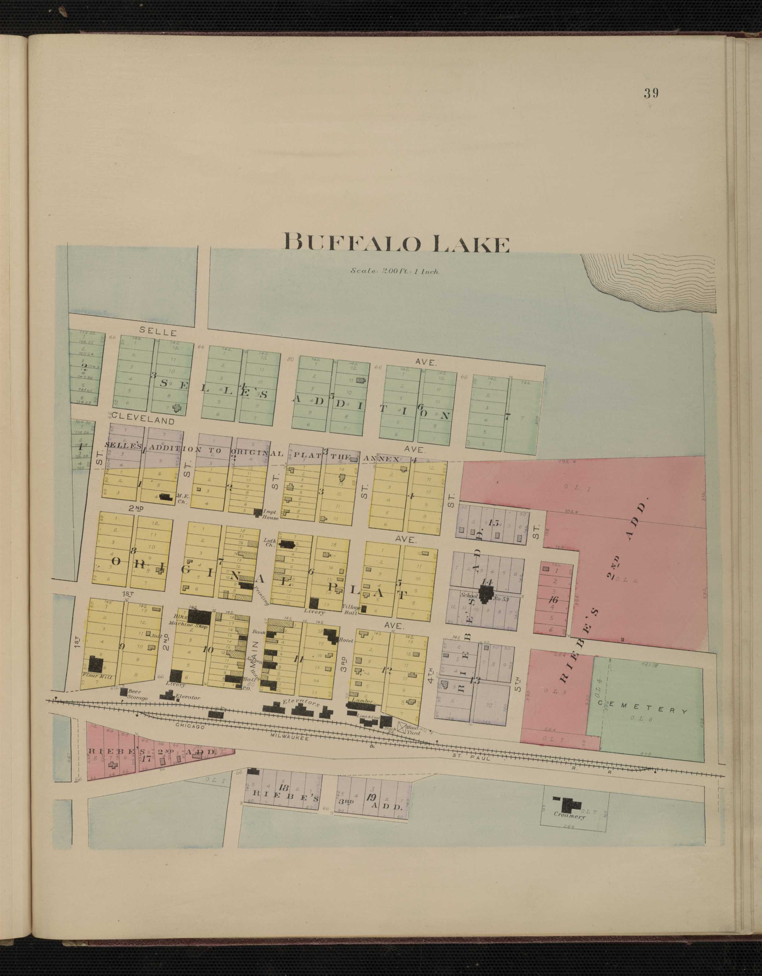
Renville County
1916 - Renville County Plat Book of the State of MinnesotaRice County
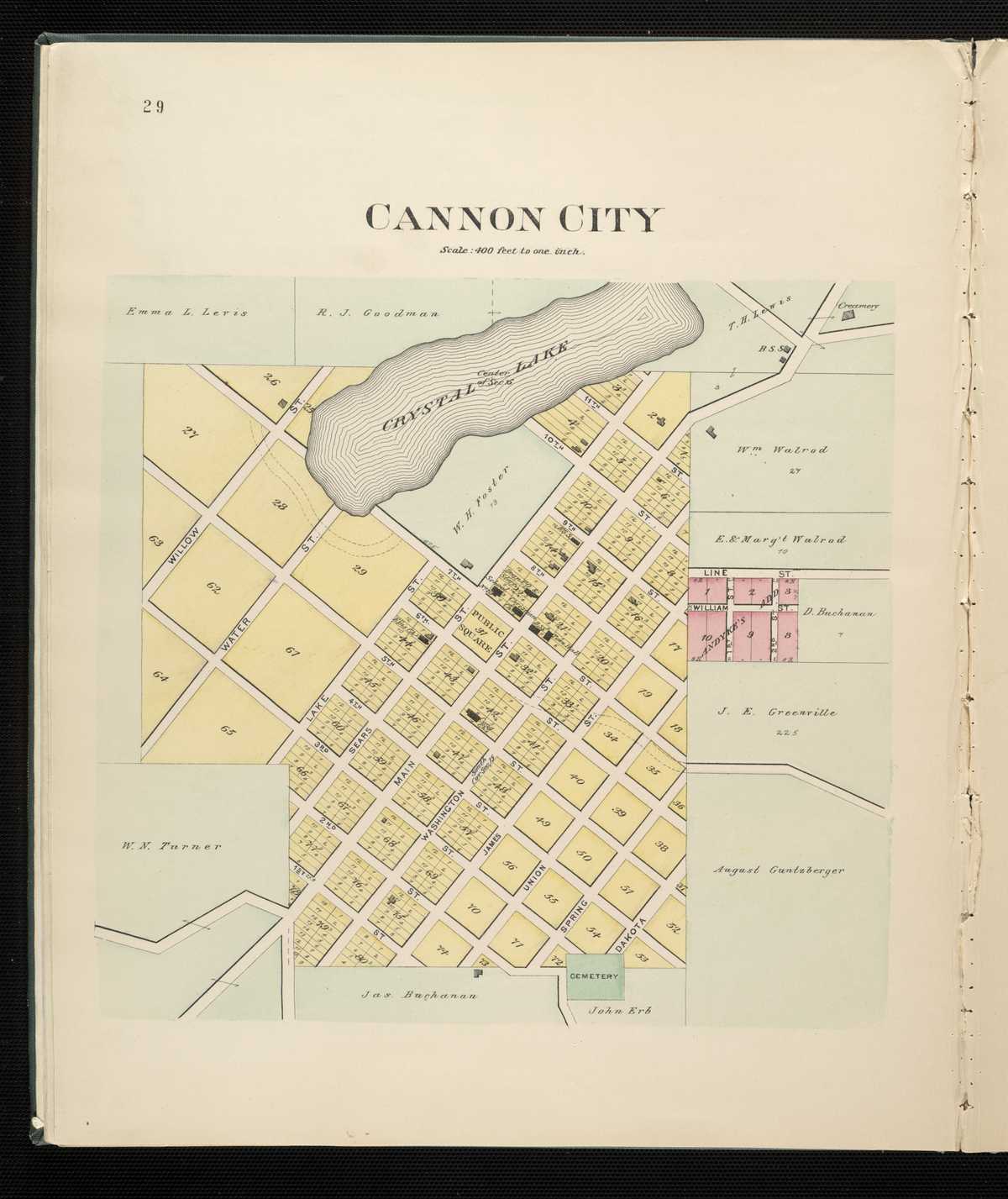
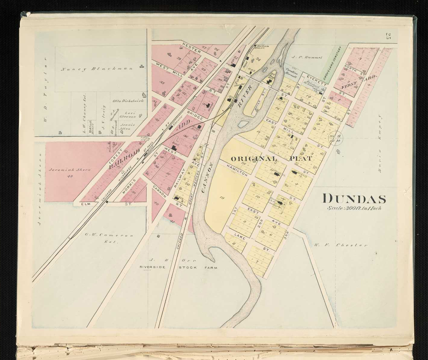
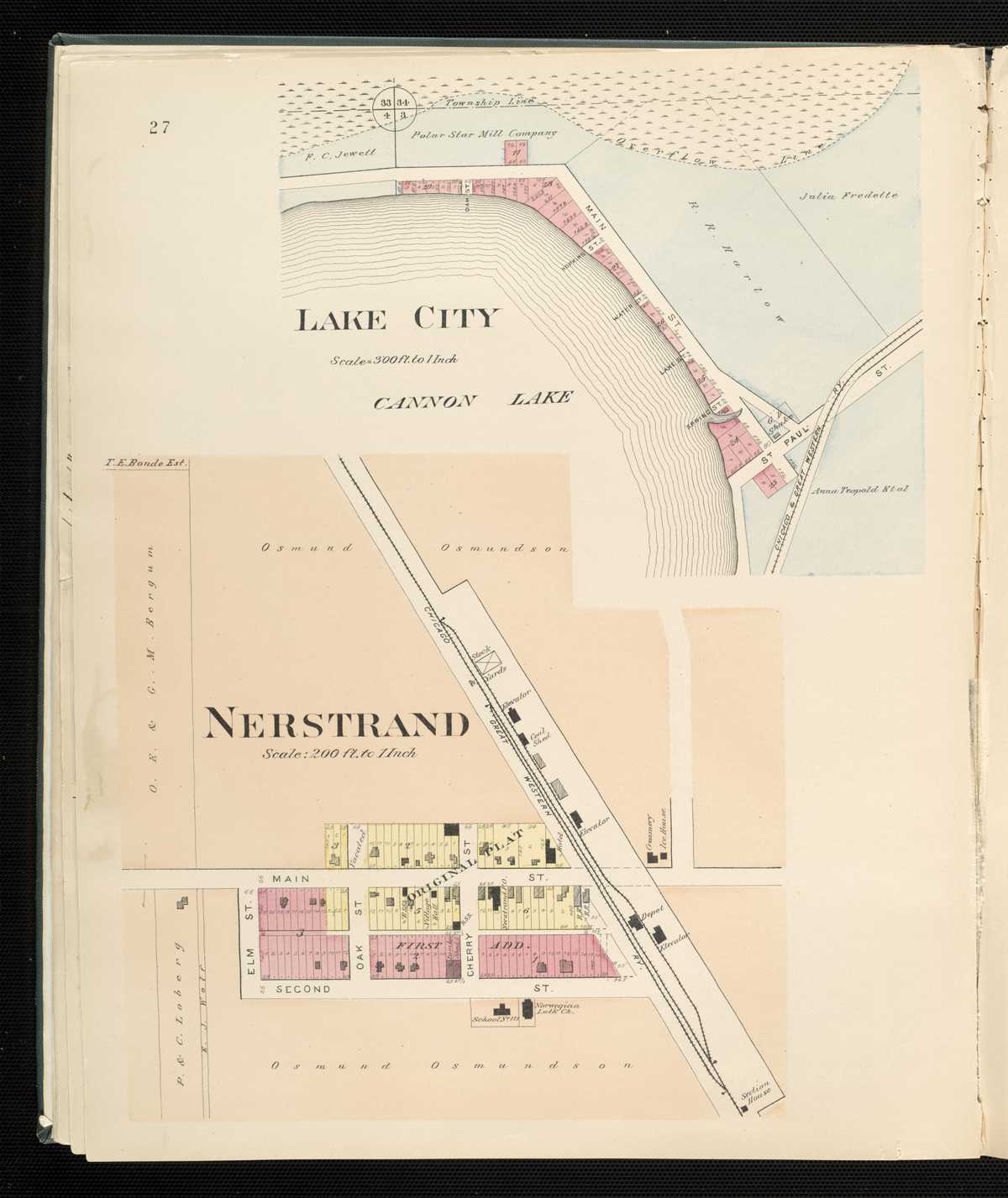
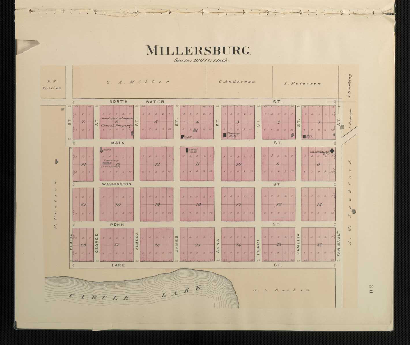
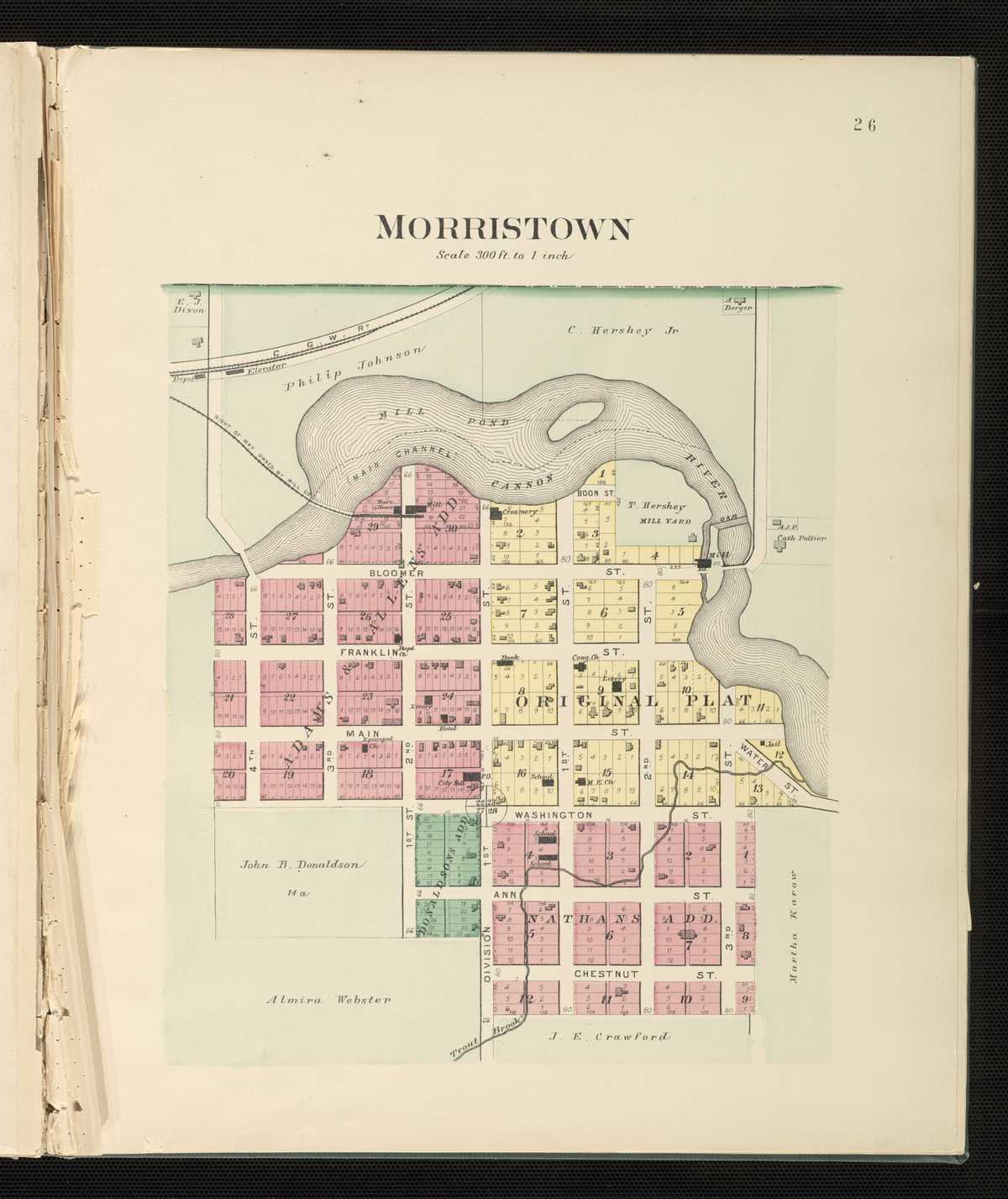
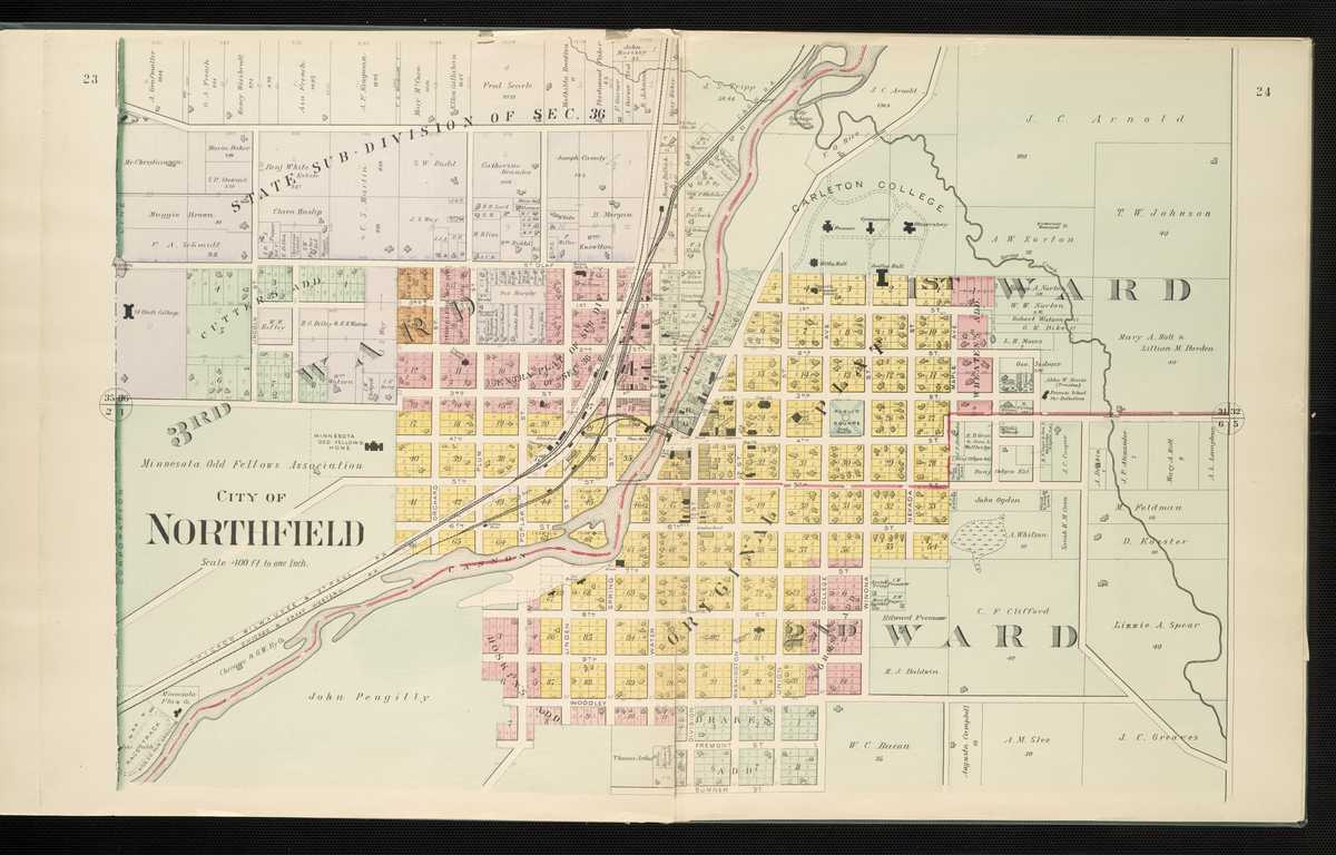
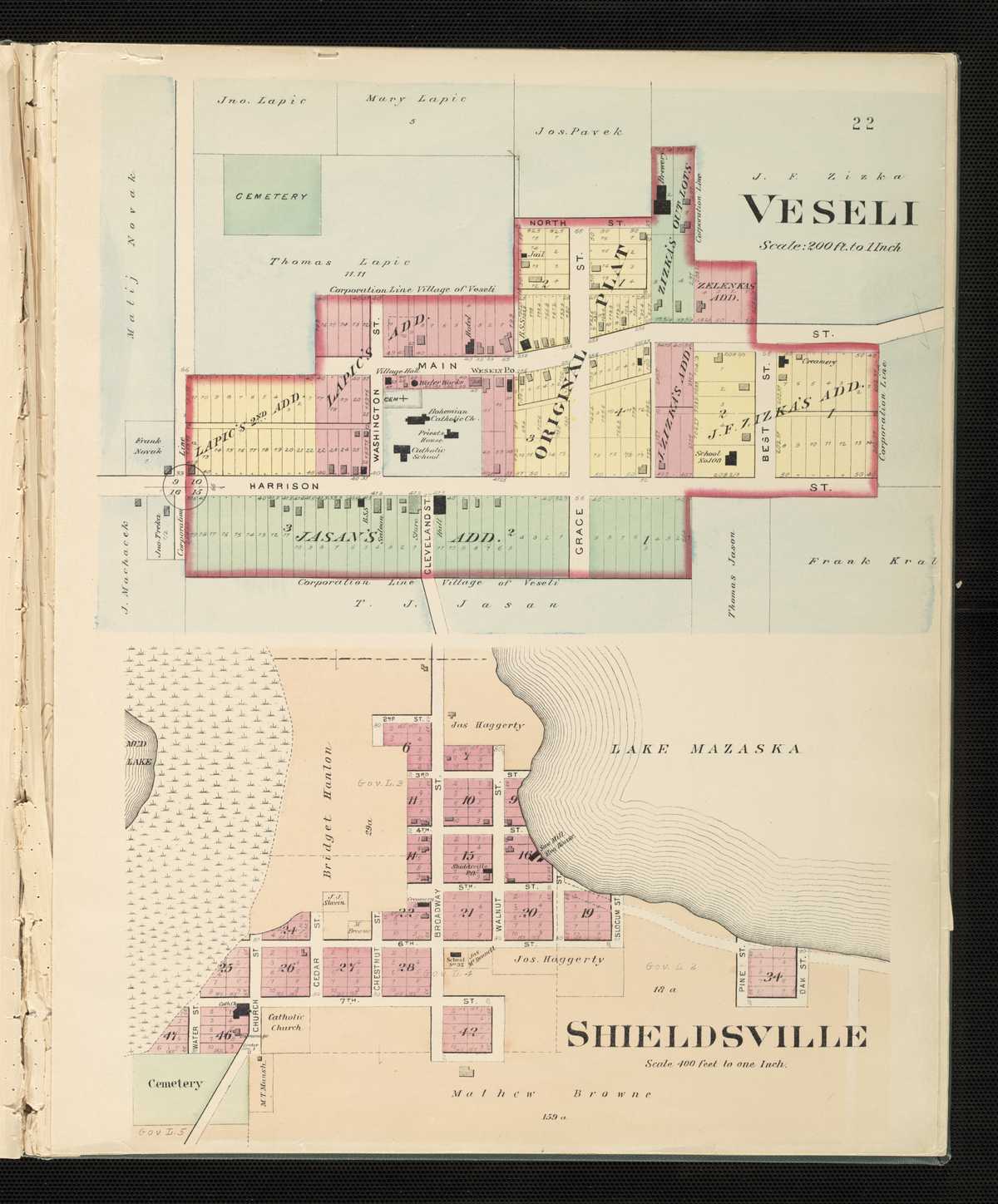
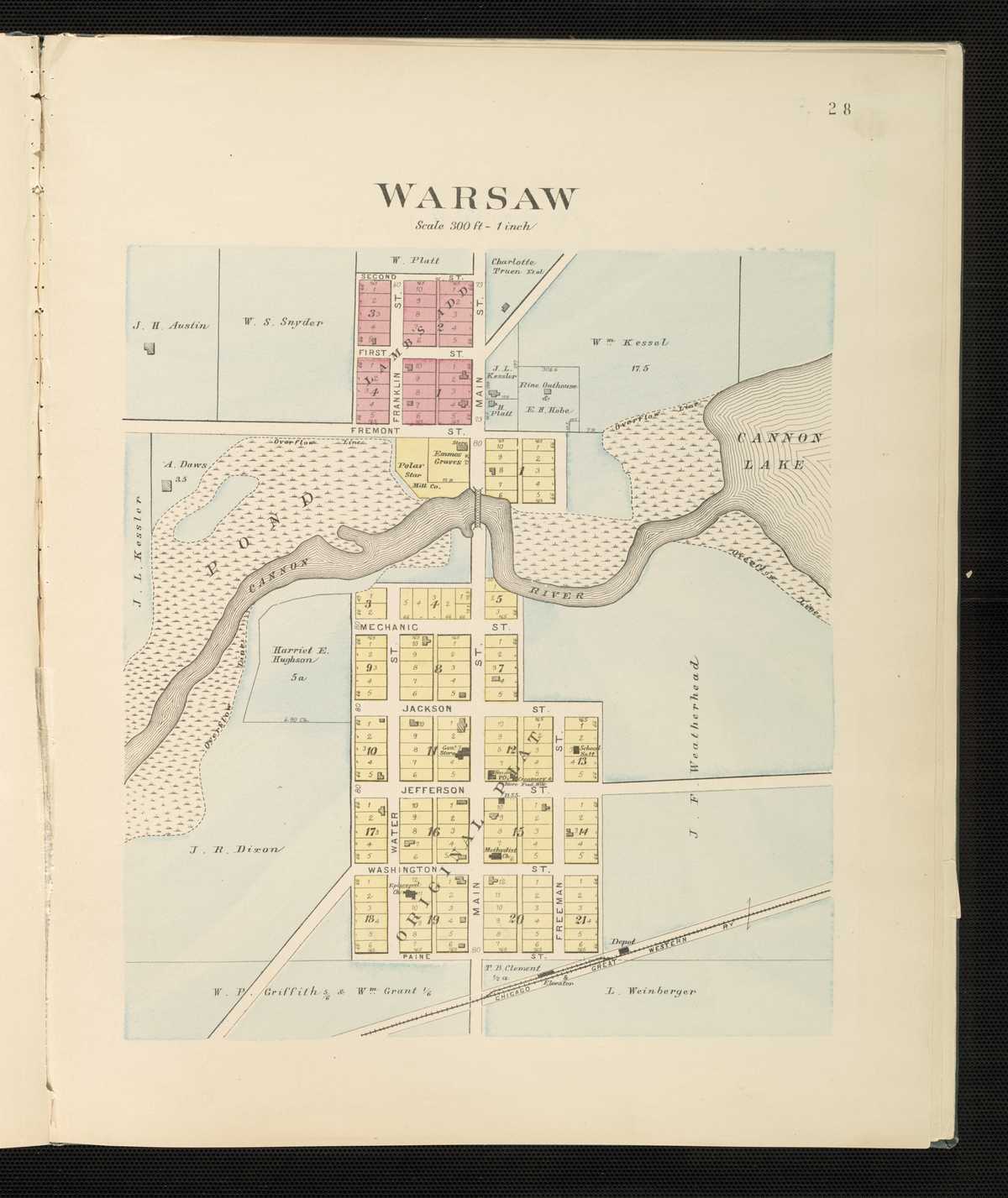
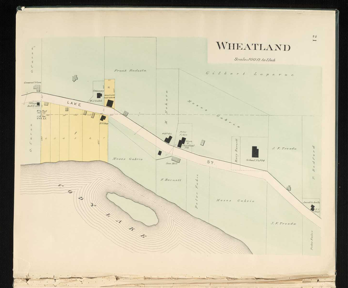
1900 - Rice County Digitized North West Publishing Co. mapFor individual plats of cities and towns, please click on the name of the city/ town of interest: Cannon City Dundas Lake City Millesburg Morristown Nerstrand Northfield Shieldsville Veseli Warsaw Wheatland
Roseau County
1916 - Roseau County Plat Book of the State of MinnesotaCounties beginning with S
Sherburne County
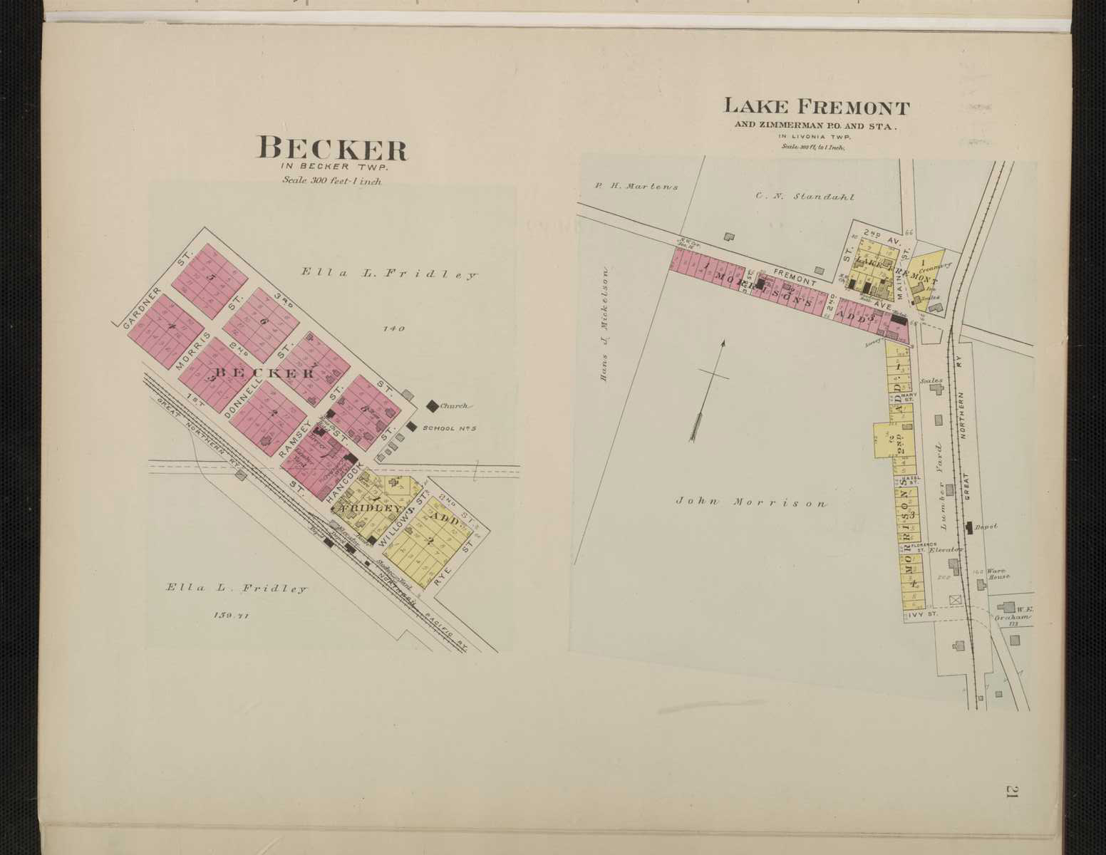
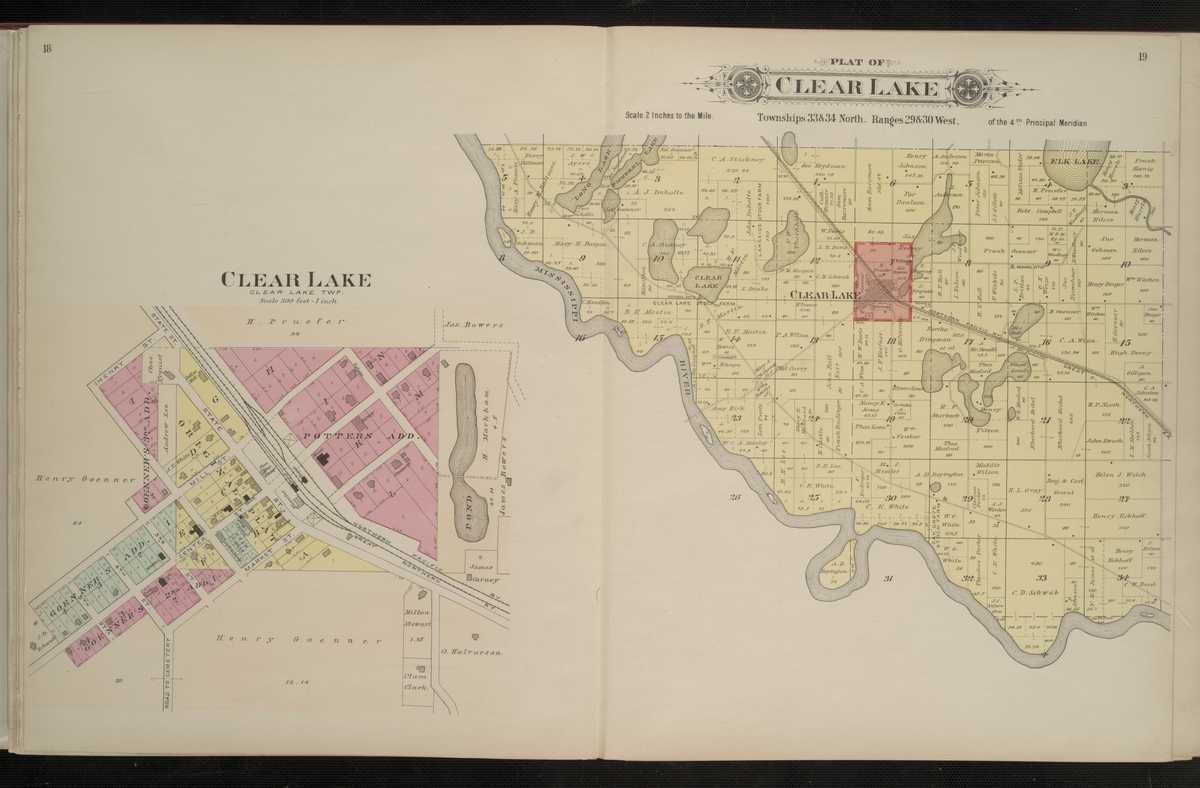
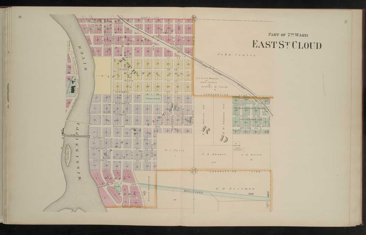
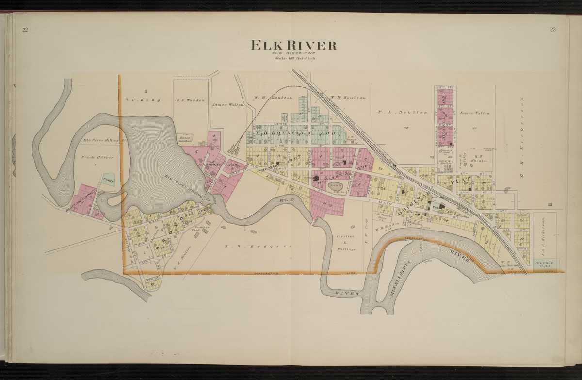
1903 - Sherburne County Digitized interactive North West Publishing Co. mapFor individual plats of cities and towns, please click on the name of the city/ town of interest: Becker Big Lake Clear Lake East St.Cloud Elk River Lake Fremont Santiago
Sherburne County
1916 - Sherburne County Plat Book of the State of MinnesotaSibley County
1916 - Sibley County Plat Book of the State of MinnesotaSt. Louis County
1916 - St. Louis County Plat Book of the State of MinnesotaStearns County
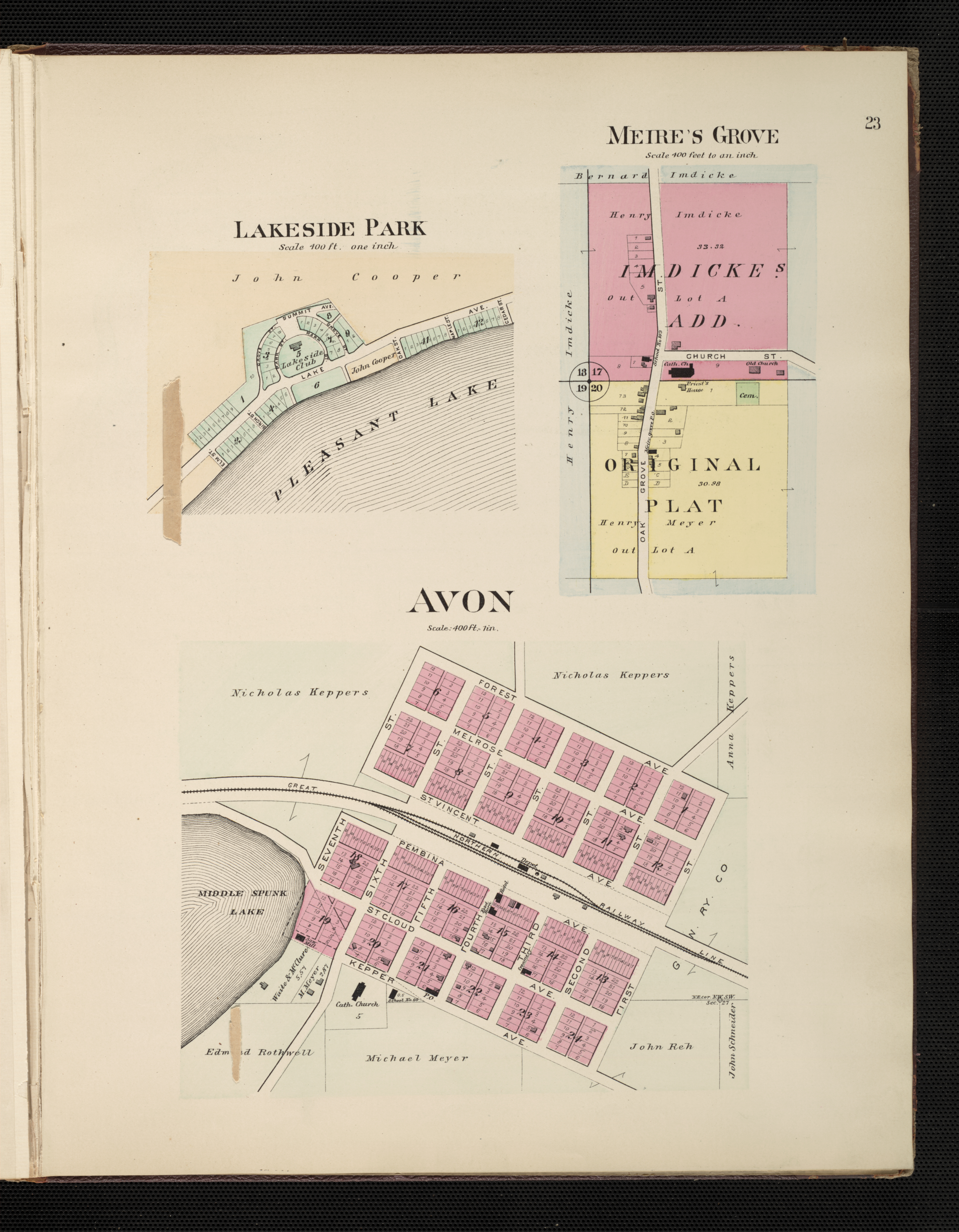
1896 - Stearns County Digitized interactive C. M. Foote & Co. mapFor individual plats of cities and towns, please click on the name of the city/ town of interest: Albany Avon Belgrade Brooten Clearwater Cold Springs Collegeville Cottage Place (Add. to St. Cloud) Eden Valley Fair Haven Freeport Georgeville Holding Ford Kimball Prairie Koronis Park Lake Side Park McClure & Whitsey's (Add. to St.Cloud) Maine Prairie Meire's Grove Melrose New Munich New Paynesville Richmond Rockville Roscoe Saint Augusta Saint Joseph Saint Martin Sauk Center, North Sauk Center, South South Saint Cloud Spring Hill Wardeville Waite Park
Stearns County
1916 - Stearns County Plat Book of the State of MinnesotaSteele County
1916 - Steele County Plat Book of the State of MinnesotaStevens County
1916 - Stevens County Plat Book of the State of MinnesotaCounties beginning with T
Traverse County
1916 - Traverse County Plat Book of the State of MinnesotaCounties beginning with W
Wabasha County
1916 - Wabasha County Plat Book of the State of MinnesotaWadena County
1916 - Wadena County Plat Book of the State of MinnesotaWaseca County
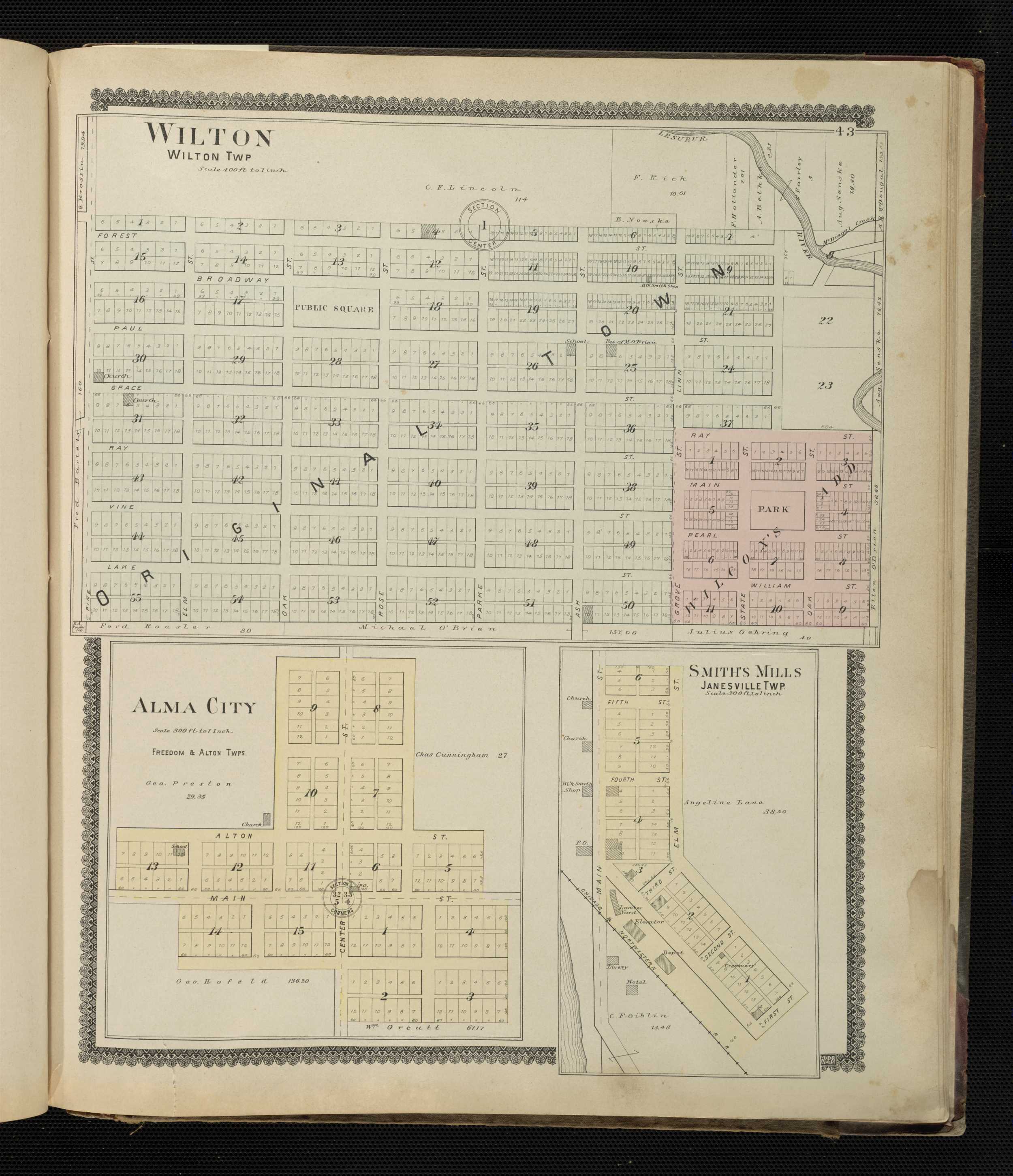
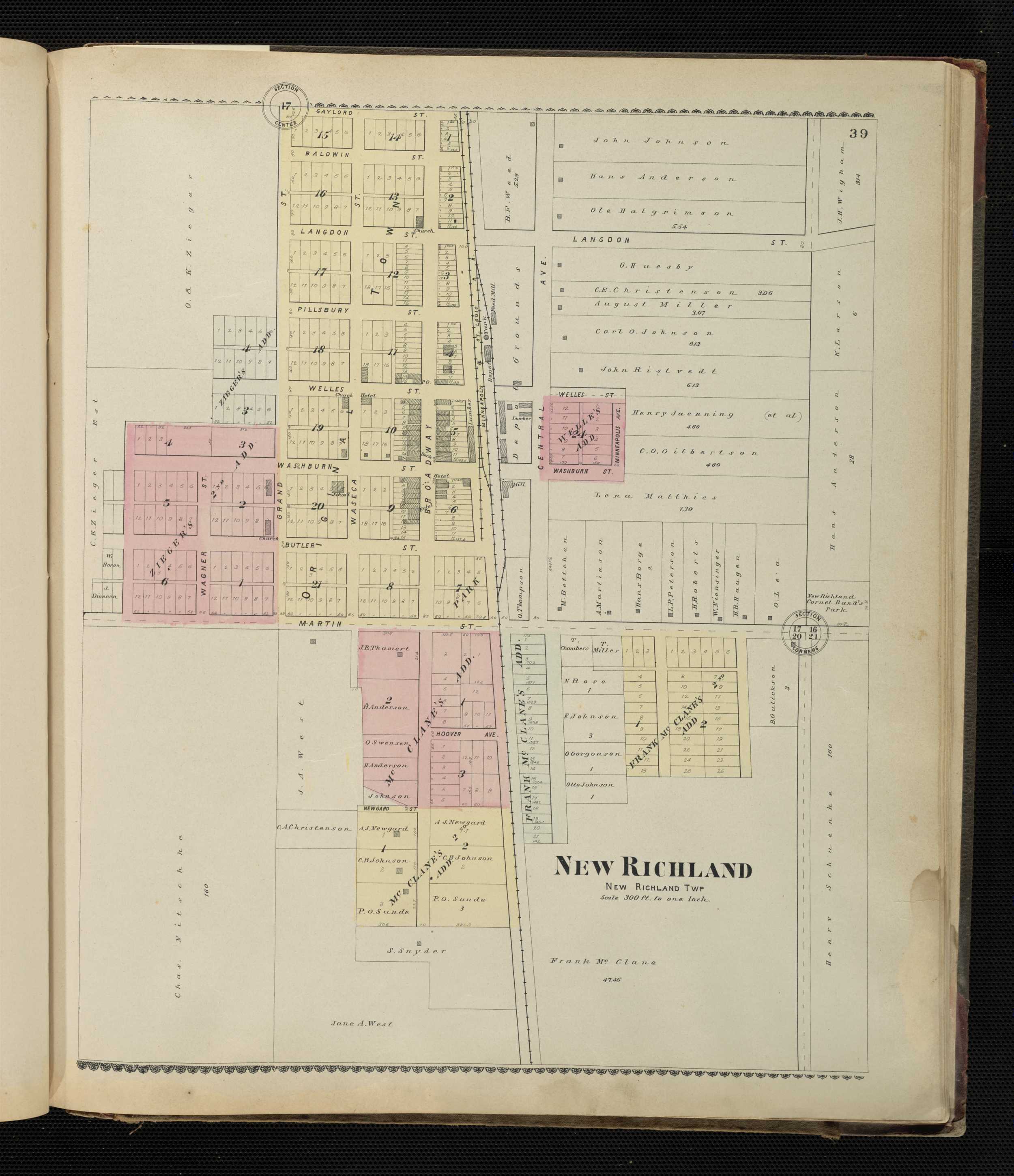
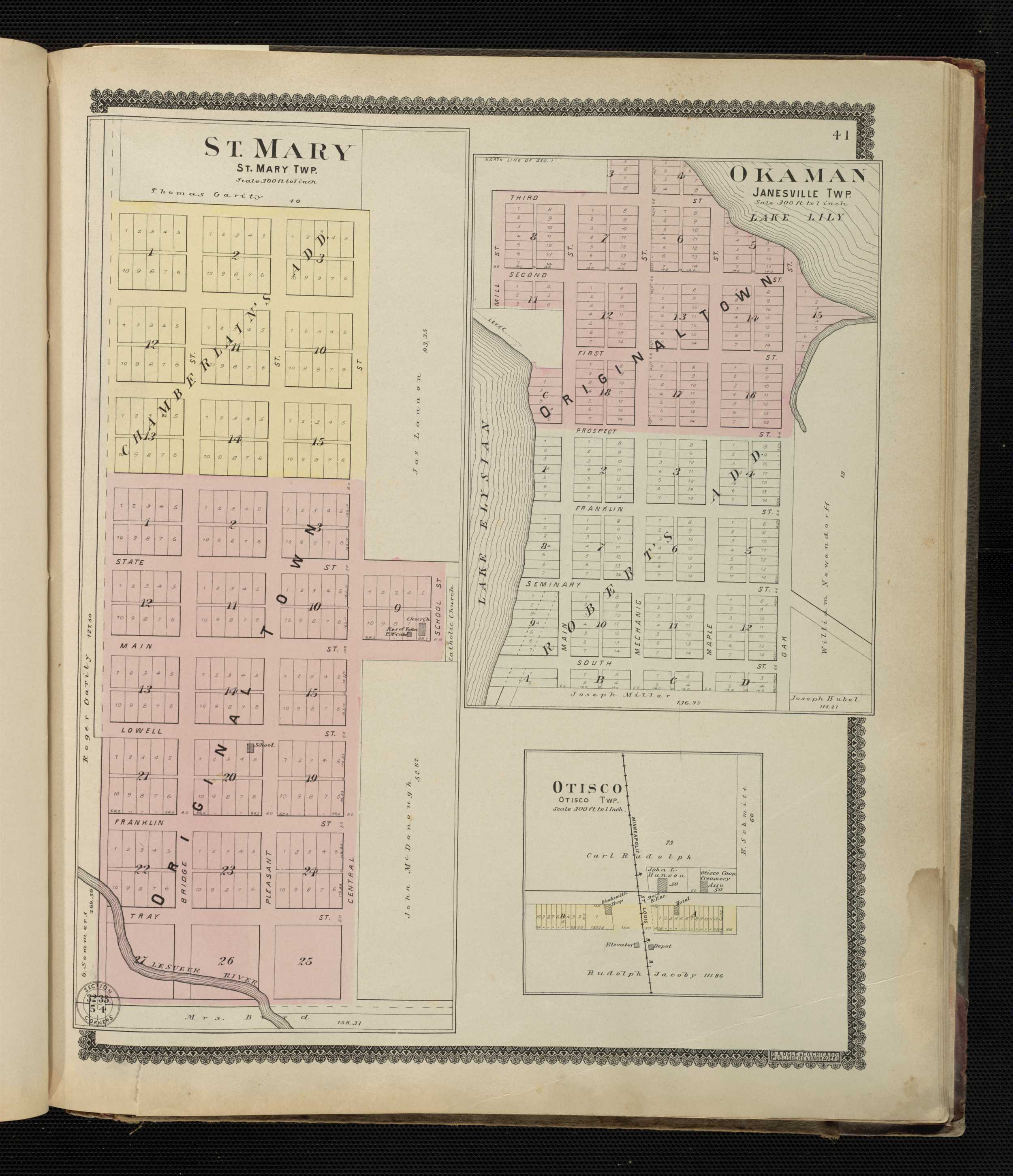
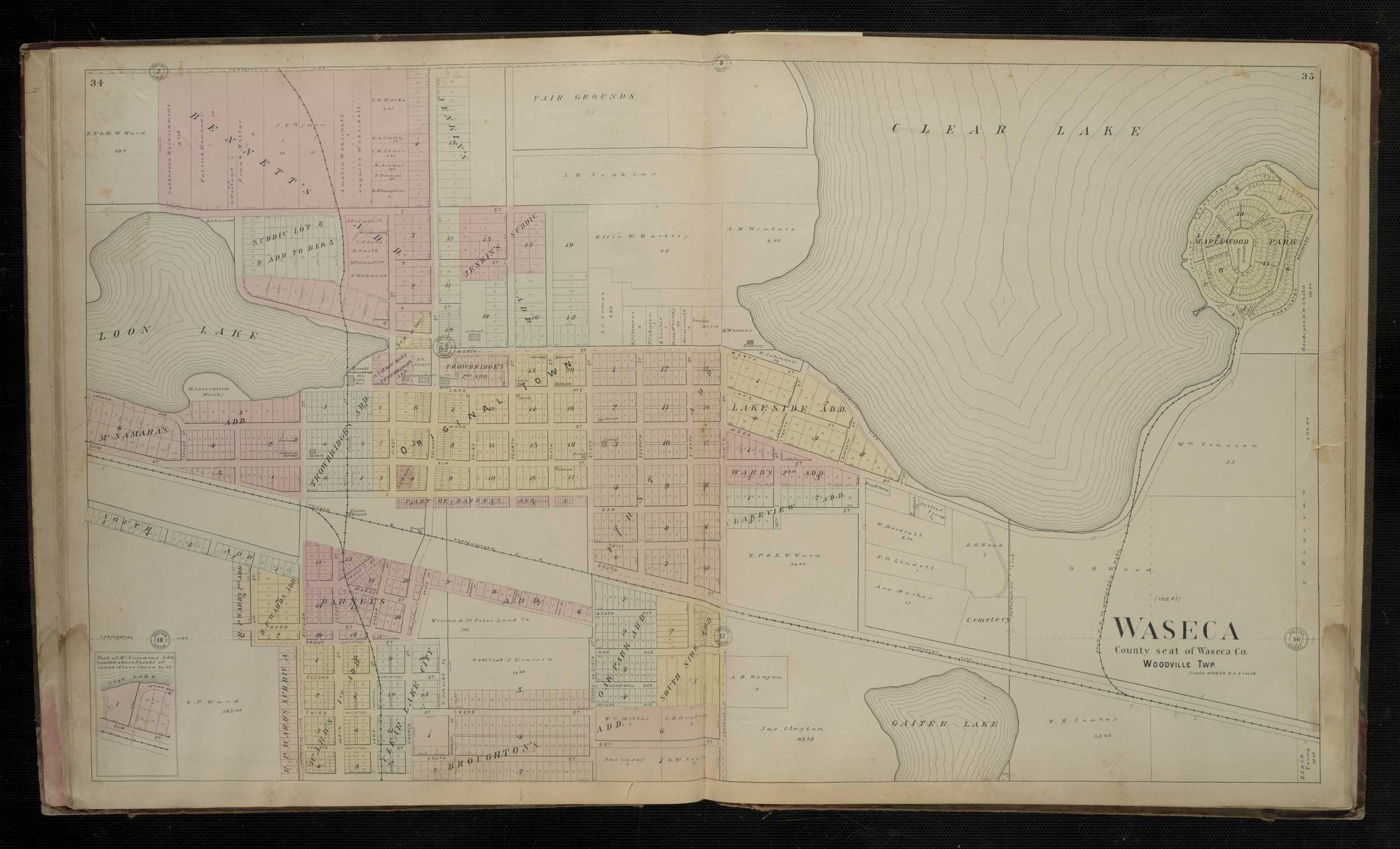
1896 - Waseca County Digitized interactive Geo. A. Ogle & Co. mapFor individual plats of cities and towns, please click on the name of the city/ town of interest: Alma City East Janesville Janesville New Richland Okaman Otisco Smith's Mills St. Mary Waseca Wilton
Waseca County
1916 - Waseca County Plat Book of the State of MinnesotaWashington County
1916 - Washington County Plat Book of the State of MinnesotaWatonwan County
1916 - Watonwan Plat Book of the State of MinnesotaWilkin County
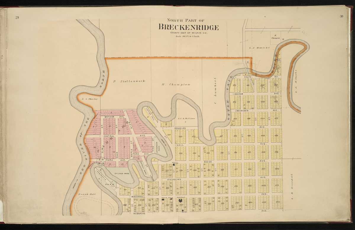
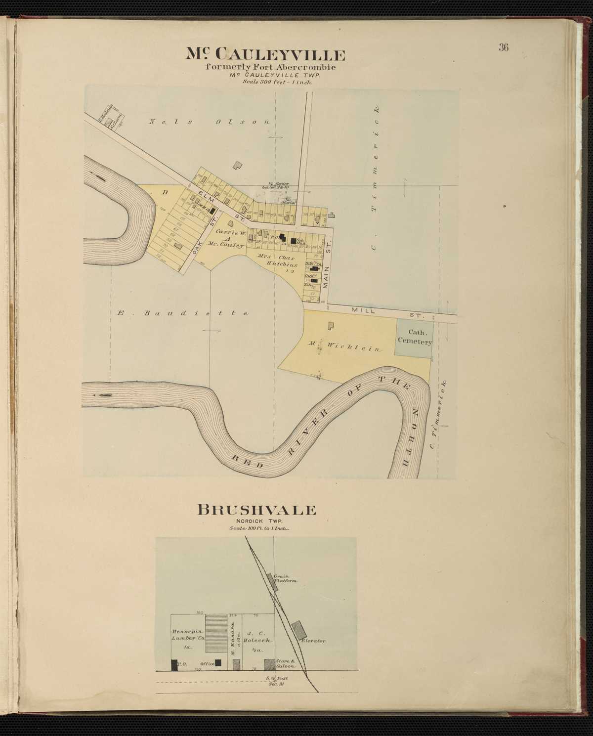
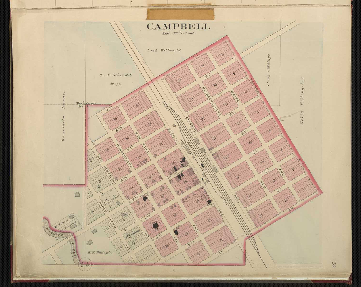
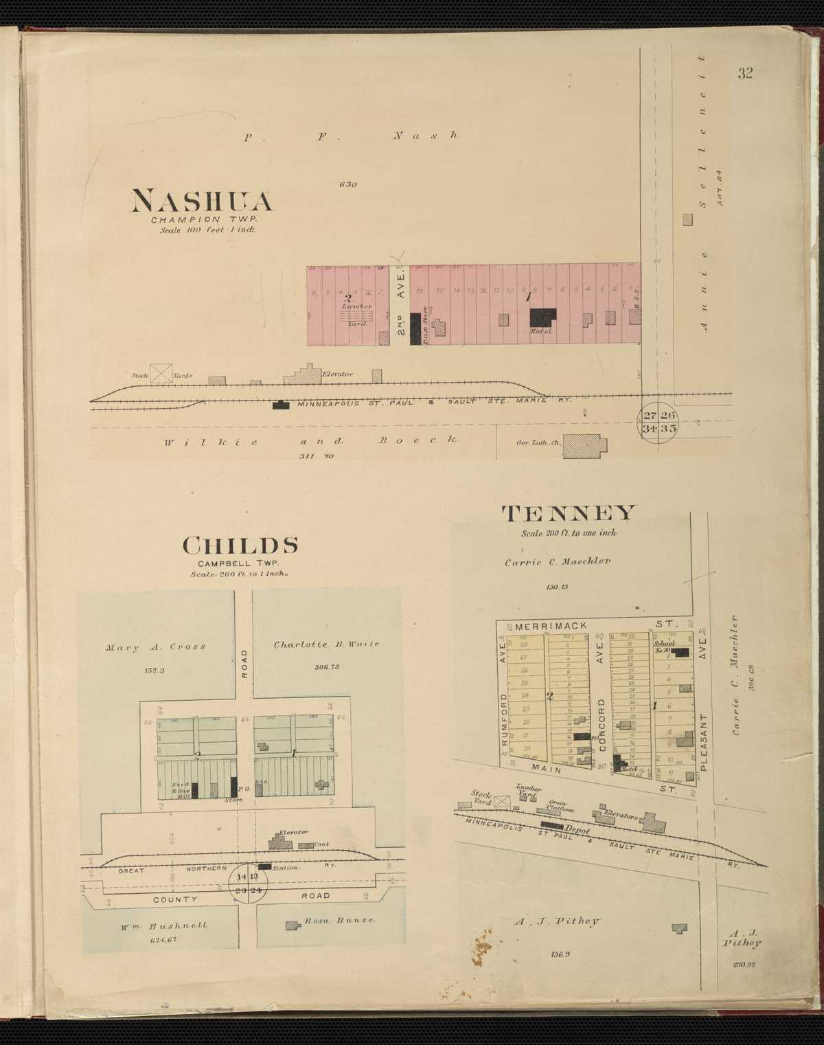
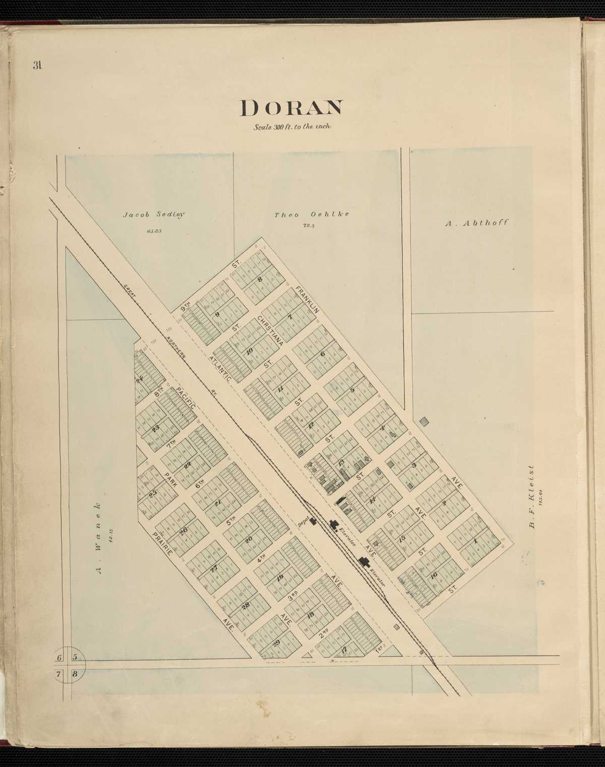
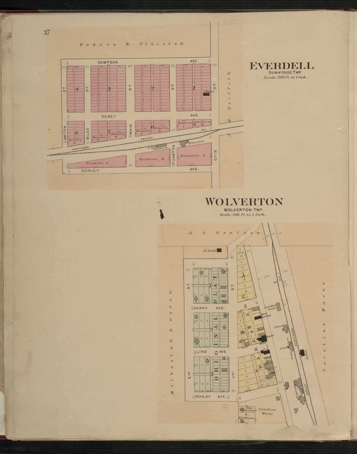
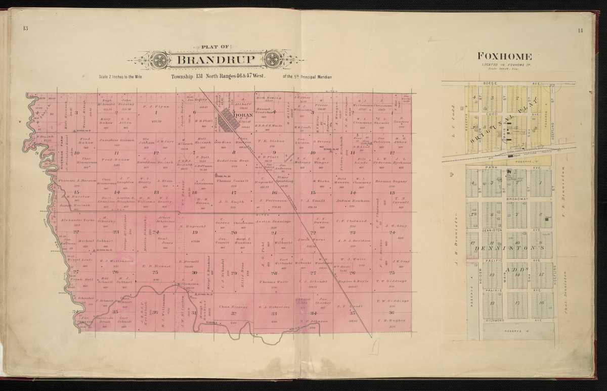
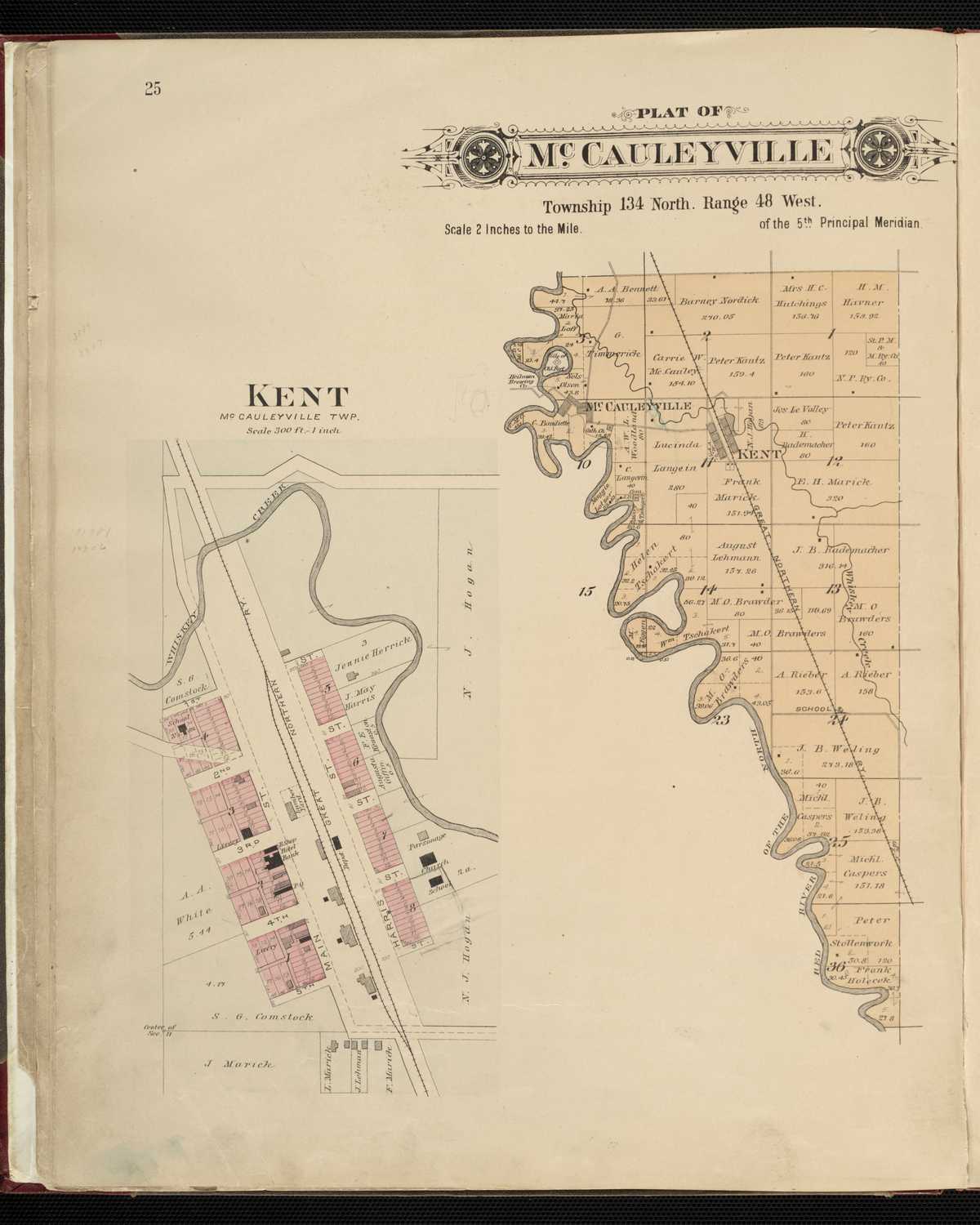
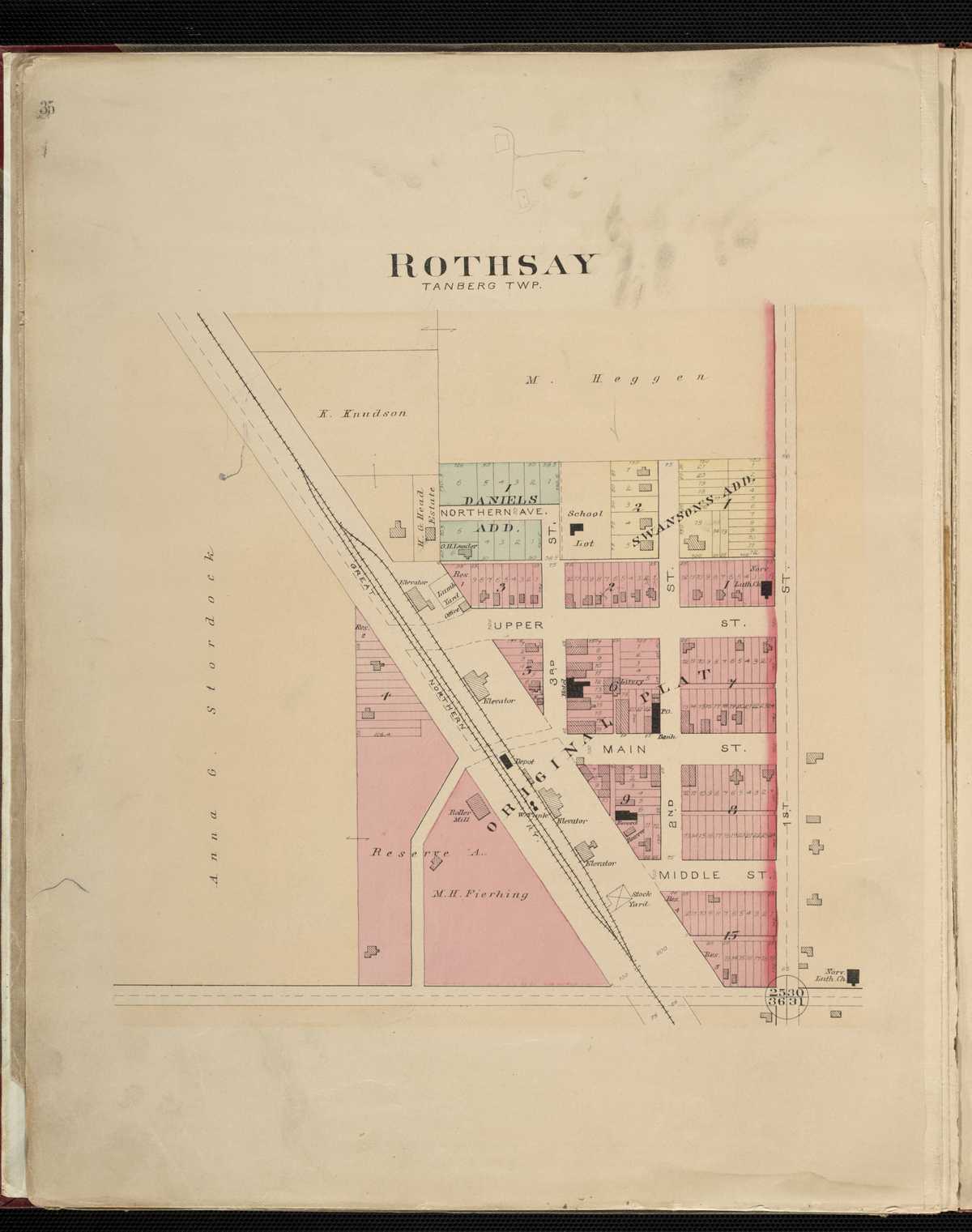
1903 - Wilkin County Digitized interactive North West Publishing Co. mapFor individual plats of cities and towns, please click on the name of the city/ town of interest: Breckenridge, North Breckenridge, South Brushvale Campbell Childs Doran Everdell Foxhome Kent McCauleyville Nashua Rothsay Tenney Wolverton